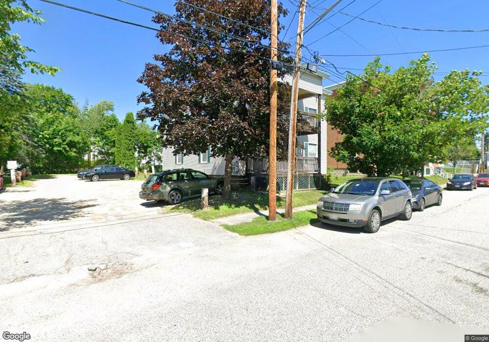
18 Green St Lewiston, ME 04240
Estimated Value: $376,000 - $427,000
6
Beds
2
Baths
2,500
Sq Ft
$162/Sq Ft
Est. Value
About This Home
This home is located at 18 Green St, Lewiston, ME 04240 and is currently estimated at $404,333, approximately $161 per square foot. 18 Green St is a home located in Androscoggin County with nearby schools including Farwell Elementary School, Lewiston Middle School, and Lewiston High School.
Ownership History
Date
Name
Owned For
Owner Type
Purchase Details
Closed on
Jul 29, 2009
Sold by
Caron Dudley H
Bought by
Toussaint Edward F and Toussaint Susan E
Current Estimated Value
Home Financials for this Owner
Home Financials are based on the most recent Mortgage that was taken out on this home.
Original Mortgage
$250,000
Outstanding Balance
$163,493
Interest Rate
5.43%
Mortgage Type
Purchase Money Mortgage
Estimated Equity
$240,840
Purchase Details
Closed on
Dec 30, 2005
Sold by
Community Facility Cor
Bought by
Toussaint Edward F and Toussaint Susan E
Create a Home Valuation Report for This Property
The Home Valuation Report is an in-depth analysis detailing your home's value as well as a comparison with similar homes in the area
Home Values in the Area
Average Home Value in this Area
Purchase History
| Date | Buyer | Sale Price | Title Company |
|---|---|---|---|
| Toussaint Edward F | -- | -- | |
| Toussaint Edward F | -- | -- |
Source: Public Records
Mortgage History
| Date | Status | Borrower | Loan Amount |
|---|---|---|---|
| Open | Toussaint Edward F | $250,000 |
Source: Public Records
Tax History Compared to Growth
Tax History
| Year | Tax Paid | Tax Assessment Tax Assessment Total Assessment is a certain percentage of the fair market value that is determined by local assessors to be the total taxable value of land and additions on the property. | Land | Improvement |
|---|---|---|---|---|
| 2025 | $3,047 | $92,940 | $19,560 | $73,380 |
| 2024 | $2,953 | $92,940 | $19,560 | $73,380 |
| 2023 | $2,788 | $92,940 | $19,560 | $73,380 |
| 2022 | $2,649 | $92,940 | $19,560 | $73,380 |
| 2021 | $2,626 | $92,940 | $19,560 | $73,380 |
| 2020 | $2,665 | $92,940 | $19,560 | $73,380 |
| 2019 | $2,687 | $92,940 | $19,560 | $73,380 |
| 2018 | $2,665 | $92,940 | $19,560 | $73,380 |
| 2017 | $2,604 | $92,940 | $19,560 | $73,380 |
| 2016 | $2,560 | $92,940 | $19,560 | $73,380 |
| 2015 | $2,544 | $92,940 | $19,560 | $73,380 |
| 2014 | $2,471 | $92,940 | $19,560 | $73,380 |
| 2013 | $2,457 | $92,940 | $19,560 | $73,380 |
Source: Public Records
Map
Nearby Homes