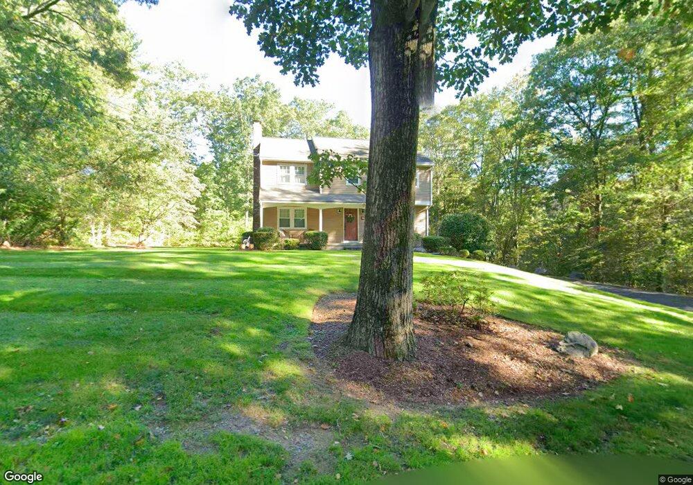
18 Huntsbridge Rd North Attleboro, MA 02760
North Attleboro NeighborhoodEstimated Value: $619,973 - $738,000
3
Beds
3
Baths
1,700
Sq Ft
$401/Sq Ft
Est. Value
About This Home
This home is located at 18 Huntsbridge Rd, North Attleboro, MA 02760 and is currently estimated at $680,993, approximately $400 per square foot. 18 Huntsbridge Rd is a home located in Bristol County with nearby schools including North Attleboro High School, Blackstone Valley Prep Elementary School 1, and Dayspring Christian Academy.
Ownership History
Date
Name
Owned For
Owner Type
Purchase Details
Closed on
Feb 7, 2003
Sold by
Wolbach Dennis and Wolbach Jane K
Bought by
Malatesta Christine M and Malatesta John E
Current Estimated Value
Home Financials for this Owner
Home Financials are based on the most recent Mortgage that was taken out on this home.
Original Mortgage
$230,000
Interest Rate
5.99%
Mortgage Type
Purchase Money Mortgage
Purchase Details
Closed on
Jun 27, 1997
Sold by
Monti Michael J and Monti Tina
Bought by
Wolbach Dennis and Wolbach Jane K
Purchase Details
Closed on
Apr 28, 1995
Sold by
Brooks Grant E and Brooks Linda F
Bought by
Monti Michael J and Messuri Tina M
Purchase Details
Closed on
Jun 18, 1993
Sold by
Mitchell Gregory D and Mitchell Patricia L
Bought by
Brooks Grant E and Brooks Linda F
Purchase Details
Closed on
Jun 9, 1987
Sold by
Jpw Rt
Bought by
Mcmahan Duncan P
Create a Home Valuation Report for This Property
The Home Valuation Report is an in-depth analysis detailing your home's value as well as a comparison with similar homes in the area
Home Values in the Area
Average Home Value in this Area
Purchase History
| Date | Buyer | Sale Price | Title Company |
|---|---|---|---|
| Malatesta Christine M | $350,000 | -- | |
| Wolbach Dennis | $195,000 | -- | |
| Monti Michael J | $188,000 | -- | |
| Brooks Grant E | $187,000 | -- | |
| Mcmahan Duncan P | $199,500 | -- |
Source: Public Records
Mortgage History
| Date | Status | Borrower | Loan Amount |
|---|---|---|---|
| Open | Mcmahan Duncan P | $215,000 | |
| Closed | Malatesta Christine M | $230,000 | |
| Previous Owner | Mcmahan Duncan P | $50,000 | |
| Previous Owner | Mcmahan Duncan P | $161,250 |
Source: Public Records
Tax History Compared to Growth
Tax History
| Year | Tax Paid | Tax Assessment Tax Assessment Total Assessment is a certain percentage of the fair market value that is determined by local assessors to be the total taxable value of land and additions on the property. | Land | Improvement |
|---|---|---|---|---|
| 2025 | $6,462 | $548,100 | $165,700 | $382,400 |
| 2024 | $6,429 | $557,100 | $165,700 | $391,400 |
| 2023 | $6,304 | $492,900 | $165,700 | $327,200 |
| 2022 | $6,036 | $433,300 | $165,700 | $267,600 |
| 2021 | $5,778 | $404,900 | $165,700 | $239,200 |
| 2020 | $5,714 | $398,200 | $165,700 | $232,500 |
| 2019 | $5,497 | $386,000 | $150,700 | $235,300 |
| 2018 | $4,966 | $372,300 | $150,700 | $221,600 |
| 2017 | $4,922 | $372,300 | $150,700 | $221,600 |
| 2016 | $4,846 | $366,600 | $167,600 | $199,000 |
| 2015 | $4,666 | $355,100 | $167,600 | $187,500 |
| 2014 | $4,463 | $337,100 | $147,100 | $190,000 |
Source: Public Records
Map
Nearby Homes
- 44 Montclair Dr
- 164 Bear Hill Rd Unit 24
- 44 Powder Horn Way
- 154 Bear Hill Rd Unit 405
- 15 Standring St
- 181 Paine Rd
- 11 Frederick a Nittel Dr
- 143 Waumsett Ave
- 41 Indiana Ave
- 41&39 Indiana Ave
- 94 Hines Rd
- 160 Shirley Dr
- 66 Pequot Ave
- 30 Bear Hill Rd
- 143 Millard Rd
- 18 Susan Dr
- 0 Narragansett Rd
- 98 Iroquois Rd
- 31 Paine Rd
- 0 Mendon Rd
- 4 Huntsbridge Rd
- 11 Huntsbridge Rd
- 5 Huntsbridge Rd
- 451 Mendon Rd
- 411 Mendon Rd
- 19 Huntsbridge Rd
- 22 Huntsbridge Rd
- 19 Huntsbridge Rd
- 401 Mendon Rd
- 6 Deer Hollow Rd
- 463 Mendon Rd
- 430 Mendon Rd
- 420 Mendon Rd
- 10 Deer Hollow Rd
- 410 Mendon Rd
- 400 Mendon Rd
- 395 Mendon Rd
- 395 Mendon Rd Unit 1
- 27 Huntsbridge Rd
- 27 Huntsbridge Rd Unit 1