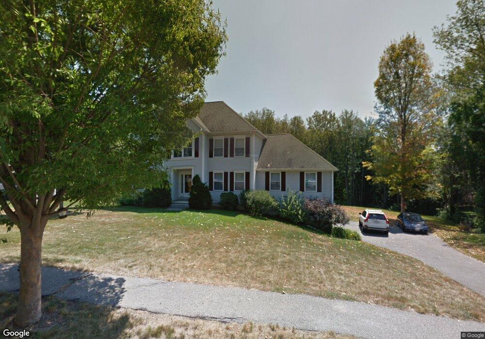
18 Kali Way Haverhill, MA 01835
Salem Street NeighborhoodEstimated Value: $844,748 - $903,000
4
Beds
3
Baths
2,644
Sq Ft
$329/Sq Ft
Est. Value
About This Home
This home is located at 18 Kali Way, Haverhill, MA 01835 and is currently estimated at $869,187, approximately $328 per square foot. 18 Kali Way is a home located in Essex County with nearby schools including Bradford Elementary School and Haverhill High School.
Ownership History
Date
Name
Owned For
Owner Type
Purchase Details
Closed on
Mar 17, 2014
Sold by
Cowl William M and Rodrigues Joanne M
Bought by
Salvato Scott and Salvato Christina
Current Estimated Value
Home Financials for this Owner
Home Financials are based on the most recent Mortgage that was taken out on this home.
Original Mortgage
$389,405
Outstanding Balance
$294,931
Interest Rate
4.32%
Mortgage Type
New Conventional
Estimated Equity
$574,256
Purchase Details
Closed on
Nov 21, 2008
Sold by
Paolino Kimberly A and Paolino Robert J
Bought by
Cowl William M
Home Financials for this Owner
Home Financials are based on the most recent Mortgage that was taken out on this home.
Original Mortgage
$345,600
Interest Rate
6.03%
Mortgage Type
Purchase Money Mortgage
Purchase Details
Closed on
Mar 6, 2000
Sold by
Nicor Prop Inc
Bought by
Paolino Robert J and Paolino Kimberly A
Create a Home Valuation Report for This Property
The Home Valuation Report is an in-depth analysis detailing your home's value as well as a comparison with similar homes in the area
Home Values in the Area
Average Home Value in this Area
Purchase History
| Date | Buyer | Sale Price | Title Company |
|---|---|---|---|
| Salvato Scott | $409,900 | -- | |
| Cowl William M | $432,100 | -- | |
| Paolino Robert J | $115,000 | -- |
Source: Public Records
Mortgage History
| Date | Status | Borrower | Loan Amount |
|---|---|---|---|
| Open | Salvato Scott | $389,405 | |
| Previous Owner | Paolino Robert J | $344,700 | |
| Previous Owner | Paolino Robert J | $345,600 |
Source: Public Records
Tax History Compared to Growth
Tax History
| Year | Tax Paid | Tax Assessment Tax Assessment Total Assessment is a certain percentage of the fair market value that is determined by local assessors to be the total taxable value of land and additions on the property. | Land | Improvement |
|---|---|---|---|---|
| 2025 | $8,202 | $765,800 | $250,500 | $515,300 |
| 2024 | $7,877 | $740,300 | $241,700 | $498,600 |
| 2023 | $7,750 | $695,100 | $241,700 | $453,400 |
| 2022 | $7,295 | $573,500 | $219,900 | $353,600 |
| 2021 | $7,243 | $538,900 | $215,500 | $323,400 |
| 2020 | $7,207 | $529,900 | $215,500 | $314,400 |
| 2019 | $6,997 | $501,600 | $187,200 | $314,400 |
| 2018 | $6,849 | $480,300 | $187,200 | $293,100 |
| 2017 | $6,630 | $442,300 | $167,600 | $274,700 |
| 2016 | $6,431 | $418,700 | $150,200 | $268,500 |
| 2015 | $6,294 | $410,000 | $141,500 | $268,500 |
Source: Public Records
Map
Nearby Homes
- 5 Towne Hill Rd
- 15 Overlook Cir
- 1 Lisa Ln
- 218 Old Groveland Rd
- 100 Towne Hill Rd
- 332 Salem St Unit 1
- 12 Munroe St
- 151 Hyatt Ave
- 425 Main St
- 54 Lincoln Ave
- 404 Main St
- 32 Harding Ave
- 65 Stetson St
- 70 Race St
- 1 Atwood Ln
- 45 Lincolnshire Dr
- 358 Main St
- 104 Keeley St Unit A
- 54 S Williams St
- 15 Hyatt Ave