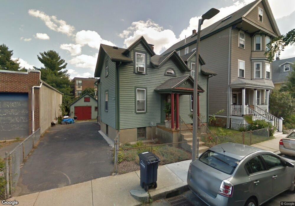
18 Kenton Rd Jamaica Plain, MA 02130
Jamaica Plain NeighborhoodEstimated Value: $714,000 - $1,105,000
4
Beds
2
Baths
1,540
Sq Ft
$595/Sq Ft
Est. Value
About This Home
This home is located at 18 Kenton Rd, Jamaica Plain, MA 02130 and is currently estimated at $916,885, approximately $595 per square foot. 18 Kenton Rd is a home located in Suffolk County with nearby schools including Neighborhood School, The Croft School - Jamaica Plain, and Meridian Academy.
Ownership History
Date
Name
Owned For
Owner Type
Purchase Details
Closed on
Aug 31, 2007
Sold by
Musto Antonio and Musto Edward
Bought by
Babcock Michael
Current Estimated Value
Home Financials for this Owner
Home Financials are based on the most recent Mortgage that was taken out on this home.
Original Mortgage
$240,000
Outstanding Balance
$153,038
Interest Rate
6.71%
Mortgage Type
Purchase Money Mortgage
Estimated Equity
$763,847
Create a Home Valuation Report for This Property
The Home Valuation Report is an in-depth analysis detailing your home's value as well as a comparison with similar homes in the area
Home Values in the Area
Average Home Value in this Area
Purchase History
| Date | Buyer | Sale Price | Title Company |
|---|---|---|---|
| Babcock Michael | $340,000 | -- |
Source: Public Records
Mortgage History
| Date | Status | Borrower | Loan Amount |
|---|---|---|---|
| Open | Babcock Michael | $240,000 |
Source: Public Records
Tax History Compared to Growth
Tax History
| Year | Tax Paid | Tax Assessment Tax Assessment Total Assessment is a certain percentage of the fair market value that is determined by local assessors to be the total taxable value of land and additions on the property. | Land | Improvement |
|---|---|---|---|---|
| 2025 | $8,131 | $702,200 | $248,700 | $453,500 |
| 2024 | $6,682 | $613,000 | $240,700 | $372,300 |
| 2023 | $6,584 | $613,000 | $240,700 | $372,300 |
| 2022 | $6,351 | $583,700 | $229,200 | $354,500 |
| 2021 | $6,106 | $572,300 | $224,700 | $347,600 |
| 2020 | $5,415 | $512,800 | $219,000 | $293,800 |
| 2019 | $5,172 | $490,700 | $176,200 | $314,500 |
| 2018 | $4,676 | $446,200 | $176,200 | $270,000 |
| 2017 | $4,414 | $416,800 | $176,200 | $240,600 |
| 2016 | $4,367 | $397,000 | $176,200 | $220,800 |
| 2015 | $4,076 | $336,600 | $161,700 | $174,900 |
| 2014 | $3,915 | $311,200 | $161,700 | $149,500 |
Source: Public Records
Map
Nearby Homes
- 60 Williams St Unit 402
- 69 Williams St Unit 302
- 69 Williams St Unit 202
- 40 Gartland St Unit 2
- 3417 Washington St Unit 2
- 3531 Washington St Unit 206
- 3531 Washington St Unit 507
- 3531 Washington St Unit 411
- 3531 Washington St Unit 316
- 10 Plainfield St Unit 1
- 10 Plainfield St Unit 3
- 10 Plainfield St Unit 2
- 44 Newbern St
- 79 Rossmore Rd Unit 1
- 76-78 Brookley Rd Unit 1
- 71-73 Brookley Rd Unit 2
- 119 Sedgwick St
- 172 Green St Unit 1
- 81 Child St Unit 3
- 76 Elm St Unit 215
- 20 Kenton Rd
- 20 Kenton Rd
- 20 Kenton Rd Unit 4
- 20 Kenton Rd Unit 1
- 20 Kenton Rd Unit 3
- 20 Kenton Rd Unit 2
- 24 Kenton Rd
- 19 Kenton Rd
- 19 Kenton Rd
- 19 Kenton Rd Unit 1
- 9 Kenton Rd Unit 11
- 23 Kenton Rd
- 23 Kenton Rd Unit 3
- 30 Kenton Rd
- 30 Kenton Rd Unit 2
- 34 Kenton Rd
- 31 Kenton Rd
- 8 Gartland St Unit 12
- 12 Gartland St Unit 12
- 10 Gartland St Unit 12