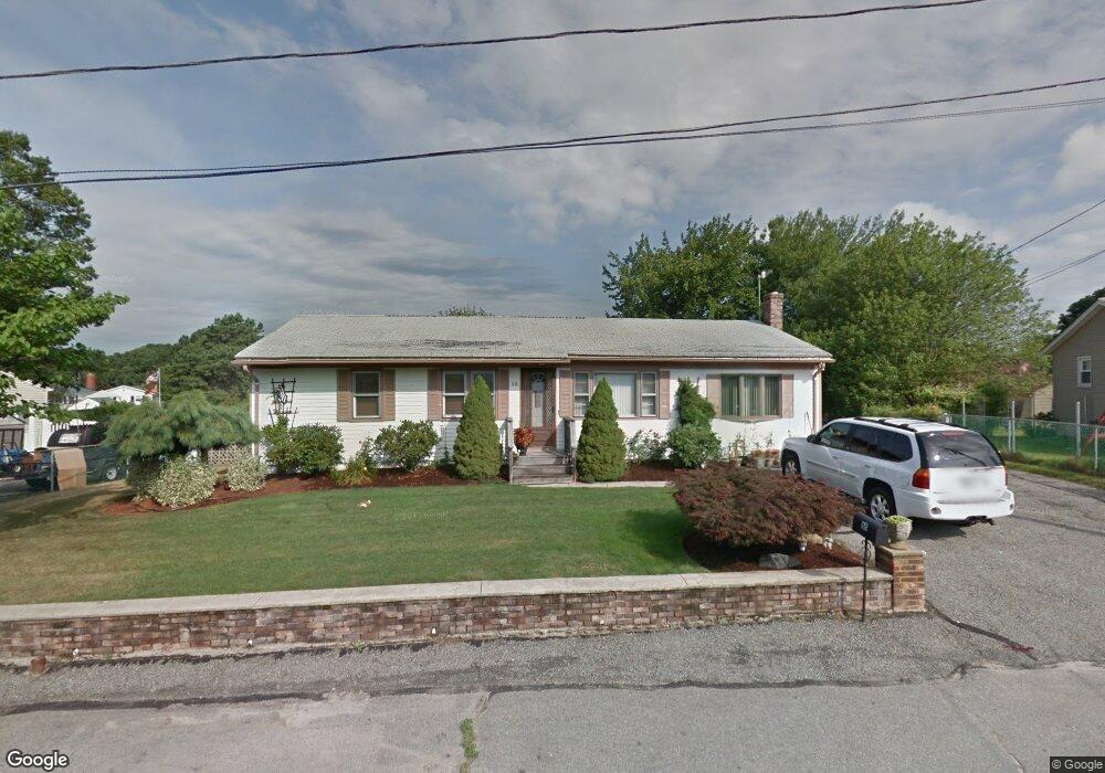
18 Kiwanis Rd West Warwick, RI 02893
Crompton NeighborhoodEstimated Value: $439,000 - $459,000
4
Beds
2
Baths
2,052
Sq Ft
$218/Sq Ft
Est. Value
About This Home
This home is located at 18 Kiwanis Rd, West Warwick, RI 02893 and is currently estimated at $446,776, approximately $217 per square foot. 18 Kiwanis Rd is a home located in Kent County with nearby schools including West Warwick High School and Father John V. Doyle School.
Ownership History
Date
Name
Owned For
Owner Type
Purchase Details
Closed on
Jul 20, 1998
Sold by
Verte Pietro V and Verte Anna
Bought by
Stanley Thomas C and Stanley Debra
Current Estimated Value
Home Financials for this Owner
Home Financials are based on the most recent Mortgage that was taken out on this home.
Original Mortgage
$92,000
Interest Rate
6.98%
Create a Home Valuation Report for This Property
The Home Valuation Report is an in-depth analysis detailing your home's value as well as a comparison with similar homes in the area
Home Values in the Area
Average Home Value in this Area
Purchase History
| Date | Buyer | Sale Price | Title Company |
|---|---|---|---|
| Stanley Thomas C | $100,000 | -- |
Source: Public Records
Mortgage History
| Date | Status | Borrower | Loan Amount |
|---|---|---|---|
| Open | Stanley Thomas C | $80,000 | |
| Open | Stanley Thomas C | $152,000 | |
| Closed | Stanley Thomas C | $92,000 |
Source: Public Records
Tax History
| Year | Tax Paid | Tax Assessment Tax Assessment Total Assessment is a certain percentage of the fair market value that is determined by local assessors to be the total taxable value of land and additions on the property. | Land | Improvement |
|---|---|---|---|---|
| 2025 | $5,556 | $388,800 | $109,300 | $279,500 |
| 2024 | $5,467 | $292,500 | $86,300 | $206,200 |
| 2023 | $5,359 | $292,500 | $86,300 | $206,200 |
| 2022 | $5,277 | $292,500 | $86,300 | $206,200 |
| 2021 | $5,272 | $229,200 | $69,100 | $160,100 |
| 2020 | $5,272 | $229,200 | $69,100 | $160,100 |
| 2019 | $6,720 | $229,200 | $69,100 | $160,100 |
| 2018 | $4,990 | $183,600 | $67,100 | $116,500 |
| 2017 | $4,831 | $183,600 | $67,100 | $116,500 |
| 2016 | $4,744 | $183,600 | $67,100 | $116,500 |
| 2015 | $4,330 | $166,800 | $67,100 | $99,700 |
| 2014 | $1,059 | $166,800 | $67,100 | $99,700 |
Source: Public Records
Map
Nearby Homes
- 59 Bratt Ln
- 0 New London Turnpike
- 12 Whittier Dr
- 25 Wescott Way Unit 80
- 2 Kings Forest Ln
- 32 Longfellow Dr
- 1 Hampton Rd Unit 27
- 19 Turner Dr
- 15 Hampton Rd Unit 20
- 19 Hampton Rd Unit 69
- 40 Wescott Way Unit 57
- 11 Kennedy Dr
- 275 E Shore Dr
- 251 E Shore Dr
- 57 Setian Ln
- 22 Rawlinson Dr
- 136 Silverwood Ln
- 2400 Division Rd
- 1728 Main St
- 8 Surrey Ln
Your Personal Tour Guide
Ask me questions while you tour the home.