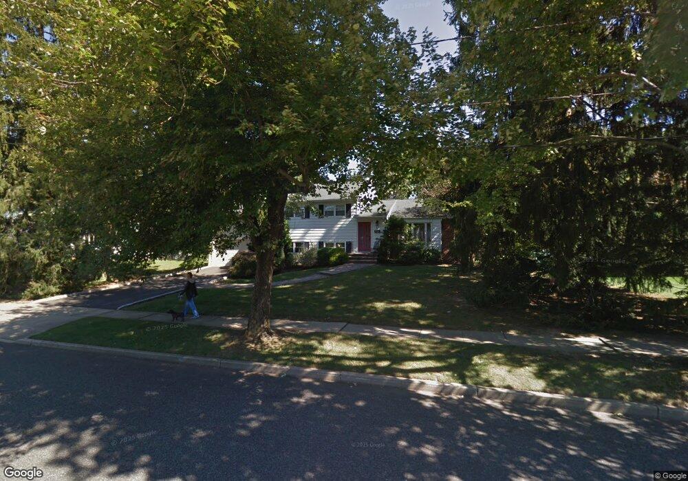
18 Landsdowne Rd East Brunswick, NJ 08816
Estimated Value: $524,794 - $730,000
--
Bed
--
Bath
1,970
Sq Ft
$337/Sq Ft
Est. Value
About This Home
This home is located at 18 Landsdowne Rd, East Brunswick, NJ 08816 and is currently estimated at $664,699, approximately $337 per square foot. 18 Landsdowne Rd is a home located in Middlesex County with nearby schools including Robert Frost Elementary School, Hammarskjold Upper Elementary School, and Churchill Junior High School.
Ownership History
Date
Name
Owned For
Owner Type
Purchase Details
Closed on
Sep 5, 2024
Sold by
Machurov Alex and Machurov Robin
Bought by
Machurov Robin
Current Estimated Value
Purchase Details
Closed on
Mar 14, 2005
Sold by
Loncar Srdjan
Bought by
Machurov Alex and Machurov Robin
Home Financials for this Owner
Home Financials are based on the most recent Mortgage that was taken out on this home.
Original Mortgage
$359,650
Interest Rate
5.95%
Mortgage Type
New Conventional
Purchase Details
Closed on
Jun 25, 1996
Sold by
Hodes Martin
Bought by
Loncar Srdjan and Baratta Anna
Home Financials for this Owner
Home Financials are based on the most recent Mortgage that was taken out on this home.
Original Mortgage
$169,000
Interest Rate
8.05%
Create a Home Valuation Report for This Property
The Home Valuation Report is an in-depth analysis detailing your home's value as well as a comparison with similar homes in the area
Home Values in the Area
Average Home Value in this Area
Purchase History
| Date | Buyer | Sale Price | Title Company |
|---|---|---|---|
| Machurov Robin | $192,802 | Foundation Title | |
| Machurov Alex | $449,900 | -- | |
| Loncar Srdjan | $211,000 | -- |
Source: Public Records
Mortgage History
| Date | Status | Borrower | Loan Amount |
|---|---|---|---|
| Previous Owner | Machurov Alex | $359,650 | |
| Previous Owner | Loncar Srdjan | $169,000 |
Source: Public Records
Tax History Compared to Growth
Tax History
| Year | Tax Paid | Tax Assessment Tax Assessment Total Assessment is a certain percentage of the fair market value that is determined by local assessors to be the total taxable value of land and additions on the property. | Land | Improvement |
|---|---|---|---|---|
| 2025 | $12,170 | $99,800 | $30,300 | $69,500 |
| 2024 | $11,806 | $99,800 | $30,300 | $69,500 |
| 2023 | $11,806 | $99,800 | $30,300 | $69,500 |
| 2022 | $11,759 | $99,800 | $30,300 | $69,500 |
| 2021 | $11,424 | $99,800 | $30,300 | $69,500 |
| 2020 | $11,408 | $99,800 | $30,300 | $69,500 |
| 2019 | $11,286 | $99,800 | $30,300 | $69,500 |
| 2018 | $10,572 | $95,100 | $30,300 | $64,800 |
| 2017 | $10,402 | $95,100 | $30,300 | $64,800 |
| 2016 | $10,192 | $95,100 | $30,300 | $64,800 |
| 2015 | $9,952 | $95,100 | $30,300 | $64,800 |
| 2014 | $9,737 | $95,100 | $30,300 | $64,800 |
Source: Public Records
Map
Nearby Homes
- 5 Queens Rd
- 17 Stephens Dr
- 113 Lloyd Ct
- 90 van Liew Ct
- 349 Summerhill Rd
- 24 Lonczak Ln
- 140 Magee Ct
- 89 Griggs Place
- 78 Whitehead Ln Unit 78
- 199 Stults Ln
- 114 Griggs Place
- 114 Griggs Place Unit FL
- 166 Stults Ln Unit 23C
- 6 Wycoff Way E
- 12 Francis Rd
- 13 Francis Rd
- 12 Watchung Rd
- 21 Rice Run
- 29 Whittney Ct
- 17 Dobson Rd
- 20 Landsdowne Rd
- 55 Canterbury Rd
- 14 Landsdowne Rd
- 17 Landsdowne Rd
- 22 Landsdowne Rd
- 59 Canterbury Rd
- 19 Landsdowne Rd
- 51 Canterbury Rd
- 15 Landsdowne Rd
- 21 Landsdowne Rd
- 63 Canterbury Rd
- 24 Landsdowne Rd
- 56 Canterbury Rd
- 7 Clovis Rd
- 3 Clovis Rd
- 4 Snowden Rd
- 11 Clovis Rd
- 67 Canterbury Rd
- 60 Canterbury Rd
- 13 Landsdowne Rd