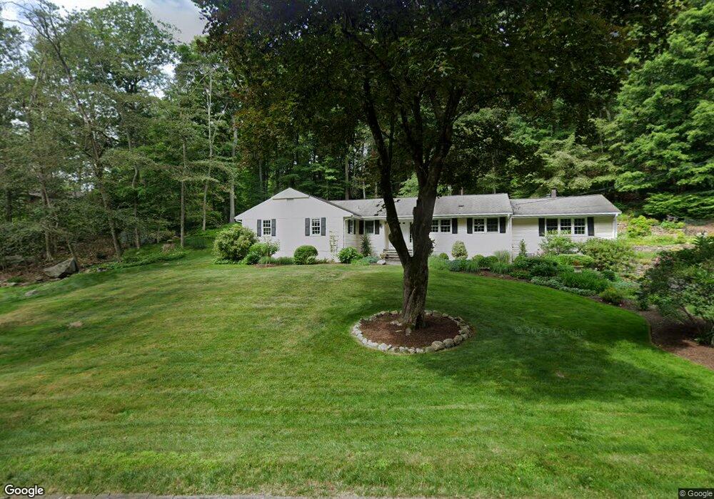
18 Laurel Ledge Ct Stamford, CT 06903
North Stamford NeighborhoodEstimated Value: $987,000 - $1,291,000
4
Beds
3
Baths
2,530
Sq Ft
$437/Sq Ft
Est. Value
About This Home
This home is located at 18 Laurel Ledge Ct, Stamford, CT 06903 and is currently estimated at $1,106,710, approximately $437 per square foot. 18 Laurel Ledge Ct is a home located in Fairfield County with nearby schools including Roxbury School, Cloonan School, and Westhill High School.
Ownership History
Date
Name
Owned For
Owner Type
Purchase Details
Closed on
Jan 10, 2011
Sold by
Jp Morgan Chase Bk
Bought by
Wolter Richard A
Current Estimated Value
Purchase Details
Closed on
Dec 10, 2010
Sold by
Wolter Richard A and Wolter Charlotte P
Bought by
Illuzzi Alphonse and Illuzzi Angela
Purchase Details
Closed on
Apr 30, 2002
Sold by
Houghton Gerald H and Houghton Gileen P
Bought by
Wolter Richard A and Wolter Charlotte P
Create a Home Valuation Report for This Property
The Home Valuation Report is an in-depth analysis detailing your home's value as well as a comparison with similar homes in the area
Home Values in the Area
Average Home Value in this Area
Purchase History
| Date | Buyer | Sale Price | Title Company |
|---|---|---|---|
| Wolter Richard A | -- | -- | |
| Illuzzi Alphonse | $685,000 | -- | |
| Wolter Richard A | $649,900 | -- |
Source: Public Records
Tax History
| Year | Tax Paid | Tax Assessment Tax Assessment Total Assessment is a certain percentage of the fair market value that is determined by local assessors to be the total taxable value of land and additions on the property. | Land | Improvement |
|---|---|---|---|---|
| 2025 | $11,428 | $491,100 | $242,170 | $248,930 |
| 2024 | $11,177 | $491,100 | $242,170 | $248,930 |
| 2023 | $12,012 | $491,100 | $242,170 | $248,930 |
| 2022 | $10,512 | $399,250 | $184,090 | $215,160 |
| 2021 | $10,369 | $399,250 | $184,090 | $215,160 |
| 2020 | $10,113 | $399,250 | $184,090 | $215,160 |
| 2019 | $10,113 | $399,250 | $184,090 | $215,160 |
| 2018 | $9,762 | $399,250 | $184,090 | $215,160 |
| 2017 | $10,456 | $408,580 | $206,440 | $202,140 |
| 2016 | $10,141 | $408,580 | $206,440 | $202,140 |
| 2015 | $9,863 | $408,580 | $206,440 | $202,140 |
| 2014 | $9,524 | $408,580 | $206,440 | $202,140 |
Source: Public Records
Map
Nearby Homes
- 80 Old Long Ridge Rd
- 4 Ravenglass Dr
- 21 S Brook Dr
- 6 S Brook Dr
- 88 Bentwood Dr
- Lot #21 S Brook Dr
- Lot #6 S Brook Dr
- 0 S Brook Dr Unit 170552650
- 150 Wildwood Rd
- 40 Wildwood Rd
- 215 S Lake Dr
- 33 Pinnacle Rock Rd
- 202 Fox Ridge Rd
- 71 Heming Way
- 125 Barn Hill Rd
- 29 Echo Hill Dr
- 2856 Long Ridge Rd
- 43 Ridgecrest Rd
- 93 E Middle Patent Rd
- 251 Saddle Hill Rd
- 7 Laurel Ledge Ct
- 28 Laurel Ledge Ct
- 124 Laurel Ledge Rd
- 428 Erskine Rd
- 36 Laurel Ledge Ct
- 104 Laurel Ledge Rd
- 83 Laurel Ledge Rd
- 38 Laurel Ledge Ct
- 416 Erskine Rd
- 45 Laurel Ledge Ct
- 0 Erskine Rd
- 346466 Erskine Rd
- 44 Laurel Ledge Ct
- 82 Laurel Ledge Rd
- 80 Tall Oaks Ct
- 396 Erskine Rd
- 85 Tall Oaks Ct
- 52 Laurel Ledge Ct
- 69 Laurel Ledge Rd
- 49 Laurel Ledge Ct
Your Personal Tour Guide
Ask me questions while you tour the home.