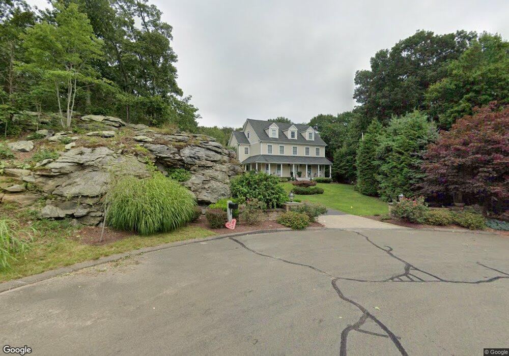
18 Linnea Ln Killingworth, CT 06419
Estimated Value: $790,000 - $886,000
4
Beds
4
Baths
3,562
Sq Ft
$238/Sq Ft
Est. Value
About This Home
This home is located at 18 Linnea Ln, Killingworth, CT 06419 and is currently estimated at $848,848, approximately $238 per square foot. 18 Linnea Ln is a home located in Middlesex County with nearby schools including Haddam-Killingworth High School.
Ownership History
Date
Name
Owned For
Owner Type
Purchase Details
Closed on
Aug 12, 1999
Sold by
Lafata Land Dev
Bought by
Marcum John D and Marcum Marsha I
Current Estimated Value
Home Financials for this Owner
Home Financials are based on the most recent Mortgage that was taken out on this home.
Original Mortgage
$230,000
Interest Rate
7.75%
Create a Home Valuation Report for This Property
The Home Valuation Report is an in-depth analysis detailing your home's value as well as a comparison with similar homes in the area
Home Values in the Area
Average Home Value in this Area
Purchase History
| Date | Buyer | Sale Price | Title Company |
|---|---|---|---|
| Marcum John D | $80,000 | -- |
Source: Public Records
Mortgage History
| Date | Status | Borrower | Loan Amount |
|---|---|---|---|
| Open | Marcum John D | $295,000 | |
| Closed | Marcum John D | $64,152 | |
| Closed | Marcum John D | $230,000 |
Source: Public Records
Tax History Compared to Growth
Tax History
| Year | Tax Paid | Tax Assessment Tax Assessment Total Assessment is a certain percentage of the fair market value that is determined by local assessors to be the total taxable value of land and additions on the property. | Land | Improvement |
|---|---|---|---|---|
| 2025 | $11,680 | $445,480 | $104,790 | $340,690 |
| 2024 | $10,790 | $445,480 | $104,790 | $340,690 |
| 2023 | $10,455 | $445,480 | $104,790 | $340,690 |
| 2022 | $10,344 | $445,480 | $104,790 | $340,690 |
| 2021 | $10,862 | $406,510 | $115,290 | $291,220 |
| 2020 | $10,862 | $406,510 | $115,290 | $291,220 |
| 2019 | $11,167 | $406,510 | $115,290 | $291,220 |
| 2018 | $11,167 | $406,510 | $115,290 | $291,220 |
| 2017 | $11,167 | $406,510 | $115,290 | $291,220 |
| 2016 | $11,412 | $440,800 | $181,120 | $259,680 |
| 2015 | $11,121 | $440,800 | $181,120 | $259,680 |
| 2014 | $10,813 | $440,800 | $181,120 | $259,680 |
Source: Public Records
Map
Nearby Homes
- 25 Roast Meat Hill Rd
- 248 Cow Hill Rd
- 11 Silver Birch Ln
- 244 Cow Hill Rd
- 4 Laurel Ln
- 43 Evergreen Park
- 246 Cow Hill Rd
- 25 Kelseytown Bridge Rd
- 0 Kelseytown Bridge Rd
- 15 Egypt Ln
- 179 Route 81
- 37 Titus Coan Rd
- 131 Cow Hill Rd
- 48A Ironworks Rd
- 5 Kings Grant Rd
- 19 Ironworks Rd
- 4 Columbia Rd
- 14 Blaine Ave
- 3 Jamaica Rd
- 262 Connecticut 81
- 94 Laurel Ridge Trail
- 16 Linnea Ln
- 12 Linnea Ln
- 92 Laurel Ridge Trail
- 15 Linnea Ln
- 17 Route 81
- 19 Lafata Ln
- 23 Route 81
- 27 Route 81
- 90 Laurel Ridge Trail
- 7 Linnea Ln
- 13 Lafata Ln
- 21 Lafata Ln
- 31 Route 81
- 10 Roast Meat Hill Rd
- 88 Laurel Ridge Trail
- 3 Linnea Ln
- 7 Lafata Ln
- 60 Laurel Ridge Trail
- 2 Roast Meat Hill Rd