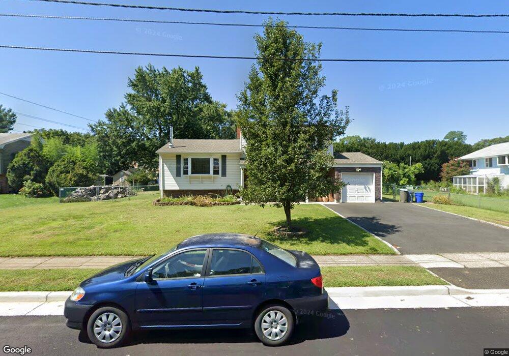
18 Lonsdale Dr South Plainfield, NJ 07080
Estimated Value: $615,261 - $716,000
4
Beds
2
Baths
--
Sq Ft
0.27
Acres
About This Home
This home is located at 18 Lonsdale Dr, South Plainfield, NJ 07080 and is currently estimated at $671,565. 18 Lonsdale Dr is a home located in Middlesex County with nearby schools including South Plainfield High School, The Queen City Academy Charter School, and Holy Savior Academy.
Ownership History
Date
Name
Owned For
Owner Type
Purchase Details
Closed on
Jan 19, 2006
Sold by
Holmes Patricia
Bought by
Prehn Edward and Prehn Kathleen
Current Estimated Value
Home Financials for this Owner
Home Financials are based on the most recent Mortgage that was taken out on this home.
Original Mortgage
$316,000
Outstanding Balance
$178,351
Interest Rate
6.34%
Estimated Equity
$493,214
Create a Home Valuation Report for This Property
The Home Valuation Report is an in-depth analysis detailing your home's value as well as a comparison with similar homes in the area
Home Values in the Area
Average Home Value in this Area
Purchase History
| Date | Buyer | Sale Price | Title Company |
|---|---|---|---|
| Prehn Edward | $395,000 | -- |
Source: Public Records
Mortgage History
| Date | Status | Borrower | Loan Amount |
|---|---|---|---|
| Open | Prehn Edward | $316,000 |
Source: Public Records
Tax History Compared to Growth
Tax History
| Year | Tax Paid | Tax Assessment Tax Assessment Total Assessment is a certain percentage of the fair market value that is determined by local assessors to be the total taxable value of land and additions on the property. | Land | Improvement |
|---|---|---|---|---|
| 2025 | $9,293 | $133,100 | $36,500 | $96,600 |
| 2024 | $8,888 | $133,100 | $36,500 | $96,600 |
| 2023 | $8,888 | $133,100 | $36,500 | $96,600 |
| 2022 | $8,778 | $133,100 | $36,500 | $96,600 |
| 2021 | $8,314 | $129,100 | $36,500 | $92,600 |
| 2020 | $8,193 | $129,100 | $36,500 | $92,600 |
| 2019 | $7,861 | $129,100 | $36,500 | $92,600 |
| 2018 | $7,658 | $129,100 | $36,500 | $92,600 |
| 2017 | $7,560 | $129,100 | $36,500 | $92,600 |
| 2016 | $7,484 | $129,100 | $36,500 | $92,600 |
| 2015 | $7,355 | $129,100 | $36,500 | $92,600 |
| 2014 | $7,143 | $129,100 | $36,500 | $92,600 |
Source: Public Records
Map
Nearby Homes
- 22 Lonsdale Dr
- 14 Lonsdale Dr
- 1507 Tooz Place
- 1511 Tooz Place
- 1503 Tooz Place
- 31 Lonsdale Dr
- 27 Lonsdale Dr
- 26 Lonsdale Dr
- 35 Lonsdale Dr
- 1515 Tooz Place
- 15 Lonsdale Dr
- 23 Lonsdale Dr
- 19 Lonsdale Dr
- 30 Lonsdale Dr
- 1506 Tooz Place
- 11 Lonsdale Dr
- 209 Ledden Terrace
- 217 Ledden Terrace
- 205 Ledden Terrace
- 1516 Tooz Place