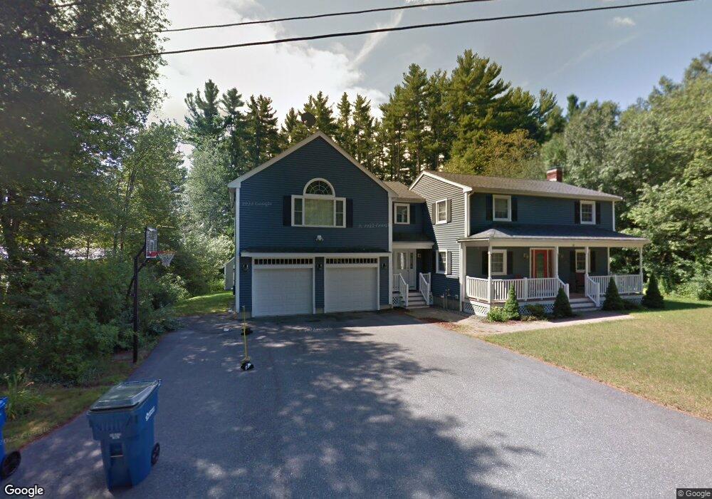
18 Louis Rd Tewksbury, MA 01876
Estimated Value: $838,000 - $956,000
4
Beds
3
Baths
3,275
Sq Ft
$273/Sq Ft
Est. Value
About This Home
This home is located at 18 Louis Rd, Tewksbury, MA 01876 and is currently estimated at $893,149, approximately $272 per square foot. 18 Louis Rd is a home located in Middlesex County with nearby schools including John F. Ryan Elementary School, John W. Wynn Middle School, and Tewksbury Memorial High School.
Ownership History
Date
Name
Owned For
Owner Type
Purchase Details
Closed on
Dec 12, 2011
Sold by
Litton Derek and Litton Lynne M
Bought by
Litton Derek
Current Estimated Value
Purchase Details
Closed on
Apr 22, 2004
Sold by
Ernest Robert J and Ernest Adrienne M
Bought by
Litton Derek and Litton Lynne M
Home Financials for this Owner
Home Financials are based on the most recent Mortgage that was taken out on this home.
Original Mortgage
$280,000
Interest Rate
5.4%
Mortgage Type
Purchase Money Mortgage
Create a Home Valuation Report for This Property
The Home Valuation Report is an in-depth analysis detailing your home's value as well as a comparison with similar homes in the area
Home Values in the Area
Average Home Value in this Area
Purchase History
| Date | Buyer | Sale Price | Title Company |
|---|---|---|---|
| Litton Derek | -- | -- | |
| Litton Derek | $395,900 | -- |
Source: Public Records
Mortgage History
| Date | Status | Borrower | Loan Amount |
|---|---|---|---|
| Previous Owner | Litton Derek | $280,000 |
Source: Public Records
Tax History Compared to Growth
Tax History
| Year | Tax Paid | Tax Assessment Tax Assessment Total Assessment is a certain percentage of the fair market value that is determined by local assessors to be the total taxable value of land and additions on the property. | Land | Improvement |
|---|---|---|---|---|
| 2025 | $10,626 | $803,800 | $335,900 | $467,900 |
| 2024 | $10,404 | $777,000 | $320,300 | $456,700 |
| 2023 | $10,101 | $716,400 | $291,100 | $425,300 |
| 2022 | $9,644 | $634,500 | $253,200 | $381,300 |
| 2021 | $8,648 | $607,300 | $230,100 | $377,200 |
| 2020 | $5,196 | $589,300 | $219,200 | $370,100 |
| 2019 | $8,805 | $555,900 | $208,800 | $347,100 |
| 2018 | $4,772 | $533,000 | $208,800 | $324,200 |
| 2017 | $8,657 | $530,800 | $208,800 | $322,000 |
| 2016 | $8,281 | $506,500 | $208,800 | $297,700 |
| 2015 | $7,971 | $486,900 | $199,200 | $287,700 |
| 2014 | $7,646 | $474,600 | $208,800 | $265,800 |
Source: Public Records
Map
Nearby Homes
- 1170 Livingston St
- 139 Prospect Hill Dr Unit Lot 15
- 68 Catamount Rd
- 399 North St
- 1117 Emerald Ct
- 11 Emerald Ct
- 1224 Emerald Ct
- 20 Meredith Rd
- 18 Newton Ave
- 65 Martin Rd
- 13 Berkeley
- 51 Nolan Ct Unit 51
- 101 Squire Ln
- 100 Pleasant St Unit 14
- 1220 Andover St
- 101 Bellevue Rd
- 9 Cobleigh Dr
- 164 Astle St
- 11 Orchard St
- 1325 Main
- LOT 3 Dairy Farm Way
- LOT 13 Sheridan Ln
- LOT 11 & 12 Whittemore St
- LOT 3 Minuteman Way
- LOT 6 Briana Lee Cir
- LOT 22 Germano Dr
- LOT 14 Germano Dr
- LOT 2 Meadowlands Ct
- LOT 9 Harold Place
- LOT 4 Briana Lee Cir
- LOT 9 Danielle Dr
- LOT 16 Germano Dr
- LOT46 Lot #11(martel Estate)
- LOT 5 Danielle Dr
- LOT 4 Danielle Dr
- 20 Marion Dr
- 16 Louis Rd
- 16 Marion Dr
- 22 Marion Dr
- 14 Louis Rd