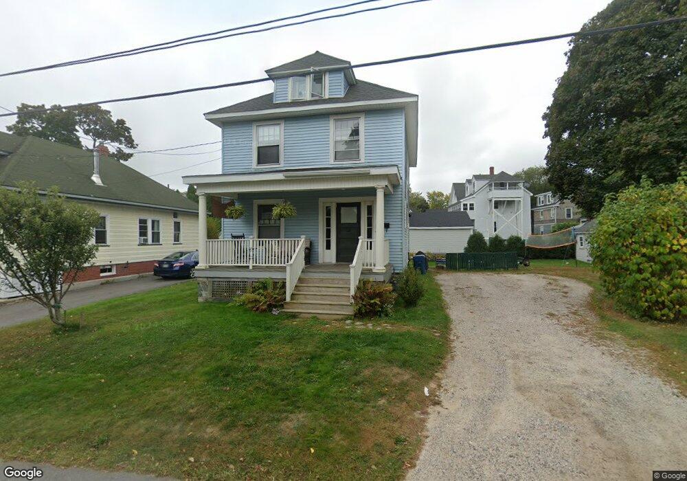
18 Mayland St Portland, ME 04103
Back Cove NeighborhoodEstimated Value: $461,000 - $653,000
3
Beds
1
Bath
1,238
Sq Ft
$439/Sq Ft
Est. Value
About This Home
This home is located at 18 Mayland St, Portland, ME 04103 and is currently estimated at $543,318, approximately $438 per square foot. 18 Mayland St is a home located in Cumberland County with nearby schools including Ocean Avenue Elementary School, Lyman Moore Middle School, and Baxter Academy for Tech & Sciences.
Ownership History
Date
Name
Owned For
Owner Type
Purchase Details
Closed on
Sep 22, 2009
Sold by
Woodward Donald W Est
Bought by
Furman Sarah E and Smith Geoffrey S
Current Estimated Value
Home Financials for this Owner
Home Financials are based on the most recent Mortgage that was taken out on this home.
Original Mortgage
$166,590
Outstanding Balance
$109,446
Interest Rate
5.28%
Mortgage Type
FHA
Estimated Equity
$433,872
Create a Home Valuation Report for This Property
The Home Valuation Report is an in-depth analysis detailing your home's value as well as a comparison with similar homes in the area
Home Values in the Area
Average Home Value in this Area
Purchase History
| Date | Buyer | Sale Price | Title Company |
|---|---|---|---|
| Furman Sarah E | -- | -- |
Source: Public Records
Mortgage History
| Date | Status | Borrower | Loan Amount |
|---|---|---|---|
| Open | Furman Sarah E | $166,590 |
Source: Public Records
Tax History Compared to Growth
Tax History
| Year | Tax Paid | Tax Assessment Tax Assessment Total Assessment is a certain percentage of the fair market value that is determined by local assessors to be the total taxable value of land and additions on the property. | Land | Improvement |
|---|---|---|---|---|
| 2024 | $4,839 | $322,400 | $70,300 | $252,100 |
| 2023 | $4,646 | $322,400 | $70,300 | $252,100 |
| 2022 | $4,388 | $322,400 | $70,300 | $252,100 |
| 2021 | $4,188 | $322,400 | $70,300 | $252,100 |
| 2020 | $4,077 | $174,900 | $70,300 | $104,600 |
| 2019 | $4,077 | $174,900 | $70,300 | $104,600 |
| 2018 | $3,932 | $174,900 | $70,300 | $104,600 |
| 2017 | $3,787 | $174,900 | $70,300 | $104,600 |
| 2016 | $3,692 | $174,900 | $70,300 | $104,600 |
| 2015 | $3,608 | $174,900 | $70,300 | $104,600 |
| 2014 | $3,498 | $174,900 | $70,300 | $104,600 |
Source: Public Records
Map
Nearby Homes
- 33 Mayland St
- 42 Sawyer St
- 33 Bay View Dr
- 736 Forest Ave
- 44 Hersey St
- 25 Pleasant Ave
- 45 George St
- 37 Wellington Rd
- 44 Pleasant Ave
- 54 Read St
- 89 Clinton St
- 930 Forest Ave
- 147 Pleasant Ave Unit 2
- 65 Mcauley Way Unit 506
- 75 Mcauley Way Unit 307
- 75 Mcauley Way Unit 206
- 75 Mcauley Way Unit 401
- 75 Mcauley Way Unit 207
- 75 Mcauley Way Unit 502
- 75 Mcauley Way Unit 304