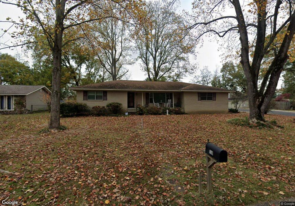
18 Mohave St Sherwood, AR 72120
Estimated Value: $172,980 - $206,000
--
Bed
2
Baths
1,747
Sq Ft
$108/Sq Ft
Est. Value
About This Home
This home is located at 18 Mohave St, Sherwood, AR 72120 and is currently estimated at $188,745, approximately $108 per square foot. 18 Mohave St is a home located in Pulaski County with nearby schools including Clinton Elementary School, Sylvan Hills Middle School, and Sylvan Hills High School.
Ownership History
Date
Name
Owned For
Owner Type
Purchase Details
Closed on
Aug 11, 2025
Sold by
Douglass Billy D
Bought by
Douglass Michael and Douglass Billy D
Current Estimated Value
Purchase Details
Closed on
Jun 30, 2016
Sold by
Douglass Billy D
Bought by
Douglass Billy D and Douglass Shirley L
Purchase Details
Closed on
Mar 23, 2006
Sold by
Henry Holli Jo and Henry Michael W
Bought by
Douglass Billy
Home Financials for this Owner
Home Financials are based on the most recent Mortgage that was taken out on this home.
Original Mortgage
$144,000
Interest Rate
6.24%
Mortgage Type
VA
Purchase Details
Closed on
Jan 15, 2003
Sold by
Nash Tom P and Nash Marilyn W
Bought by
Henry Michael W and Henry Holli Jo
Home Financials for this Owner
Home Financials are based on the most recent Mortgage that was taken out on this home.
Original Mortgage
$97,200
Interest Rate
5.96%
Create a Home Valuation Report for This Property
The Home Valuation Report is an in-depth analysis detailing your home's value as well as a comparison with similar homes in the area
Home Values in the Area
Average Home Value in this Area
Purchase History
| Date | Buyer | Sale Price | Title Company |
|---|---|---|---|
| Douglass Michael | -- | Professional Land Title Of Ark | |
| Douglass Billy D | -- | None Available | |
| Douglass Billy | $144,000 | Professional Land Title Comp | |
| Henry Michael W | $122,000 | Stewart Title Of Arkansas |
Source: Public Records
Mortgage History
| Date | Status | Borrower | Loan Amount |
|---|---|---|---|
| Previous Owner | Douglass Billy | $144,000 | |
| Previous Owner | Henry Michael W | $97,200 |
Source: Public Records
Tax History Compared to Growth
Tax History
| Year | Tax Paid | Tax Assessment Tax Assessment Total Assessment is a certain percentage of the fair market value that is determined by local assessors to be the total taxable value of land and additions on the property. | Land | Improvement |
|---|---|---|---|---|
| 2025 | $1,022 | $32,281 | $3,600 | $28,681 |
| 2024 | $1,022 | $32,281 | $3,600 | $28,681 |
| 2023 | $1,022 | $32,281 | $3,600 | $28,681 |
| 2022 | $1,201 | $32,281 | $3,600 | $28,681 |
| 2021 | $1,150 | $25,060 | $4,100 | $20,960 |
| 2020 | $768 | $25,060 | $4,100 | $20,960 |
| 2019 | $768 | $25,060 | $4,100 | $20,960 |
| 2018 | $793 | $25,060 | $4,100 | $20,960 |
| 2017 | $778 | $25,060 | $4,100 | $20,960 |
| 2016 | $778 | $23,580 | $4,800 | $18,780 |
| 2015 | $996 | $19,610 | $4,800 | $14,810 |
| 2014 | $996 | $19,610 | $4,800 | $14,810 |
Source: Public Records
Map
Nearby Homes
- 11 Whalen Place
- 606 Bay View Ct
- 7416 Glenn Hills Dr
- 68 Shoshoni Dr
- 10 Ponca St
- 106 Winona Dr
- 2125 Glenn Arbor Ct
- 6608 Southshore Ln
- 2125 Gap Creek Dr
- 6 W Laramie Dr
- 8711 Cayuga Ln
- 201 Bearskin Dr
- 6813 Gap Point Cir
- 2226 Bearskin Dr
- 6901 Gap Point Cir
- 7000 Park Meadows Dr
- 2216 Sage Meadows Cir
- 7112 E Ridge Dr
- 1306 Tupelo Ct
- 112 Sugar Maple Dr