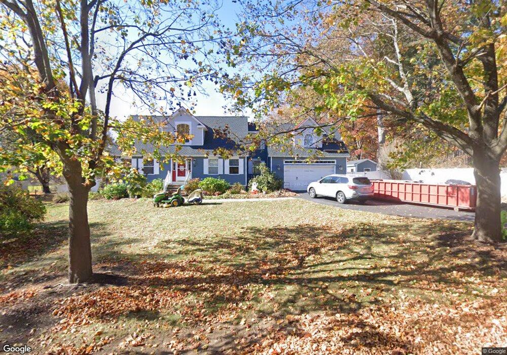
18 N Hunt Rd Amesbury, MA 01913
Estimated Value: $811,000 - $962,000
4
Beds
3
Baths
2,486
Sq Ft
$360/Sq Ft
Est. Value
About This Home
This home is located at 18 N Hunt Rd, Amesbury, MA 01913 and is currently estimated at $893,932, approximately $359 per square foot. 18 N Hunt Rd is a home located in Essex County with nearby schools including Amesbury High School and Amesbury Seventh-Day Adventist School.
Ownership History
Date
Name
Owned For
Owner Type
Purchase Details
Closed on
Aug 25, 2016
Sold by
Pryor John M and Pryor Megan J
Bought by
Graham Stephanie and Graham William R
Current Estimated Value
Home Financials for this Owner
Home Financials are based on the most recent Mortgage that was taken out on this home.
Original Mortgage
$417,000
Outstanding Balance
$332,976
Interest Rate
3.42%
Mortgage Type
New Conventional
Estimated Equity
$560,956
Purchase Details
Closed on
Oct 13, 2011
Sold by
Peveri Tracy L
Bought by
Pryor John M and Pryor Megan J
Home Financials for this Owner
Home Financials are based on the most recent Mortgage that was taken out on this home.
Original Mortgage
$279,920
Interest Rate
4.25%
Mortgage Type
Purchase Money Mortgage
Purchase Details
Closed on
Jun 26, 2002
Sold by
Dore Charles E and Dore Linwood R
Bought by
Loadman Tracy L
Create a Home Valuation Report for This Property
The Home Valuation Report is an in-depth analysis detailing your home's value as well as a comparison with similar homes in the area
Home Values in the Area
Average Home Value in this Area
Purchase History
| Date | Buyer | Sale Price | Title Company |
|---|---|---|---|
| Graham Stephanie | $439,000 | -- | |
| Pryor John M | $349,900 | -- | |
| Loadman Tracy L | $95,000 | -- |
Source: Public Records
Mortgage History
| Date | Status | Borrower | Loan Amount |
|---|---|---|---|
| Open | Graham Stephanie | $417,000 | |
| Previous Owner | Loadman Tracy L | $279,920 | |
| Previous Owner | Loadman Tracy L | $300,000 | |
| Previous Owner | Loadman Tracy L | $170,000 |
Source: Public Records
Tax History Compared to Growth
Tax History
| Year | Tax Paid | Tax Assessment Tax Assessment Total Assessment is a certain percentage of the fair market value that is determined by local assessors to be the total taxable value of land and additions on the property. | Land | Improvement |
|---|---|---|---|---|
| 2025 | $11,694 | $764,300 | $214,100 | $550,200 |
| 2024 | $11,764 | $752,200 | $202,000 | $550,200 |
| 2023 | $10,642 | $651,300 | $175,600 | $475,700 |
| 2022 | $9,728 | $549,900 | $152,700 | $397,200 |
| 2021 | $9,463 | $518,500 | $118,000 | $400,500 |
| 2020 | $8,714 | $507,200 | $113,400 | $393,800 |
| 2019 | $8,630 | $469,800 | $113,400 | $356,400 |
| 2018 | $8,834 | $465,200 | $108,000 | $357,200 |
| 2017 | $8,399 | $421,000 | $108,000 | $313,000 |
| 2016 | $8,090 | $398,900 | $108,000 | $290,900 |
| 2015 | $8,023 | $390,600 | $108,000 | $282,600 |
| 2014 | $7,264 | $346,400 | $108,000 | $238,400 |
Source: Public Records
Map
Nearby Homes
- 13 Bailey Pond Ln Unit 13
- 47 Cutter Ln Unit 47
- 8 Riverview Heights
- 19 Cutter Ln Unit 19
- 28 Beacon St
- The Beacon Plan at The Village At Bailey's Pond
- The Essex Plan at The Village At Bailey's Pond
- The Whaler Plan at The Village At Bailey's Pond
- The Bailey Plan at The Village At Bailey's Pond
- 49 W Greenwood St
- 31 Whitter Meadows Dr Unit 31
- 60 Merrimac St Unit 907
- 60 Merrimac St Unit 604
- 5 Moncrief St Unit 5
- 188 Lions Mouth Rd
- 35 Merrimac St
- 1 Acadia Kimball Rd Unit 1
- 4 Acadia Kimball Rd
- 4 Greenwood St
- 160 Haverhill Rd