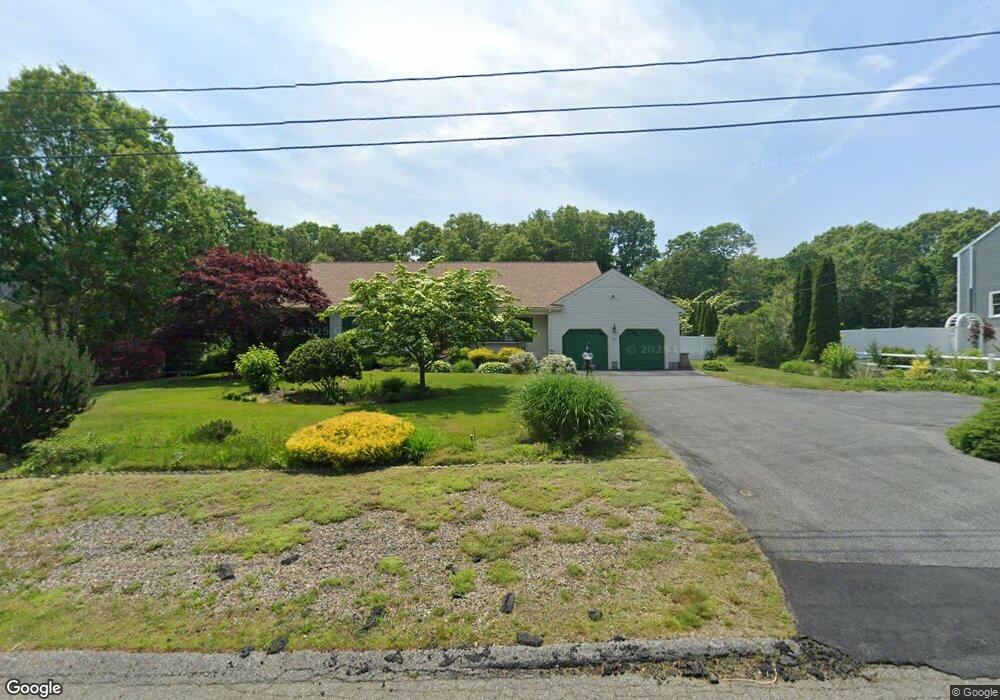
18 Nauset Rd Sagamore Beach, MA 02562
Estimated Value: $661,000 - $749,334
3
Beds
3
Baths
1,808
Sq Ft
$399/Sq Ft
Est. Value
About This Home
This home is located at 18 Nauset Rd, Sagamore Beach, MA 02562 and is currently estimated at $720,834, approximately $398 per square foot. 18 Nauset Rd is a home located in Barnstable County with nearby schools including Bourne High School, Bridgeview Montessori School, and New Testament Christian School.
Ownership History
Date
Name
Owned For
Owner Type
Purchase Details
Closed on
Aug 23, 2022
Sold by
Kelly Ellen M and Harrington Eleanor I
Bought by
Kelly Harrington T and Kelly Harrington
Current Estimated Value
Purchase Details
Closed on
Dec 28, 2001
Sold by
Albertazzi Edward D and Albertazzi Margaret E
Bought by
Harrington Eleanor I and Kelly Ellen M
Home Financials for this Owner
Home Financials are based on the most recent Mortgage that was taken out on this home.
Original Mortgage
$250,000
Interest Rate
6.61%
Mortgage Type
Purchase Money Mortgage
Purchase Details
Closed on
Nov 25, 1997
Sold by
R&G Rt and Goode Roger
Bought by
Albertazzi Edward and Albertazzi Margaret H
Purchase Details
Closed on
Jun 6, 1997
Sold by
18 Nausett Rd Rt and Doyle Julia
Bought by
R&G Rt and Goode Roger
Create a Home Valuation Report for This Property
The Home Valuation Report is an in-depth analysis detailing your home's value as well as a comparison with similar homes in the area
Home Values in the Area
Average Home Value in this Area
Purchase History
| Date | Buyer | Sale Price | Title Company |
|---|---|---|---|
| Kelly Harrington T | -- | None Available | |
| Kelly Harrington T | -- | None Available | |
| Harrington Eleanor I | $335,000 | -- | |
| Harrington Eleanor I | $335,000 | -- | |
| Albertazzi Edward | $140,000 | -- | |
| R&G Rt | $65,000 | -- |
Source: Public Records
Mortgage History
| Date | Status | Borrower | Loan Amount |
|---|---|---|---|
| Previous Owner | R&G Rt | $275,000 | |
| Previous Owner | R&G Rt | $268,100 | |
| Previous Owner | R&G Rt | $250,000 |
Source: Public Records
Tax History Compared to Growth
Tax History
| Year | Tax Paid | Tax Assessment Tax Assessment Total Assessment is a certain percentage of the fair market value that is determined by local assessors to be the total taxable value of land and additions on the property. | Land | Improvement |
|---|---|---|---|---|
| 2025 | $5,415 | $693,300 | $217,900 | $475,400 |
| 2024 | $5,335 | $665,200 | $207,500 | $457,700 |
| 2023 | $5,242 | $595,000 | $183,600 | $411,400 |
| 2022 | $4,964 | $492,000 | $162,500 | $329,500 |
| 2021 | $4,875 | $452,600 | $147,900 | $304,700 |
| 2020 | $4,744 | $441,700 | $146,500 | $295,200 |
| 2019 | $4,512 | $429,300 | $146,500 | $282,800 |
| 2018 | $4,193 | $397,800 | $139,500 | $258,300 |
| 2017 | $4,030 | $391,300 | $138,200 | $253,100 |
| 2016 | $3,917 | $385,500 | $138,200 | $247,300 |
| 2015 | $3,756 | $373,000 | $125,700 | $247,300 |
Source: Public Records
Map
Nearby Homes
- 10 Tecumseh Rd
- 5 Oakwood Dr
- 20 Brady Rd
- 133 Phillips Rd
- 5 Pocasset Rd
- 368 Old Plymouth Rd
- 67 Phillips Rd
- 67 Phillips Rd
- 0 State Rd
- 18 Ocean Pines Dr Unit A
- 16 Ocean Pines Dr Unit B
- 11 Village Green Dr Unit B
- 4 Fieldwood Dr
- 4 Fieldwood Dr
- 19 Oak Bluff Rd
- 42 Siasconset Dr
- 29 Sheppard Rd
- 38 Siasconset Dr
- 48 Menotomy Rd
- 1 Kara's Way