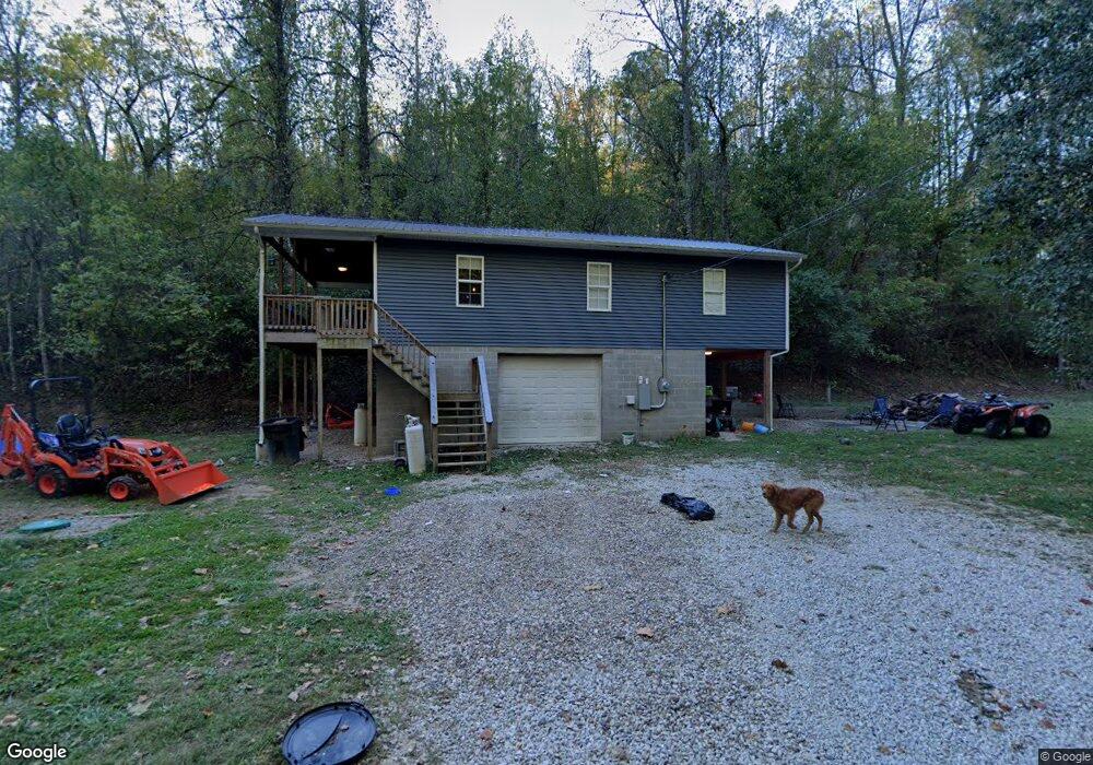
18 Owens Branch Rd Huntington, WV 25701
Estimated Value: $116,000 - $249,000
2
Beds
1
Bath
960
Sq Ft
$190/Sq Ft
Est. Value
About This Home
This home is located at 18 Owens Branch Rd, Huntington, WV 25701 and is currently estimated at $182,500, approximately $190 per square foot. 18 Owens Branch Rd is a home with nearby schools including Southside Elementary School, Huntington Middle School, and Huntington High School.
Ownership History
Date
Name
Owned For
Owner Type
Purchase Details
Closed on
Jul 15, 2025
Sold by
Belcher Justin
Bought by
Belcher Lindsey R
Current Estimated Value
Home Financials for this Owner
Home Financials are based on the most recent Mortgage that was taken out on this home.
Original Mortgage
$128,205
Outstanding Balance
$127,986
Interest Rate
6.81%
Mortgage Type
FHA
Estimated Equity
$54,514
Create a Home Valuation Report for This Property
The Home Valuation Report is an in-depth analysis detailing your home's value as well as a comparison with similar homes in the area
Home Values in the Area
Average Home Value in this Area
Purchase History
| Date | Buyer | Sale Price | Title Company |
|---|---|---|---|
| Belcher Lindsey R | $160,000 | None Listed On Document |
Source: Public Records
Mortgage History
| Date | Status | Borrower | Loan Amount |
|---|---|---|---|
| Open | Belcher Lindsey R | $128,205 |
Source: Public Records
Tax History Compared to Growth
Tax History
| Year | Tax Paid | Tax Assessment Tax Assessment Total Assessment is a certain percentage of the fair market value that is determined by local assessors to be the total taxable value of land and additions on the property. | Land | Improvement |
|---|---|---|---|---|
| 2024 | $658 | $53,720 | $11,660 | $42,060 |
| 2023 | $649 | $52,810 | $11,530 | $41,280 |
| 2022 | $637 | $51,560 | $11,660 | $39,900 |
| 2021 | $185 | $14,960 | $11,660 | $3,300 |
| 2020 | $185 | $14,900 | $11,660 | $3,240 |
| 2019 | $216 | $15,320 | $11,660 | $3,660 |
| 2018 | $190 | $15,260 | $11,660 | $3,600 |
| 2017 | $189 | $15,200 | $11,660 | $3,540 |
| 2016 | $210 | $16,800 | $7,680 | $9,120 |
| 2015 | $189 | $15,290 | $6,420 | $8,870 |
| 2014 | $194 | $15,470 | $6,420 | $9,050 |
Source: Public Records
Map
Nearby Homes
- 3515 Sky Oak Dr
- 0 Foster Rd Unit 181947
- 4308 8th Street Rd
- 175 Rock Ridge Ln
- 3600 Camp Creek Rd
- 3685 Morrow Rd
- 162 Woodhaven Dr
- 8 Woodhaven Dr
- 2209 S Inwood Dr
- 6419 Camp Creek Rd
- 2910 Harvey Rd
- 2050 Donald Ave
- 2055 Donald Ave
- 121 Honeysuckle Ln
- 119 Honeysuckle Ln
- 81 Hamill Rd
- 1873 Mccoy Rd
- 3379 Woodville Dr
- 417 Wilson Ct
- 1860 Mccoy Rd
- 16 Owens Branch Rd
- 1000 Dylan Dr
- 3516 Skyoak Dr
- 3516 Skyoak Dr
- 800 Dylan Dr
- 3518 Sky Oak Dr
- 3520 Sky Oak Dr
- 700 Dylan Dr
- 3522 Sky Oak Dr
- 3524 Sky Oak Dr
- 3526 Sky Oak Dr
- 3528 Skyoak Dr
- 3519 Skyoak Dr
- 3521 Sky Oak Dr
- 3517 Sky Oak Dr
- 3523 Sky Oak Dr
- 14 Owens Branch Rd
- 3525 Skyoak Dr
- 3515 Skyoak Dr
- 3653 Skyview Dr