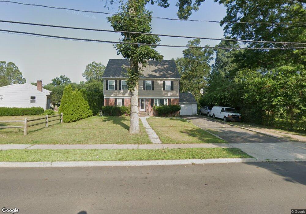
18 Pershing Ave Stamford, CT 06905
Belltown NeighborhoodEstimated Value: $642,000 - $969,216
2
Beds
3
Baths
2,535
Sq Ft
$319/Sq Ft
Est. Value
About This Home
This home is located at 18 Pershing Ave, Stamford, CT 06905 and is currently estimated at $809,054, approximately $319 per square foot. 18 Pershing Ave is a home located in Fairfield County with nearby schools including Julia A. Stark Elementary School, Dolan School, and Stamford High School.
Ownership History
Date
Name
Owned For
Owner Type
Purchase Details
Closed on
Nov 22, 2013
Sold by
Russell Linda M
Bought by
Pinto Jonathan M and Pinto Carla M
Current Estimated Value
Home Financials for this Owner
Home Financials are based on the most recent Mortgage that was taken out on this home.
Original Mortgage
$240,000
Outstanding Balance
$179,122
Interest Rate
4.25%
Mortgage Type
New Conventional
Estimated Equity
$629,932
Create a Home Valuation Report for This Property
The Home Valuation Report is an in-depth analysis detailing your home's value as well as a comparison with similar homes in the area
Home Values in the Area
Average Home Value in this Area
Purchase History
| Date | Buyer | Sale Price | Title Company |
|---|---|---|---|
| Pinto Jonathan M | $300,000 | -- | |
| Pinto Jonathan M | $300,000 | -- |
Source: Public Records
Mortgage History
| Date | Status | Borrower | Loan Amount |
|---|---|---|---|
| Open | Pinto Jonathan M | $240,000 | |
| Closed | Pinto Jonathan M | $240,000 |
Source: Public Records
Tax History
| Year | Tax Paid | Tax Assessment Tax Assessment Total Assessment is a certain percentage of the fair market value that is determined by local assessors to be the total taxable value of land and additions on the property. | Land | Improvement |
|---|---|---|---|---|
| 2025 | $13,313 | $562,670 | $248,120 | $314,550 |
| 2024 | $13,020 | $562,670 | $248,120 | $314,550 |
| 2023 | $13,988 | $562,670 | $248,120 | $314,550 |
| 2022 | $12,091 | $452,160 | $186,750 | $265,410 |
| 2021 | $11,960 | $452,160 | $186,750 | $265,410 |
| 2020 | $11,652 | $452,160 | $186,750 | $265,410 |
| 2019 | $11,652 | $452,160 | $186,750 | $265,410 |
| 2018 | $11,223 | $452,160 | $186,750 | $265,410 |
| 2017 | $10,953 | $421,280 | $172,930 | $248,350 |
| 2016 | $7,044 | $278,730 | $172,930 | $105,800 |
| 2015 | $6,965 | $283,030 | $172,930 | $110,100 |
| 2014 | $6,733 | $283,030 | $172,930 | $110,100 |
Source: Public Records
Map
Nearby Homes
- 173 Belltown Rd
- 10 Turner Rd
- 42 Hastings Ln
- 78 Elizabeth Ave
- 1 Megan Ln
- 102 Hirsch Rd
- 51 Saint Charles Ave
- 11 Belltown Rd Unit 1
- 153 Oaklawn Ave
- 71 Deleo Dr
- 680 Hope St Unit 12
- 28 Crestview Ave
- 39 Crane Rd
- 20 Norman Rd
- 91 Dann Dr
- 760 Hope St
- 408 Strawberry Hill Ave
- 7 Barnstable Ln
- 8 Barnstable Ln
- 455 Hope St Unit 4B
- 26 Pershing Ave
- 219 Belltown Rd
- 227 Belltown Rd
- 11 Pershing Ave
- 32 Pershing Ave
- 23 Pershing Ave
- 15 Pershing Ave
- 19 Pershing Ave
- 53 Todd Ln
- 233 Belltown Rd
- 27 Pershing Ave
- 33 Pershing Ave
- 200 Belltown Rd
- 237 Belltown Rd
- 47 Todd Ln
- 5 Maryanne Ln
- 190 Belltown Rd
- 55 Pershing Ave
- 41 Todd Ln
- 53 Pershing Ave
Your Personal Tour Guide
Ask me questions while you tour the home.