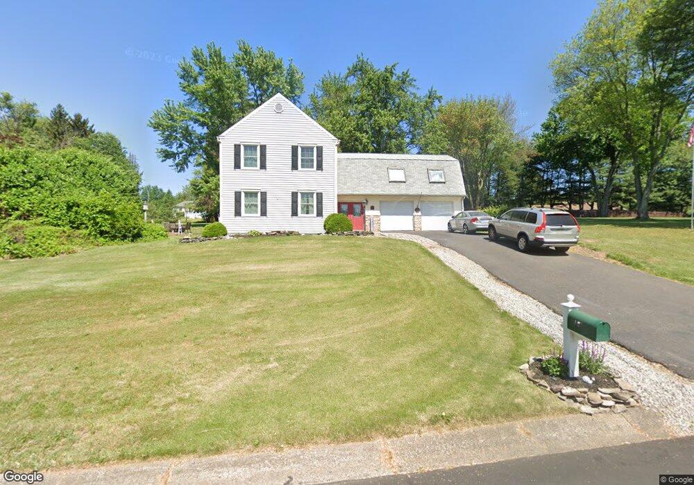
18 Pheasant Rd Doylestown, PA 18901
Estimated Value: $707,000 - $812,000
4
Beds
3
Baths
2,879
Sq Ft
$260/Sq Ft
Est. Value
About This Home
This home is located at 18 Pheasant Rd, Doylestown, PA 18901 and is currently estimated at $748,737, approximately $260 per square foot. 18 Pheasant Rd is a home located in Bucks County with nearby schools including Kutz Elementary School, Lenape Middle School, and Central Bucks High School-West.
Ownership History
Date
Name
Owned For
Owner Type
Purchase Details
Closed on
Jan 4, 2005
Sold by
Klayman Charles E and Klayman Digna E
Bought by
Brennan Leonard R and Brennan Colleen Brophy
Current Estimated Value
Home Financials for this Owner
Home Financials are based on the most recent Mortgage that was taken out on this home.
Original Mortgage
$10,000
Outstanding Balance
$5,035
Interest Rate
5.71%
Mortgage Type
Credit Line Revolving
Estimated Equity
$743,702
Purchase Details
Closed on
Apr 29, 2000
Sold by
Klayman Charles E and Klayman Lili
Bought by
Klayman Charles E and Klayman Digna E
Create a Home Valuation Report for This Property
The Home Valuation Report is an in-depth analysis detailing your home's value as well as a comparison with similar homes in the area
Home Values in the Area
Average Home Value in this Area
Purchase History
| Date | Buyer | Sale Price | Title Company |
|---|---|---|---|
| Brennan Leonard R | $365,900 | -- | |
| Klayman Charles E | $100,000 | -- |
Source: Public Records
Mortgage History
| Date | Status | Borrower | Loan Amount |
|---|---|---|---|
| Open | Brennan Leonard R | $10,000 | |
| Open | Brennan Leonard R | $199,300 |
Source: Public Records
Tax History
| Year | Tax Paid | Tax Assessment Tax Assessment Total Assessment is a certain percentage of the fair market value that is determined by local assessors to be the total taxable value of land and additions on the property. | Land | Improvement |
|---|---|---|---|---|
| 2025 | $6,725 | $38,000 | $8,920 | $29,080 |
| 2024 | $6,725 | $38,000 | $8,920 | $29,080 |
| 2023 | $6,412 | $38,000 | $8,920 | $29,080 |
| 2022 | $6,341 | $38,000 | $8,920 | $29,080 |
| 2021 | $6,210 | $38,000 | $8,920 | $29,080 |
| 2020 | $6,182 | $38,000 | $8,920 | $29,080 |
| 2019 | $6,115 | $38,000 | $8,920 | $29,080 |
| 2018 | $6,096 | $38,000 | $8,920 | $29,080 |
| 2017 | $6,049 | $38,000 | $8,920 | $29,080 |
| 2016 | $6,011 | $38,000 | $8,920 | $29,080 |
| 2015 | -- | $38,000 | $8,920 | $29,080 |
| 2014 | -- | $38,000 | $8,920 | $29,080 |
Source: Public Records
Map
Nearby Homes
- 117 Windover Ln
- 34 Houk Rd
- 3795 Route 202
- 3775 Buckingham Dr
- 45 Springs Dr
- 2980 Yorkshire Rd
- 000 Cherry Ln
- 150 Watercrest Dr
- 223 Cherry Ln
- 607 S Chubb Dr
- 152 Watercrest Dr
- 5 Belmont Square
- 3889 Robin Rd
- 3660 Buttonwood Dr
- 110 E Ashland St
- 146 E Court St
- 236 Green St
- 69 E Oakland Ave
- 4245 Mechanicsville Rd
- 150 Selner Ln
Your Personal Tour Guide
Ask me questions while you tour the home.