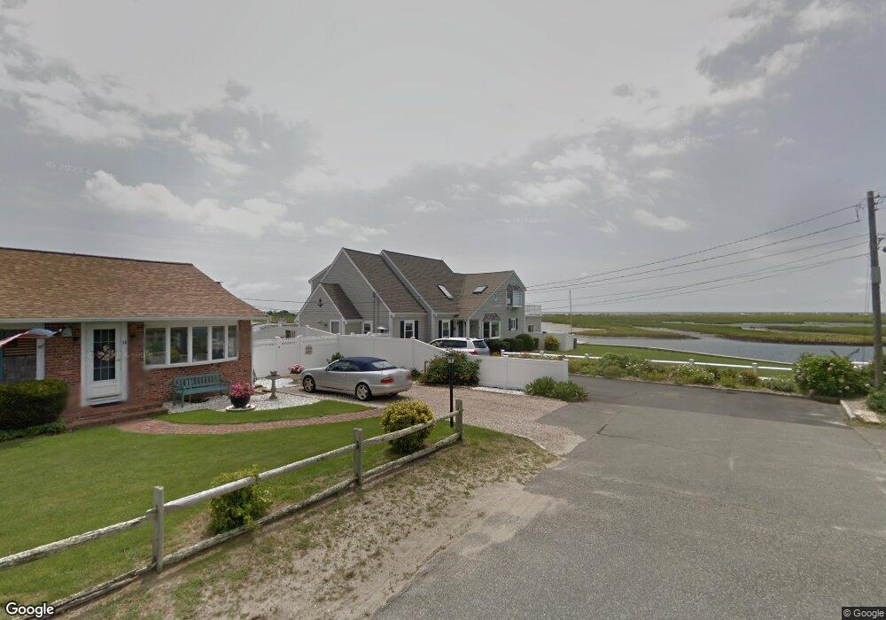
18 Port Way West Dennis, MA 02670
West Dennis NeighborhoodEstimated Value: $2,030,000 - $2,779,024
3
Beds
3
Baths
1,501
Sq Ft
$1,509/Sq Ft
Est. Value
About This Home
This home is located at 18 Port Way, West Dennis, MA 02670 and is currently estimated at $2,264,756, approximately $1,508 per square foot. 18 Port Way is a home located in Barnstable County with nearby schools including Dennis-Yarmouth Regional High School and St. Pius X. School.
Ownership History
Date
Name
Owned For
Owner Type
Purchase Details
Closed on
Nov 19, 2018
Sold by
Speca Bruce R and Speca Gail E
Bought by
Speca Rt and Speca
Current Estimated Value
Purchase Details
Closed on
Jul 31, 2008
Sold by
Speca Rt and Speca
Bought by
Speca Bruce R and Speca Gail E
Purchase Details
Closed on
Oct 10, 1997
Sold by
Rhodes Richard A and Rhodes Helen L
Bought by
Speca Bruce R and Speca Gail E
Home Financials for this Owner
Home Financials are based on the most recent Mortgage that was taken out on this home.
Original Mortgage
$350,000
Interest Rate
7.52%
Mortgage Type
Purchase Money Mortgage
Create a Home Valuation Report for This Property
The Home Valuation Report is an in-depth analysis detailing your home's value as well as a comparison with similar homes in the area
Home Values in the Area
Average Home Value in this Area
Purchase History
| Date | Buyer | Sale Price | Title Company |
|---|---|---|---|
| Speca Rt | -- | -- | |
| Speca Bruce R | -- | -- | |
| Speca Bruce R | -- | -- | |
| Speca Bruce R | $511,000 | -- |
Source: Public Records
Mortgage History
| Date | Status | Borrower | Loan Amount |
|---|---|---|---|
| Previous Owner | Speca Bruce R | $285,000 | |
| Previous Owner | Speca Bruce R | $350,000 | |
| Previous Owner | Speca Bruce R | $275,000 |
Source: Public Records
Tax History Compared to Growth
Tax History
| Year | Tax Paid | Tax Assessment Tax Assessment Total Assessment is a certain percentage of the fair market value that is determined by local assessors to be the total taxable value of land and additions on the property. | Land | Improvement |
|---|---|---|---|---|
| 2025 | $9,865 | $2,278,400 | $1,204,200 | $1,074,200 |
| 2024 | $9,677 | $2,204,300 | $1,158,100 | $1,046,200 |
| 2023 | $9,361 | $2,004,400 | $1,052,700 | $951,700 |
| 2022 | $8,620 | $1,539,300 | $834,600 | $704,700 |
| 2021 | $8,390 | $1,391,300 | $818,100 | $573,200 |
| 2020 | $8,290 | $1,359,000 | $818,100 | $540,900 |
| 2019 | $7,933 | $1,285,800 | $802,200 | $483,600 |
| 2018 | $7,649 | $1,206,500 | $763,600 | $442,900 |
| 2017 | $7,049 | $1,146,200 | $723,100 | $423,100 |
| 2016 | $7,604 | $1,164,500 | $804,100 | $360,400 |
| 2015 | $7,453 | $1,164,500 | $804,100 | $360,400 |
| 2014 | $7,323 | $1,153,200 | $804,100 | $349,100 |
Source: Public Records
Map
Nearby Homes
- 2 Rita Mary Way
- 14 Schoolhouse Ln
- 178 School St
- 209 Main St Unit 3
- 209 Main St Unit 6
- 209 Main St Unit 1
- 209 Main St Unit 2
- 209 Main St Unit 4
- 209 Main St Unit 5
- 23 Doric Ave
- 181 Pleasant St
- 308 Old Main St
- 401 Main St Unit 201
- 401 Main St Unit 101
- 45 Seth Ln
- 40 Kelley Rd
- 467 Main St
- 745 Willow St
- 29 Bass River Rd
- 6 Baker Way