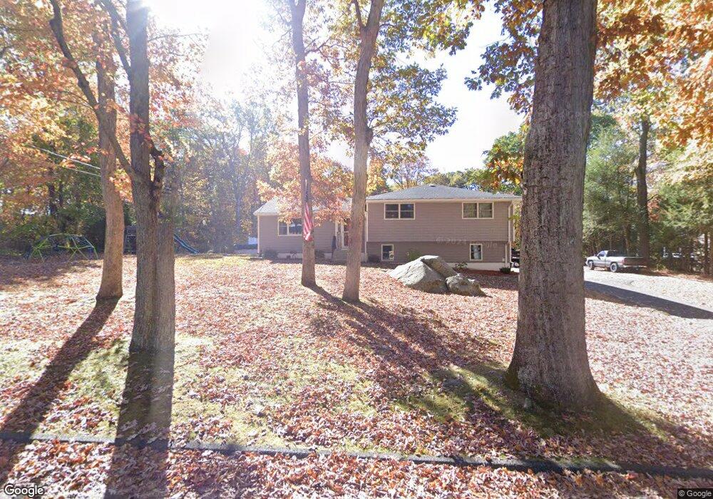
18 Ransom Hall Rd Unit EXT Wolcott, CT 06716
Estimated Value: $368,000 - $433,000
3
Beds
6
Baths
1,416
Sq Ft
$276/Sq Ft
Est. Value
About This Home
This home is located at 18 Ransom Hall Rd Unit EXT, Wolcott, CT 06716 and is currently estimated at $390,684, approximately $275 per square foot. 18 Ransom Hall Rd Unit EXT is a home located in New Haven County with nearby schools including Tyrrell Middle School, Wolcott High School, and St Peter & Paul School.
Ownership History
Date
Name
Owned For
Owner Type
Purchase Details
Closed on
Jul 16, 2010
Sold by
Weingart Lorna and Ryar Linda
Bought by
Santasiere Erik J
Current Estimated Value
Home Financials for this Owner
Home Financials are based on the most recent Mortgage that was taken out on this home.
Original Mortgage
$171,084
Outstanding Balance
$113,858
Interest Rate
4.75%
Mortgage Type
FHA
Estimated Equity
$276,826
Purchase Details
Closed on
Mar 17, 2010
Sold by
Fitzgerald Joan
Bought by
Ryar Linda and Weingart Lorna
Create a Home Valuation Report for This Property
The Home Valuation Report is an in-depth analysis detailing your home's value as well as a comparison with similar homes in the area
Home Values in the Area
Average Home Value in this Area
Purchase History
| Date | Buyer | Sale Price | Title Company |
|---|---|---|---|
| Santasiere Erik J | $175,000 | -- | |
| Ryar Linda | -- | -- |
Source: Public Records
Mortgage History
| Date | Status | Borrower | Loan Amount |
|---|---|---|---|
| Open | Ryar Linda | $171,084 |
Source: Public Records
Tax History Compared to Growth
Tax History
| Year | Tax Paid | Tax Assessment Tax Assessment Total Assessment is a certain percentage of the fair market value that is determined by local assessors to be the total taxable value of land and additions on the property. | Land | Improvement |
|---|---|---|---|---|
| 2025 | $6,545 | $182,170 | $57,670 | $124,500 |
| 2024 | $6,024 | $182,170 | $57,670 | $124,500 |
| 2023 | $5,806 | $182,170 | $57,670 | $124,500 |
| 2022 | $5,611 | $182,170 | $57,670 | $124,500 |
| 2021 | $4,808 | $145,090 | $54,870 | $90,220 |
| 2020 | $4,808 | $145,090 | $54,870 | $90,220 |
| 2019 | $4,808 | $145,090 | $54,870 | $90,220 |
| 2018 | $4,672 | $145,090 | $54,870 | $90,220 |
| 2017 | $4,537 | $145,090 | $54,870 | $90,220 |
| 2016 | $4,668 | $161,480 | $57,900 | $103,580 |
| 2015 | $4,534 | $161,480 | $57,900 | $103,580 |
| 2014 | $4,387 | $161,480 | $57,900 | $103,580 |
Source: Public Records
Map
Nearby Homes
- 13 Margaret Terrace
- 0 Bound Line Rd Unit 170253486
- 143 Bound Line Rd
- 0 Coe Rd
- 4 Moss Ln
- 00 Woodtick Rd
- 1209 Woodtick Rd
- 77 S Colman Rd
- 160 Brooks Hill Rd
- 20 Upson Rd
- 8 Ranslow Dr
- 25 Hillside Dr
- 1038 Woodtick Rd
- 20 Wolf Hill Rd Unit 7H
- 210 Munson Rd Unit 2-D
- 210 Munson Rd Unit 2-B
- 210 Munson Rd Unit 2-F
- 210 Munson Rd Unit 3B
- 210 Munson Rd Unit 2-G
- 210 Munson Rd Unit 3D
- 18 Ransom Hall Rd
- 14 Ransom Hall Rd
- 19 Ransom Hall Rd
- 17 Ransom Hall Rd
- 10 Ransom Hall Rd
- 20 Ransom Hall Rd
- 21 Ransom Hall Rd
- 8 Homewood Place
- 23 Ransom Hall Rd
- 25 Ransom Hall Rd
- 14 Homewood Place
- 24 Bound Line Rd
- 3 Margaret Terrace
- 20 Bound Line Rd
- 26 Ransom Hall Rd
- 0 Margaret Terrace
- 697 Woodtick Rd
- 705 Woodtick Rd
- 5 Margaret Terrace
- 26 Bound Line Rd