Estimated Value: $732,000 - $780,031
3
Beds
3
Baths
1,684
Sq Ft
$450/Sq Ft
Est. Value
About This Home
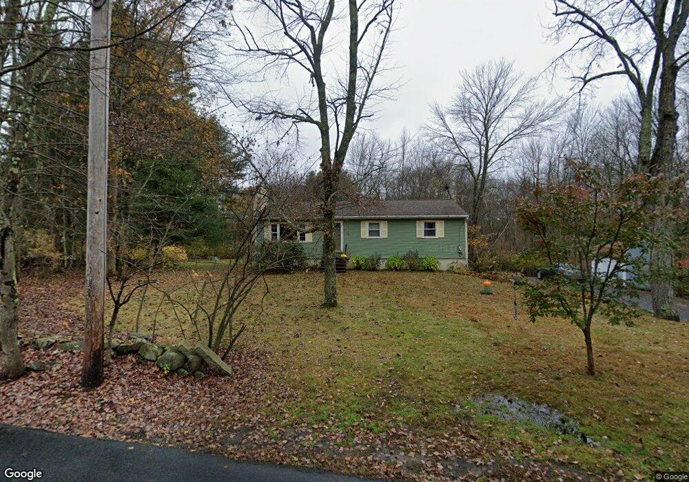
This home is located at 18 Robbins St, Acton, MA 01720 and is currently estimated at $757,508, approximately $449 per square foot. 18 Robbins St is a home located in Middlesex County with nearby schools including Acton-Boxborough Regional High School and Maynard Knowledge Beginnings.
Ownership History
Date
Name
Owned For
Owner Type
Purchase Details
Closed on
Aug 23, 1999
Sold by
Tivnan John L and Tivnan Lisa S
Bought by
Butler Brian D and Butler Darlene A
Current Estimated Value
Home Financials for this Owner
Home Financials are based on the most recent Mortgage that was taken out on this home.
Original Mortgage
$140,000
Outstanding Balance
$37,856
Interest Rate
7.6%
Mortgage Type
Purchase Money Mortgage
Estimated Equity
$719,652
Purchase Details
Closed on
Oct 27, 1997
Sold by
Clark Richard L and Clark Cecelia J
Bought by
Tivnan John L and Tivnan Lisa S
Home Financials for this Owner
Home Financials are based on the most recent Mortgage that was taken out on this home.
Original Mortgage
$182,700
Interest Rate
7.48%
Mortgage Type
Purchase Money Mortgage
Create a Home Valuation Report for This Property
The Home Valuation Report is an in-depth analysis detailing your home's value as well as a comparison with similar homes in the area
Home Values in the Area
Average Home Value in this Area
Purchase History
| Date | Buyer | Sale Price | Title Company |
|---|---|---|---|
| Butler Brian D | $260,500 | -- | |
| Tivnan John L | $203,000 | -- |
Source: Public Records
Mortgage History
| Date | Status | Borrower | Loan Amount |
|---|---|---|---|
| Open | Tivnan John L | $140,000 | |
| Previous Owner | Tivnan John L | $182,700 | |
| Previous Owner | Tivnan John L | $27,000 |
Source: Public Records
Tax History
| Year | Tax Paid | Tax Assessment Tax Assessment Total Assessment is a certain percentage of the fair market value that is determined by local assessors to be the total taxable value of land and additions on the property. | Land | Improvement |
|---|---|---|---|---|
| 2025 | $11,019 | $642,500 | $297,000 | $345,500 |
| 2024 | $10,447 | $626,700 | $297,000 | $329,700 |
| 2023 | $10,136 | $577,200 | $269,900 | $307,300 |
| 2022 | $10,118 | $520,200 | $234,600 | $285,600 |
| 2021 | $9,668 | $477,900 | $217,600 | $260,300 |
| 2020 | $9,056 | $470,700 | $217,600 | $253,100 |
| 2019 | $8,538 | $440,800 | $217,600 | $223,200 |
| 2018 | $7,926 | $409,000 | $217,600 | $191,400 |
| 2017 | $7,904 | $414,700 | $217,600 | $197,100 |
| 2016 | $7,413 | $385,500 | $217,600 | $167,900 |
| 2015 | $7,378 | $387,300 | $217,600 | $169,700 |
| 2014 | $7,391 | $380,000 | $217,600 | $162,400 |
Source: Public Records
Map
Nearby Homes
- 71 Liberty St
- 19 Railroad St Unit D2
- 19 Railroad St Unit C2
- 131 Main St
- 129 Main St Unit 129
- 25 Nylander Way
- 40 High St
- 63 Conant St
- 2 Marble Farm Rd
- 30 Brewster Ln
- 90 Willow St Unit 1
- 92 Willow St Unit 3
- 92 Willow St Unit 2
- 70 River St
- 7 Kelley Rd
- 6 Durant Ave
- 12 Patti Ln
- 246 Main St Unit 2
- 247 W Acton Rd
- 12 Brown St
Your Personal Tour Guide
Ask me questions while you tour the home.