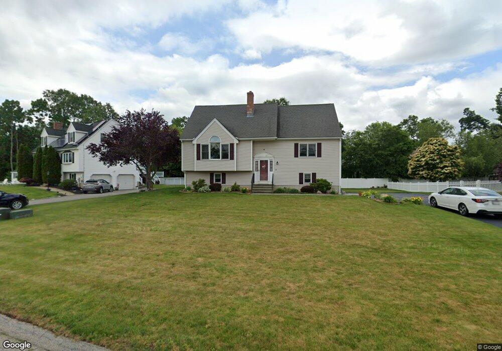
18 Rollie Shepard Dr Millbury, MA 01527
Estimated Value: $640,668 - $681,000
3
Beds
3
Baths
2,007
Sq Ft
$332/Sq Ft
Est. Value
About This Home
This home is located at 18 Rollie Shepard Dr, Millbury, MA 01527 and is currently estimated at $665,417, approximately $331 per square foot. 18 Rollie Shepard Dr is a home located in Worcester County with nearby schools including Elmwood Street Elementary School, Raymond E. Shaw Elementary School, and Millbury Junior/Senior High School.
Ownership History
Date
Name
Owned For
Owner Type
Purchase Details
Closed on
May 15, 2000
Sold by
Rollie Shepard Rt and Miles
Bought by
Quan Sang V and Quan Han N
Current Estimated Value
Create a Home Valuation Report for This Property
The Home Valuation Report is an in-depth analysis detailing your home's value as well as a comparison with similar homes in the area
Home Values in the Area
Average Home Value in this Area
Purchase History
| Date | Buyer | Sale Price | Title Company |
|---|---|---|---|
| Quan Sang V | $199,000 | -- | |
| Quan Sang V | $199,000 | -- |
Source: Public Records
Mortgage History
| Date | Status | Borrower | Loan Amount |
|---|---|---|---|
| Open | Quan Sang V | $90,000 | |
| Closed | Quan Sang V | $50,000 | |
| Closed | Quan Sang V | $93,000 |
Source: Public Records
Tax History Compared to Growth
Tax History
| Year | Tax Paid | Tax Assessment Tax Assessment Total Assessment is a certain percentage of the fair market value that is determined by local assessors to be the total taxable value of land and additions on the property. | Land | Improvement |
|---|---|---|---|---|
| 2025 | $7,481 | $558,700 | $113,800 | $444,900 |
| 2024 | $6,872 | $519,400 | $105,400 | $414,000 |
| 2023 | $6,070 | $420,100 | $73,900 | $346,200 |
| 2022 | $5,886 | $392,400 | $73,900 | $318,500 |
| 2021 | $5,737 | $371,800 | $73,900 | $297,900 |
| 2020 | $5,542 | $361,500 | $73,900 | $287,600 |
| 2019 | $5,685 | $358,700 | $73,500 | $285,200 |
| 2018 | $5,516 | $337,600 | $73,500 | $264,100 |
| 2017 | $4,881 | $297,100 | $73,500 | $223,600 |
| 2016 | $4,823 | $293,000 | $73,500 | $219,500 |
| 2015 | $4,752 | $288,700 | $74,800 | $213,900 |
| 2014 | $4,434 | $259,300 | $78,200 | $181,100 |
Source: Public Records
Map
Nearby Homes
- 90 Macarthur Dr
- 3 May St
- 86 Wheelock Ave
- 2 Diane St
- 12 Irene Ct
- 11 Westview Ave
- 1 Pineland Ave
- 46 John Dr Unit 46
- 5 Edward Dr
- 1 Broadmeadow Ave
- 12 Alstead Path
- 28 Lincoln Ln
- 21 Lordvale Blvd Unit 406
- 5 Lincoln Ln Unit 5
- 76 Samuel Dr
- 123 Riverlin St
- 15 Rayburn Dr
- 64 Millbury Ave
- 11 Maplewood Rd
- 330 Millbury Ave
- 20 Rollie Shepard Dr
- 16 Rollie Shepard Dr
- 5 Montgomery Dr
- 19 Rollie Shepard Dr
- 3 Montgomery Dr
- 14 Rollie Shepard Dr
- 17 Rollie Shepard Dr
- 7 Montgomery Dr
- 15 Rollie Shepard Dr
- 21 Rollie Shepard Dr
- 2 Montgomery Dr
- 13 Rollie Shepard Dr
- 4 Montgomery Dr
- 12 Rollie Shepard Dr
- 23 Rollie Shepard Dr
- 1 Montgomery Dr
- 6 Montgomery Dr
- 25 Rollie Shepard Dr
- 47 Macarthur Dr
- 2 Bill Graham Ln