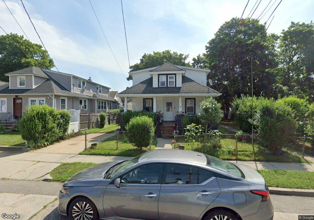
18 Rutland Rd Freeport, NY 11520
Estimated Value: $633,000 - $695,867
--
Bed
2
Baths
1,840
Sq Ft
$361/Sq Ft
Est. Value
About This Home
This home is located at 18 Rutland Rd, Freeport, NY 11520 and is currently estimated at $664,434, approximately $361 per square foot. 18 Rutland Rd is a home located in Nassau County with nearby schools including Columbus Avenue School, Caroline G. Atkinson Intermediate School, and John W Dodd Middle School.
Ownership History
Date
Name
Owned For
Owner Type
Purchase Details
Closed on
Jan 13, 1998
Sold by
Peter Mavnarino
Bought by
Most Woodrow J
Current Estimated Value
Create a Home Valuation Report for This Property
The Home Valuation Report is an in-depth analysis detailing your home's value as well as a comparison with similar homes in the area
Home Values in the Area
Average Home Value in this Area
Purchase History
| Date | Buyer | Sale Price | Title Company |
|---|---|---|---|
| Most Woodrow J | $155,000 | -- | |
| Most Woodrow J | $155,000 | -- |
Source: Public Records
Tax History Compared to Growth
Tax History
| Year | Tax Paid | Tax Assessment Tax Assessment Total Assessment is a certain percentage of the fair market value that is determined by local assessors to be the total taxable value of land and additions on the property. | Land | Improvement |
|---|---|---|---|---|
| 2025 | $8,539 | $396 | $178 | $218 |
| 2024 | $846 | $391 | $175 | $216 |
| 2023 | $8,168 | $399 | $179 | $220 |
| 2022 | $8,168 | $406 | $182 | $224 |
| 2021 | $11,917 | $389 | $174 | $215 |
| 2020 | $7,819 | $469 | $393 | $76 |
| 2019 | $6,902 | $503 | $395 | $108 |
| 2018 | $7,283 | $536 | $0 | $0 |
| 2017 | $6,860 | $570 | $326 | $244 |
| 2016 | $7,715 | $603 | $344 | $259 |
| 2015 | $1,065 | $737 | $421 | $316 |
| 2014 | $1,065 | $737 | $421 | $316 |
| 2013 | $1,006 | $737 | $421 | $316 |
Source: Public Records
Map
Nearby Homes
- 26 Rosedale Ave
- 96 N Columbus Ave
- 98 N Columbus Ave
- 11 Mount Ave
- 182 Grand Ave
- 6 Frederick Ave
- 47 Harding Place
- 45 Lakeview Ave
- 251 Grand Ave
- 268 Grand Ave
- 70 S Main St Unit 307-PH
- 45 Dehnhoff Ave
- 221 E Dean St
- 78 Jesse St
- 67 E Dean St
- 70 N Grove St Unit 1R
- 101 Harris Ave
- 112 E Seaman Ave
- 173 E Seaman Ave
- 117 N Grove St
- 22 Rutland Rd
- 133 Commercial St
- 7 Shonnard Ave
- 5 Shonnard Ave
- 15 Shonnard Ave
- 26 Rutland Rd
- 143 Commercial St
- 121 Commercial St
- 17 Shonnard Ave
- 30 Rutland Rd
- 122 Commercial St
- 117 Commercial St
- 120 Commercial St
- 19 Shonnard Ave
- 27 Rutland Rd
- 34 Rutland Rd
- 15 Rutland Rd
- 113 Commercial St
- 25 Shonnard Ave
- 38 Rutland Rd