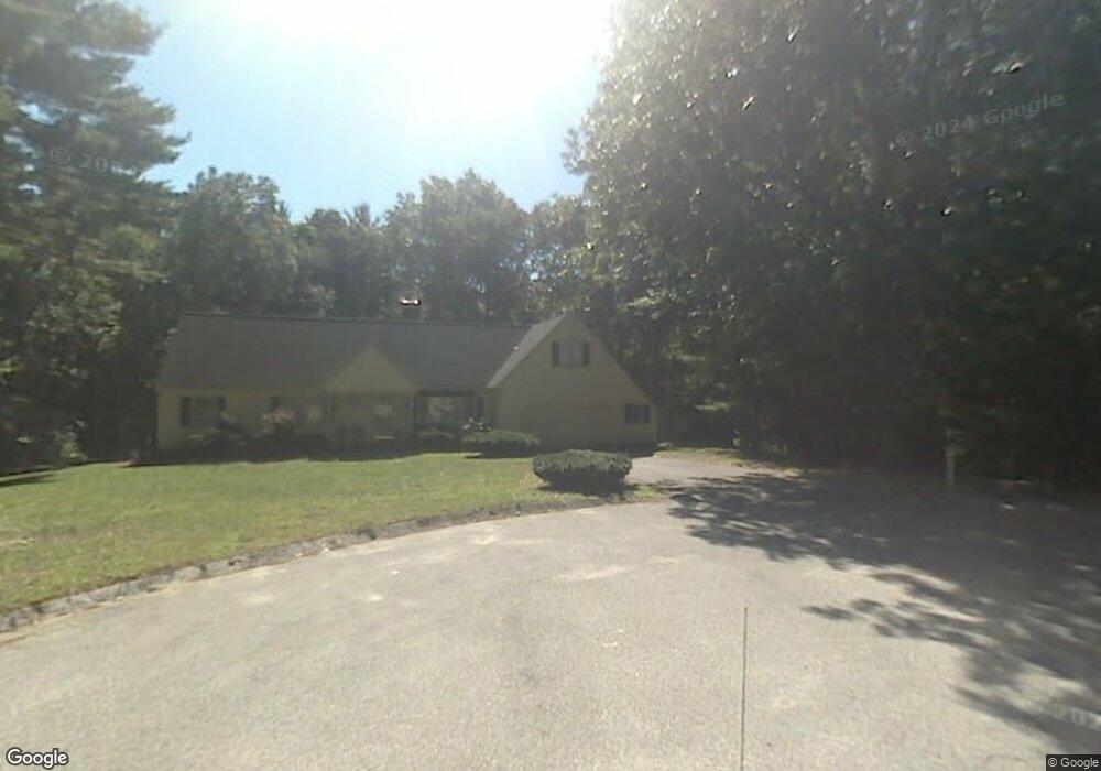
18 Sassafras Rd Westford, MA 01886
Estimated Value: $997,318 - $1,379,000
4
Beds
3
Baths
2,452
Sq Ft
$476/Sq Ft
Est. Value
About This Home
This home is located at 18 Sassafras Rd, Westford, MA 01886 and is currently estimated at $1,167,580, approximately $476 per square foot. 18 Sassafras Rd is a home located in Middlesex County with nearby schools including Col John Robinson, John A. Crisafulli Elementary School, and Blanchard Middle School.
Ownership History
Date
Name
Owned For
Owner Type
Purchase Details
Closed on
Jul 2, 2008
Sold by
Fenn Gary E and Fenn Margaret E
Bought by
Parr Kristie A and Parr Scott K
Current Estimated Value
Home Financials for this Owner
Home Financials are based on the most recent Mortgage that was taken out on this home.
Original Mortgage
$220,000
Interest Rate
6.01%
Mortgage Type
Purchase Money Mortgage
Purchase Details
Closed on
Jul 1, 1996
Sold by
Koerber Michael A and Koerber Barbara
Bought by
Fenn Gary E and Fenn Margaret
Purchase Details
Closed on
Dec 22, 1992
Sold by
Scotty Hollow Ii Inc
Bought by
Koerber Michael A and Koerber Barbara
Create a Home Valuation Report for This Property
The Home Valuation Report is an in-depth analysis detailing your home's value as well as a comparison with similar homes in the area
Home Values in the Area
Average Home Value in this Area
Purchase History
| Date | Buyer | Sale Price | Title Company |
|---|---|---|---|
| Parr Kristie A | $603,500 | -- | |
| Fenn Gary E | $315,000 | -- | |
| Koerber Michael A | $254,350 | -- |
Source: Public Records
Mortgage History
| Date | Status | Borrower | Loan Amount |
|---|---|---|---|
| Open | Koerber Michael A | $201,701 | |
| Closed | Koerber Michael A | $223,000 | |
| Closed | Parr Kristie A | $220,000 |
Source: Public Records
Tax History
| Year | Tax Paid | Tax Assessment Tax Assessment Total Assessment is a certain percentage of the fair market value that is determined by local assessors to be the total taxable value of land and additions on the property. | Land | Improvement |
|---|---|---|---|---|
| 2025 | $11,848 | $879,600 | $358,200 | $521,400 |
| 2024 | $11,557 | $839,300 | $341,100 | $498,200 |
| 2023 | $11,423 | $773,900 | $325,000 | $448,900 |
| 2022 | $11,545 | $716,200 | $287,500 | $428,700 |
| 2021 | $5,579 | $655,300 | $287,500 | $367,800 |
| 2020 | $10,727 | $656,900 | $287,500 | $369,400 |
| 2019 | $10,352 | $625,100 | $287,500 | $337,600 |
| 2018 | $22,046 | $615,200 | $277,600 | $337,600 |
| 2017 | $10,507 | $640,300 | $277,600 | $362,700 |
| 2016 | $9,800 | $601,200 | $265,300 | $335,900 |
| 2015 | $9,634 | $593,200 | $256,900 | $336,300 |
| 2014 | $9,467 | $570,300 | $246,900 | $323,400 |
Source: Public Records
Map
Nearby Homes
- 252 Concord Rd Unit Lot 3A
- 254 Concord Rd Unit Lot 2A
- 5 Carriage Dr
- 360 Littleton Rd Unit A4
- 91 Jimney Dr Unit 91
- 84 Powers Rd
- 209 New Yorker Ave
- 235 New Yorker Ave
- 128 Main St Unit 1
- 62 Main St
- 243 Mason Ave
- 12 Martin St
- 41 Flagg Rd
- 80 Daniels Ln
- 262 Littleton Rd Unit 14
- 875 Acton St
- 927 Main St
- 24 Sorli Way
- 6 Colonel Rolls Dr
- 258 Virginia Farme Ln
- 16 Sassafras Rd
- 13 Misty Ln
- 14 Sassafras Rd
- 8 Sequoia Rd
- 11 Misty Ln
- 19 Sassafras Rd
- 15 Misty Ln
- 15 Sassafras Rd
- 12 Jennie Richards Rd
- 10 Jennie Richards Rd
- 6 Sequoia Rd
- 13 Sassafras Rd
- 14 Jennie Richards Rd
- 7 Sequoia Rd
- 17 Misty Ln
- 9 Misty Ln
- 10 Misty Ln
- 11 Sassafras Rd
- 19 Misty Ln
- 5 Jennie Richards Rd
Your Personal Tour Guide
Ask me questions while you tour the home.