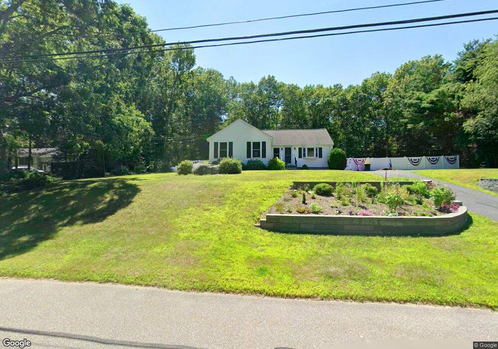
18 Shelly Rd Norton, MA 02766
Estimated Value: $553,309 - $587,000
3
Beds
1
Bath
1,548
Sq Ft
$368/Sq Ft
Est. Value
About This Home
This home is located at 18 Shelly Rd, Norton, MA 02766 and is currently estimated at $569,077, approximately $367 per square foot. 18 Shelly Rd is a home located in Bristol County with nearby schools including J.C. Solmonese Elementary School, Henri A. Yelle Elementary School, and Norton Middle School.
Ownership History
Date
Name
Owned For
Owner Type
Purchase Details
Closed on
Dec 5, 2024
Sold by
Doyle Dianne M and Camire-Doyle Heide M
Bought by
Camire Doyle Ft and Doyle
Current Estimated Value
Purchase Details
Closed on
Mar 1, 2018
Sold by
Doyle Diane M
Bought by
Camire-Doyle Heide M and Doyle Dianne M
Purchase Details
Closed on
Dec 27, 1996
Sold by
Bonner Michael R and Bonner Ellen T
Bought by
Doyle Dianne M
Home Financials for this Owner
Home Financials are based on the most recent Mortgage that was taken out on this home.
Original Mortgage
$108,000
Interest Rate
7.55%
Mortgage Type
Purchase Money Mortgage
Create a Home Valuation Report for This Property
The Home Valuation Report is an in-depth analysis detailing your home's value as well as a comparison with similar homes in the area
Home Values in the Area
Average Home Value in this Area
Purchase History
| Date | Buyer | Sale Price | Title Company |
|---|---|---|---|
| Camire Doyle Ft | -- | None Available | |
| Camire Doyle Ft | -- | None Available | |
| Camire-Doyle Heide M | -- | -- | |
| Doyle Dianne M | $135,500 | -- | |
| Camire-Doyle Heide M | -- | -- | |
| Doyle Dianne M | $135,500 | -- |
Source: Public Records
Mortgage History
| Date | Status | Borrower | Loan Amount |
|---|---|---|---|
| Previous Owner | Doyle Dianne M | $98,700 | |
| Previous Owner | Doyle Dianne M | $108,000 |
Source: Public Records
Tax History Compared to Growth
Tax History
| Year | Tax Paid | Tax Assessment Tax Assessment Total Assessment is a certain percentage of the fair market value that is determined by local assessors to be the total taxable value of land and additions on the property. | Land | Improvement |
|---|---|---|---|---|
| 2025 | $59 | $455,100 | $187,100 | $268,000 |
| 2024 | $5,619 | $433,900 | $178,100 | $255,800 |
| 2023 | $5,319 | $409,500 | $168,000 | $241,500 |
| 2022 | $5,152 | $361,300 | $152,700 | $208,600 |
| 2021 | $4,781 | $320,200 | $145,500 | $174,700 |
| 2020 | $4,632 | $313,000 | $141,200 | $171,800 |
| 2019 | $3,999 | $268,400 | $135,900 | $132,500 |
| 2018 | $3,775 | $249,000 | $135,900 | $113,100 |
| 2017 | $3,720 | $242,000 | $135,900 | $106,100 |
| 2016 | $3,500 | $224,200 | $135,900 | $88,300 |
| 2015 | $3,375 | $219,300 | $133,200 | $86,100 |
| 2014 | $3,228 | $210,000 | $126,800 | $83,200 |
Source: Public Records
Map
Nearby Homes
- 3 Goff Rd
- 16 Park Ln
- 11 Edgewater Dr
- 189 W Main St
- 27 Taylor Ct
- 97 N Worcester St
- 108 S Worcester St
- 13 Crowe Farm Ln
- 98 S Worcester St
- 55 Sturdy St
- 122 N Worcester St
- 130 W Main St
- 4 Stephen St
- 3 Village Way Unit B
- 145 S Worcester St
- 378 Old Colony Rd
- 178 S Worcester St
- 2 Top Flight Dr Unit B
- 173 S Worcester St
- 13 Village Way Unit B