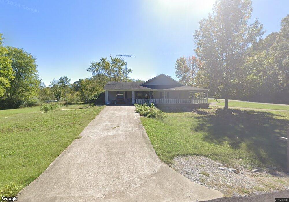
18 Stroud Rd Hardin, KY 42048
Estimated Value: $169,000 - $211,000
2
Beds
2
Baths
1,376
Sq Ft
$133/Sq Ft
Est. Value
About This Home
This home is located at 18 Stroud Rd, Hardin, KY 42048 and is currently estimated at $182,380, approximately $132 per square foot. 18 Stroud Rd is a home located in Marshall County with nearby schools including Jonathan Elementary School and Marshall County High School.
Ownership History
Date
Name
Owned For
Owner Type
Purchase Details
Closed on
Dec 15, 2011
Sold by
Hornick Michael J and Hornick Glenda S
Bought by
Price Ramon L and Price Debrah L
Current Estimated Value
Home Financials for this Owner
Home Financials are based on the most recent Mortgage that was taken out on this home.
Original Mortgage
$107,211
Outstanding Balance
$72,035
Interest Rate
3.87%
Mortgage Type
FHA
Estimated Equity
$110,345
Create a Home Valuation Report for This Property
The Home Valuation Report is an in-depth analysis detailing your home's value as well as a comparison with similar homes in the area
Purchase History
| Date | Buyer | Sale Price | Title Company |
|---|---|---|---|
| Price Ramon L | $110,000 | None Available |
Source: Public Records
Mortgage History
| Date | Status | Borrower | Loan Amount |
|---|---|---|---|
| Open | Price Ramon L | $107,211 |
Source: Public Records
Tax History
| Year | Tax Paid | Tax Assessment Tax Assessment Total Assessment is a certain percentage of the fair market value that is determined by local assessors to be the total taxable value of land and additions on the property. | Land | Improvement |
|---|---|---|---|---|
| 2025 | $1,587 | $136,000 | $10,000 | $126,000 |
| 2024 | $1,200 | $89,900 | $10,000 | $79,900 |
| 2023 | $1,399 | $135,000 | $0 | $0 |
| 2022 | $1,293 | $89,900 | $10,000 | $79,900 |
| 2021 | $1,309 | $89,900 | $10,000 | $79,900 |
| 2020 | $1,319 | $89,900 | $10,000 | $79,900 |
| 2019 | $1,319 | $89,900 | $10,000 | $79,900 |
| 2018 | $1,324 | $89,900 | $10,000 | $79,900 |
| 2017 | $1,326 | $89,900 | $10,000 | $79,900 |
| 2016 | $1,328 | $89,900 | $10,000 | $79,900 |
| 2015 | $1,335 | $89,900 | $10,000 | $79,900 |
| 2014 | $1,335 | $89,900 | $0 | $0 |
| 2010 | -- | $75,600 | $8,000 | $67,600 |
Source: Public Records
Map
Nearby Homes
- 92 Mermie Rd
- 51 Windjammer Loop Unit Pirates Cove Sub
- 425 W Unity Church Rd
- 308 Landing Strip Rd
- 415 Beasley Rd
- 646 W Unity Church Rd
- 198 Mandor Rd
- 842 Treasure Island Rd
- 102 Jurt Ln
- 00 E Unity Church Rd
- 2234 Beal Rd
- 243 Shelton Ln
- 4998 Olive Creek Rd
- 145 Brad Dr
- 00 Beal Rd
- 4231 Beal Rd
- 7485 Aurora Hwy
- 000 Hughes Rd
- 15 Harborview
- 420 Curd Cemetery Rd
- 795 Beasley Rd
- 780 Beasley Rd
- 140 Jolly Roger Dr
- 194 Musket Dr
- 90 Jolly Roger Dr
- 866 Beasley Rd
- 745 Beasley Rd
- 133 Friend Ln
- 891 Beasley Rd
- 00 Bear Rd
- 000 Friend Ln Unit Lot 9
- 000 Friend Ln Unit Lot 25/Block 21
- 000 Friend Ln Unit Lot 26/Block 21
- 000 Friend Ln Unit Lot 19/Block 21
- 91 Jolly Roger Dr
- 90 Jolly Roger Dr
- 54 Jolly Roger Dr
- 704 Beasley Rd Unit Pirates Cove
- 704 Beasley Rd
- 113 Stroud Rd
Your Personal Tour Guide
Ask me questions while you tour the home.