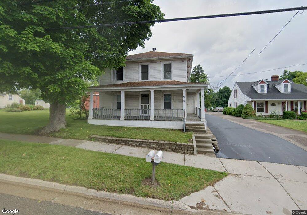
18 W High St Metamora, MI 48455
Estimated Value: $228,000 - $341,000
4
Beds
2
Baths
1,926
Sq Ft
$150/Sq Ft
Est. Value
About This Home
This home is located at 18 W High St, Metamora, MI 48455 and is currently estimated at $288,483, approximately $149 per square foot. 18 W High St is a home located in Lapeer County with nearby schools including Emma Murphy Elementary School, Rolland-Warner Middle School, and Lapeer High School.
Ownership History
Date
Name
Owned For
Owner Type
Purchase Details
Closed on
Jan 29, 2019
Sold by
Walker Lloyd K
Bought by
Walker Lloyd K and Walker Kristie A
Current Estimated Value
Purchase Details
Closed on
Jan 18, 2019
Sold by
Walker Lloyd K
Bought by
Walker Lloyd K and Walker Kristie A
Purchase Details
Closed on
Jun 22, 2018
Sold by
Walker Russell E
Bought by
Walker Lloyd K
Home Financials for this Owner
Home Financials are based on the most recent Mortgage that was taken out on this home.
Original Mortgage
$15,000
Interest Rate
4.5%
Mortgage Type
Credit Line Revolving
Purchase Details
Closed on
Jul 13, 2015
Sold by
Walker Deborah J
Bought by
Walker Lloyd K
Purchase Details
Closed on
May 27, 2010
Sold by
La Krew And Associates Llc
Bought by
Walker Russell E and Block Jayne E
Create a Home Valuation Report for This Property
The Home Valuation Report is an in-depth analysis detailing your home's value as well as a comparison with similar homes in the area
Home Values in the Area
Average Home Value in this Area
Purchase History
| Date | Buyer | Sale Price | Title Company |
|---|---|---|---|
| Walker Lloyd K | -- | None Listed On Document | |
| Walker Lloyd K | -- | -- | |
| Walker Lloyd K | -- | None Listed On Document | |
| Walker Lloyd K | $65,000 | None Listed On Document | |
| Walker Lloyd K | $65,000 | -- | |
| Walker Lloyd K | $65,000 | None Listed On Document | |
| Walker Lloyd K | -- | -- | |
| Walker Russell E | -- | -- |
Source: Public Records
Mortgage History
| Date | Status | Borrower | Loan Amount |
|---|---|---|---|
| Previous Owner | Walker Lloyd K | $15,000 |
Source: Public Records
Tax History Compared to Growth
Tax History
| Year | Tax Paid | Tax Assessment Tax Assessment Total Assessment is a certain percentage of the fair market value that is determined by local assessors to be the total taxable value of land and additions on the property. | Land | Improvement |
|---|---|---|---|---|
| 2025 | $1,602 | $103,000 | $0 | $0 |
| 2024 | $1,058 | $96,500 | $0 | $0 |
| 2023 | $998 | $86,700 | $0 | $0 |
| 2022 | $1,922 | $74,800 | $0 | $0 |
| 2021 | $1,820 | $68,100 | $0 | $0 |
| 2020 | $1,809 | $68,100 | $0 | $0 |
| 2019 | $1,812 | $61,000 | $0 | $0 |
| 2018 | $1,755 | $54,000 | $54,000 | $0 |
| 2017 | $1,256 | $53,100 | $0 | $0 |
| 2016 | $430 | $50,850 | $50,850 | $0 |
| 2015 | -- | $0 | $0 | $0 |
| 2014 | -- | $43,700 | $43,700 | $0 |
| 2013 | -- | $42,950 | $42,950 | $0 |
Source: Public Records
Map
Nearby Homes
- 68 Fox Hollow Dr
- 4090 School St
- 118 Fox Hollow Dr
- 153 1st St
- 3871 N Oak St
- 00 Jamestown Dr
- 0 Jamestown Dr Unit 20250014721
- 441 W Dryden Rd
- 4020 Metamora Ridge
- 4035 Metamora Ridge
- 4075 Metamora Ridge
- 0 Jamestown Lot A B Dr Unit 20250014742
- 4070 Metamora Ridge
- 4055 Metamora Ridge
- 3730 Winding Pine Dr
- 4050 Metamora Ridge Drive Ridge
- 23 Medford Hill Dr
- 22 Medford Hill Dr
- 21 Medford Hill Dr
- 19 Medford Hill Dr
- 40 W High St
- 39 W High St
- 12 W High St
- 51 W High St
- 65 W High St
- 74 Barrows St
- 75 W High St
- 56 Barrows St
- 74 Fox Hollow Dr
- 56 Fox Hollow Dr
- 54 Fox Hollow Dr
- 66 Fox Hollow Dr
- 000 Foxtail Ln Unit 25
- 000 Foxtail Ln Unit 24
- 42 Barrows St
- 0 Foxtail Ln Unit 25 5486315
- 0 Foxtail Ln Unit 24 5486267
- 4010 S Oak St
- 73 Barrows St Unit Bldg-Unit
- 73 Barrows St