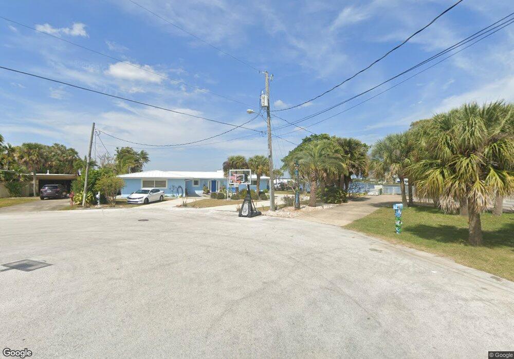
18 West Point Dr Cocoa Beach, FL 32931
Estimated Value: $1,091,000 - $1,448,000
4
Beds
3
Baths
2,392
Sq Ft
$534/Sq Ft
Est. Value
About This Home
This home is located at 18 West Point Dr, Cocoa Beach, FL 32931 and is currently estimated at $1,276,679, approximately $533 per square foot. 18 West Point Dr is a home located in Brevard County with nearby schools including Theodore Roosevelt Elementary School, Cocoa Beach Junior/Senior High School, and Cocoa Beach Christian School.
Ownership History
Date
Name
Owned For
Owner Type
Purchase Details
Closed on
Jan 23, 2020
Sold by
Scafetta Dominic M and Scafetta Theresa A
Bought by
Scafetta Dominic M and Scafetta Theresa A
Current Estimated Value
Purchase Details
Closed on
Jul 1, 2016
Bought by
Scafetta Dominic
Create a Home Valuation Report for This Property
The Home Valuation Report is an in-depth analysis detailing your home's value as well as a comparison with similar homes in the area
Home Values in the Area
Average Home Value in this Area
Purchase History
| Date | Buyer | Sale Price | Title Company |
|---|---|---|---|
| Scafetta Dominic M | -- | None Available | |
| Scafetta Dominic | $521,000 | -- |
Source: Public Records
Tax History
| Year | Tax Paid | Tax Assessment Tax Assessment Total Assessment is a certain percentage of the fair market value that is determined by local assessors to be the total taxable value of land and additions on the property. | Land | Improvement |
|---|---|---|---|---|
| 2025 | $6,314 | $533,840 | -- | -- |
| 2024 | $6,252 | $518,800 | -- | -- |
| 2023 | $6,252 | $503,690 | $0 | $0 |
| 2022 | $5,828 | $489,020 | $0 | $0 |
| 2021 | $6,036 | $474,780 | $0 | $0 |
| 2020 | $6,001 | $468,230 | $0 | $0 |
| 2019 | $5,975 | $457,710 | $0 | $0 |
| 2018 | $5,970 | $445,400 | $0 | $0 |
| 2017 | $6,078 | $436,240 | $0 | $0 |
| 2016 | $8,452 | $540,830 | $368,500 | $172,330 |
| 2015 | $504 | $436,900 | $291,500 | $145,400 |
| 2014 | $504 | $433,440 | $291,500 | $141,940 |
Source: Public Records
Map
Nearby Homes
- 1790 Bayshore Dr
- 1675 Bayshore Dr
- 1375 Bayshore Dr
- 2 River Falls Dr
- 1299 S Orlando Ave
- 1277 S Orlando Ave Unit 4B
- 1531 S Orlando Ave
- 1305 S Atlantic Ave Unit 110
- 2050 S Atlantic Ave
- 1139 S Brevard Ave
- 1527 S Atlantic Ave Unit 201
- 1563 S Atlantic Ave Unit 13
- 1515 S Atlantic Ave Unit 404
- 24 Olive St
- 1800 S Orlando Ave Unit 1
- 7 Cove View Ct
- 1700 S Atlantic Ave Unit 104
- 1155 S Atlantic Ave Unit 203
- 1000 S Orlando Ave
- 1081 S Atlantic Ave
- 19 West Point Dr
- 17 West Point Dr
- 20 W Point Dr
- 20 West Point Dr
- 15 W Point Dr
- 16 W Point Dr
- 15 West Point Dr
- 21 W Point Dr
- 21 W Point Dr Unit 101
- 21 West Point Dr
- 21 West Point Dr Unit 101
- 1800 Bayshore Dr
- 14 West Point Dr
- 14 W Point Dr
- 1791 Bayshore Dr
- 22 W Point Dr
- 13 W Point Dr
- 22 West Point Dr
- 13 West Point Dr
- 95 W Bay Dr
Your Personal Tour Guide
Ask me questions while you tour the home.