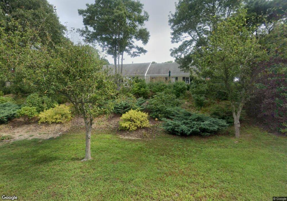
18 Westerly Dr Bourne, MA 2532
Monument Beach NeighborhoodEstimated Value: $655,808 - $835,000
3
Beds
3
Baths
1,940
Sq Ft
$375/Sq Ft
Est. Value
About This Home
This home is located at 18 Westerly Dr, Bourne, MA 2532 and is currently estimated at $726,702, approximately $374 per square foot. 18 Westerly Dr is a home located in Barnstable County with nearby schools including Bourne High School, Cadence Academy Preschool - Bourne, and St Margaret Regional School.
Ownership History
Date
Name
Owned For
Owner Type
Purchase Details
Closed on
Sep 3, 2013
Sold by
Dietrich Sally R
Bought by
Petersen Albert C and Petersen Janet H
Current Estimated Value
Purchase Details
Closed on
Jul 29, 2004
Sold by
Dietrich Robert G and Dietrich Sally R
Bought by
Dietrich Sally R
Create a Home Valuation Report for This Property
The Home Valuation Report is an in-depth analysis detailing your home's value as well as a comparison with similar homes in the area
Home Values in the Area
Average Home Value in this Area
Purchase History
| Date | Buyer | Sale Price | Title Company |
|---|---|---|---|
| Petersen Albert C | $315,000 | -- | |
| Petersen Albert C | $315,000 | -- | |
| Dietrich Sally R | -- | -- | |
| Dietrich Sally R | -- | -- |
Source: Public Records
Mortgage History
| Date | Status | Borrower | Loan Amount |
|---|---|---|---|
| Previous Owner | Dietrich Sally R | $250,000 | |
| Previous Owner | Dietrich Sally R | $50,000 |
Source: Public Records
Tax History
| Year | Tax Paid | Tax Assessment Tax Assessment Total Assessment is a certain percentage of the fair market value that is determined by local assessors to be the total taxable value of land and additions on the property. | Land | Improvement |
|---|---|---|---|---|
| 2025 | $4,750 | $608,200 | $214,300 | $393,900 |
| 2024 | $4,644 | $579,100 | $204,100 | $375,000 |
| 2023 | $4,516 | $512,600 | $180,700 | $331,900 |
| 2022 | $4,271 | $423,300 | $159,900 | $263,400 |
| 2021 | $4,182 | $388,300 | $145,500 | $242,800 |
| 2020 | $4,041 | $376,300 | $144,100 | $232,200 |
| 2019 | $3,818 | $363,300 | $144,100 | $219,200 |
| 2018 | $3,538 | $335,700 | $137,300 | $198,400 |
| 2017 | $3,304 | $320,800 | $129,200 | $191,600 |
| 2016 | $3,215 | $316,400 | $129,200 | $187,200 |
| 2015 | $3,049 | $302,800 | $115,600 | $187,200 |
Source: Public Records
Map
Nearby Homes
- 4 Harbor Hill Dr
- 20 Colony Ave
- 16 Amberwood Ct
- 12 Turnberry Rd Unit 12
- 4 Hollyhock Knoll Ct Unit 4
- 4 Hollyhock Knoll Ct Unit 4
- 203 County Rd
- 5 Sea Knoll Ct
- 13 Laurel Hill Ct
- 5 Zoli Ln
- 44 Cotuit Rd
- 10 Sandy Ln
- 566 Shore Rd
- 60 Sandwich Rd
- 3 1st St
- 709 County Rd
- 7 4th Ave
- 3 4th Ave
- 3 Honora Ln Unit 3
- 38 Old Bridge Rd
- 18 Westerly Dr
- 20 Westerly Dr
- 19 Westerly Dr
- 20 Westerly Dr
- 16 Westerly Dr
- 47 Harbor Hill Dr
- 46 Harbor Hill Dr
- 45 Harbor Hill Dr
- 44 Harbor Hill Dr
- 43 Harbor Hill Dr
- 43 Harbor Hill Dr Unit 9
- 45 Harbor Hill Dr Unit 45
- 45 Harbor Hill Dr
- 44 Harbor Hill Dr
- 43 Harbor Hill Dr
- 15 Westerly Dr
- 15 Westerly Dr
- 21 Westerly Dr
- 42 Harbor Hill Dr
- 41 Harbor Hill Dr
Your Personal Tour Guide
Ask me questions while you tour the home.