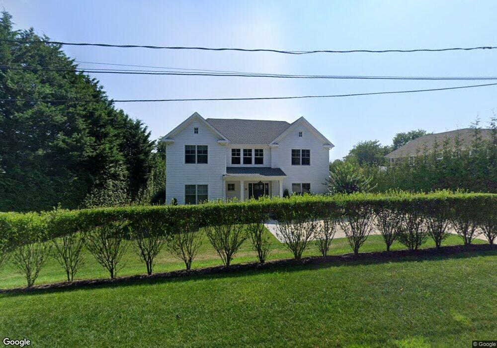
18 Whitfield Rd Southampton, NY 11968
Estimated Value: $3,826,000 - $5,223,000
7
Beds
--
Bath
3,980
Sq Ft
$1,136/Sq Ft
Est. Value
About This Home
This home is located at 18 Whitfield Rd, Southampton, NY 11968 and is currently estimated at $4,520,313, approximately $1,135 per square foot. 18 Whitfield Rd is a home with nearby schools including Southampton Elementary School, Southampton Intermediate School, and Southampton High School.
Ownership History
Date
Name
Owned For
Owner Type
Purchase Details
Closed on
Nov 9, 2020
Sold by
Eckel Development Llc
Bought by
Raine Evan and Raine Rashmi P
Current Estimated Value
Home Financials for this Owner
Home Financials are based on the most recent Mortgage that was taken out on this home.
Original Mortgage
$2,620,000
Interest Rate
2.38%
Mortgage Type
Purchase Money Mortgage
Purchase Details
Closed on
Sep 4, 2019
Sold by
Wilson May C Est
Bought by
Eckel Development Llc
Purchase Details
Closed on
Jan 2, 2001
Sold by
Wilson May C and Wilson Sylvia
Bought by
Wilson May C
Create a Home Valuation Report for This Property
The Home Valuation Report is an in-depth analysis detailing your home's value as well as a comparison with similar homes in the area
Home Values in the Area
Average Home Value in this Area
Purchase History
| Date | Buyer | Sale Price | Title Company |
|---|---|---|---|
| Raine Evan | $3,495,000 | None Available | |
| Eckel Development Llc | $249,990 | -- | |
| Wilson May C | -- | -- |
Source: Public Records
Mortgage History
| Date | Status | Borrower | Loan Amount |
|---|---|---|---|
| Previous Owner | Raine Evan | $2,620,000 |
Source: Public Records
Tax History Compared to Growth
Tax History
| Year | Tax Paid | Tax Assessment Tax Assessment Total Assessment is a certain percentage of the fair market value that is determined by local assessors to be the total taxable value of land and additions on the property. | Land | Improvement |
|---|---|---|---|---|
| 2024 | $12,909 | $3,085,500 | $563,500 | $2,522,000 |
| 2023 | $12,909 | $3,085,500 | $563,500 | $2,522,000 |
| 2022 | $1,726 | $3,085,500 | $563,500 | $2,522,000 |
| 2021 | $1,726 | $2,188,800 | $563,500 | $1,625,300 |
| 2020 | $1,749 | $783,500 | $563,500 | $220,000 |
| 2019 | $1,749 | $0 | $0 | $0 |
| 2018 | -- | $371,200 | $371,200 | $0 |
| 2017 | $1,606 | $371,200 | $371,200 | $0 |
| 2016 | $1,666 | $371,200 | $371,200 | $0 |
| 2015 | -- | $371,200 | $371,200 | $0 |
| 2014 | -- | $326,600 | $326,600 | $0 |
Source: Public Records
Map
Nearby Homes
- 150 Edge of Woods Rd
- 485 N Sea Mecox Rd
- 473 N Sea Mecox Rd
- 509 N Main St
- 5 Kings Ln
- 9 Kings Ln
- 58 Clearview Farm Rd
- 300 N Sea Mecox Rd
- 620 Majors Path
- 601 Majors Path
- 28 Apple Rd
- 411 N Main St
- 107 Seven Ponds Rd
- 2 Herrick Ln
- 205 Little Fresh Pond Rd
- 195 Little Fresh Pond Rd
- 816 N Sea Rd
- 16 Wood Edge Ct
- 155 Little Fresh Pond Rd
- 276 N Main St
- 22 Whitfield Rd
- 10 Whitfield Rd
- 30 Long Springs Rd
- 21 Whitfield Rd
- 36 Long Springs Rd
- 28 Long Springs Rd
- 42 Long Springs Rd
- 56 Long Springs Rd
- 178 Edge of Woods Rd
- 32 Long Springs Rd
- 32 Long Springs Rd
- 26 Long Springs Rd
- 60 Long Springs Rd
- 24 Long Springs Rd
- 51 Long Springs Rd
- 14 Long Springs Rd
- 18 Long Springs Rd
- 210 Edge of Woods Rd
- 27 Long Springs Rd
- 165 Edge of Woods Rd