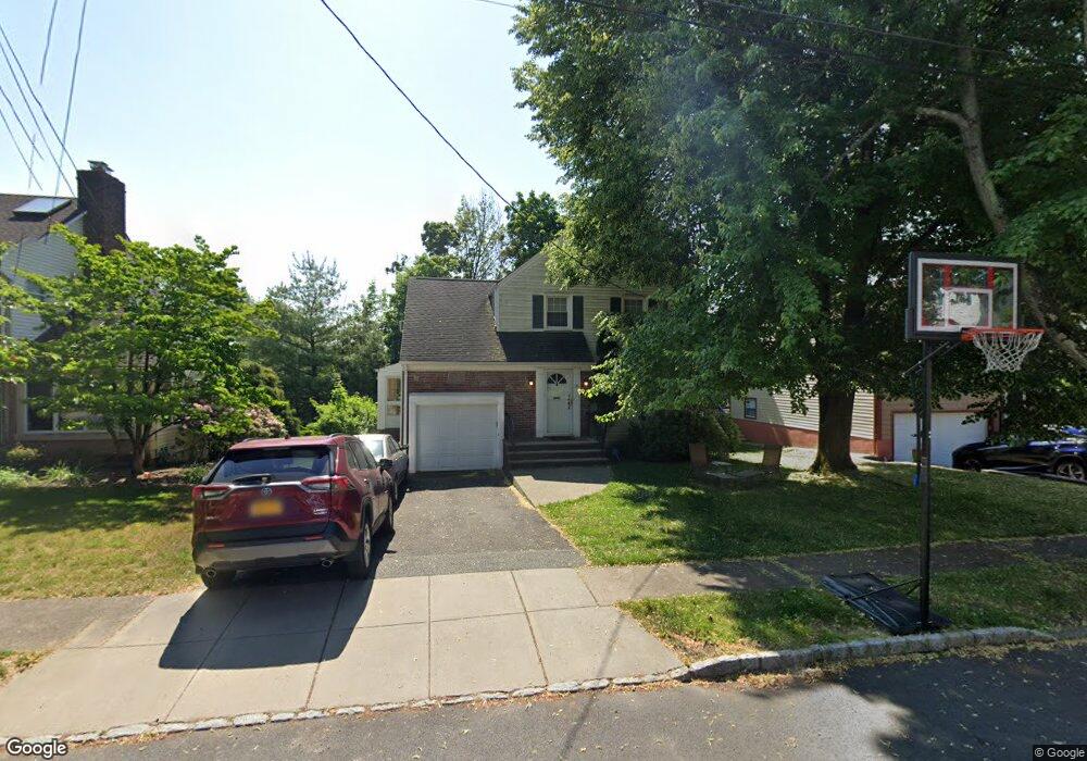
18 Whitman St West Orange, NJ 07052
Estimated Value: $553,645 - $644,000
--
Bed
--
Bath
1,429
Sq Ft
$432/Sq Ft
Est. Value
About This Home
This home is located at 18 Whitman St, West Orange, NJ 07052 and is currently estimated at $617,661, approximately $432 per square foot. 18 Whitman St is a home located in Essex County with nearby schools including West Orange High School, Our Lady of the Lake School, and Mount Carmel Guild Academy.
Ownership History
Date
Name
Owned For
Owner Type
Purchase Details
Closed on
Nov 13, 2023
Sold by
Flumen Brian and Flumen Barbara
Bought by
Flumen Brian and Flumen Barbara
Current Estimated Value
Purchase Details
Closed on
Jun 19, 2003
Purchase Details
Closed on
Oct 18, 1999
Sold by
Eisenberg Gary
Bought by
Bloom Robert and Bloom Tami
Home Financials for this Owner
Home Financials are based on the most recent Mortgage that was taken out on this home.
Original Mortgage
$190,000
Interest Rate
7.73%
Purchase Details
Closed on
Apr 4, 1989
Sold by
Berman Steven J and Berman Mindy L
Bought by
Eisenberg Gary F and Eisenberg Karen G
Create a Home Valuation Report for This Property
The Home Valuation Report is an in-depth analysis detailing your home's value as well as a comparison with similar homes in the area
Home Values in the Area
Average Home Value in this Area
Purchase History
| Date | Buyer | Sale Price | Title Company |
|---|---|---|---|
| Flumen Brian | -- | None Listed On Document | |
| -- | $325,500 | -- | |
| Bloom Robert | $200,000 | -- | |
| Eisenberg Gary F | $195,000 | -- |
Source: Public Records
Mortgage History
| Date | Status | Borrower | Loan Amount |
|---|---|---|---|
| Previous Owner | Bloom Robert | $190,000 |
Source: Public Records
Tax History Compared to Growth
Tax History
| Year | Tax Paid | Tax Assessment Tax Assessment Total Assessment is a certain percentage of the fair market value that is determined by local assessors to be the total taxable value of land and additions on the property. | Land | Improvement |
|---|---|---|---|---|
| 2025 | $13,941 | $570,200 | $266,400 | $303,800 |
| 2024 | $13,941 | $303,200 | $140,200 | $163,000 |
| 2022 | $13,453 | $303,200 | $140,200 | $163,000 |
| 2021 | $13,201 | $303,200 | $140,200 | $163,000 |
| 2020 | $12,989 | $303,200 | $140,200 | $163,000 |
| 2019 | $12,616 | $303,200 | $140,200 | $163,000 |
| 2018 | $12,243 | $303,200 | $140,200 | $163,000 |
| 2017 | $12,086 | $303,200 | $140,200 | $163,000 |
| 2016 | $11,794 | $303,200 | $140,200 | $163,000 |
| 2015 | $11,573 | $303,200 | $140,200 | $163,000 |
| 2014 | $11,346 | $303,200 | $140,200 | $163,000 |
Source: Public Records
Map
Nearby Homes