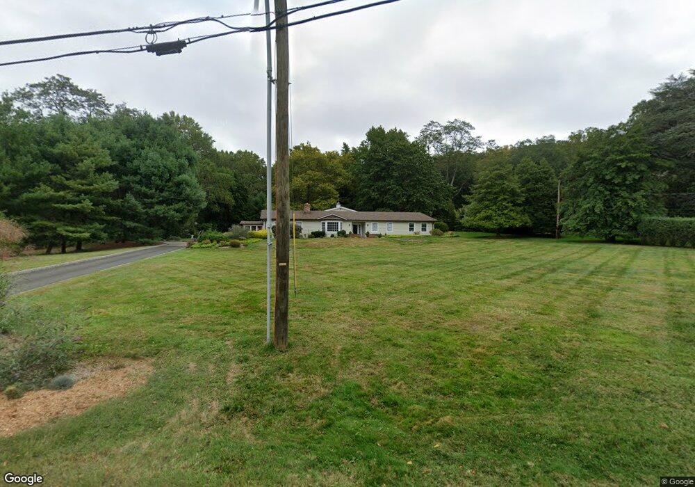
18 Wigwam Rd Rumson, NJ 07760
Estimated Value: $1,688,310 - $2,686,000
5
Beds
3
Baths
4,251
Sq Ft
$505/Sq Ft
Est. Value
About This Home
This home is located at 18 Wigwam Rd, Rumson, NJ 07760 and is currently estimated at $2,147,078, approximately $505 per square foot. 18 Wigwam Rd is a home located in Monmouth County with nearby schools including Navesink Elementary School, Bayshore Middle School, and Middletown - South High School.
Ownership History
Date
Name
Owned For
Owner Type
Purchase Details
Closed on
Sep 6, 2012
Sold by
Gross Paul and Gross Patricia
Bought by
Cosgrove John and Cosgrove Elizabeth
Current Estimated Value
Home Financials for this Owner
Home Financials are based on the most recent Mortgage that was taken out on this home.
Original Mortgage
$625,500
Interest Rate
3.39%
Mortgage Type
New Conventional
Purchase Details
Closed on
Jan 21, 2009
Sold by
Gross Patricia
Bought by
Gross Patricia and Gross Paul
Home Financials for this Owner
Home Financials are based on the most recent Mortgage that was taken out on this home.
Original Mortgage
$205,000
Interest Rate
4.94%
Mortgage Type
Stand Alone Refi Refinance Of Original Loan
Purchase Details
Closed on
Jul 13, 1994
Sold by
Soloway Lance
Bought by
Gross Patricia
Home Financials for this Owner
Home Financials are based on the most recent Mortgage that was taken out on this home.
Original Mortgage
$175,000
Interest Rate
8.25%
Create a Home Valuation Report for This Property
The Home Valuation Report is an in-depth analysis detailing your home's value as well as a comparison with similar homes in the area
Home Values in the Area
Average Home Value in this Area
Purchase History
| Date | Buyer | Sale Price | Title Company |
|---|---|---|---|
| Cosgrove John | $1,100,000 | Wfg National Title Ins Co | |
| Gross Patricia | -- | Black Page Title Agency Inc | |
| Gross Patricia | $390,000 | -- |
Source: Public Records
Mortgage History
| Date | Status | Borrower | Loan Amount |
|---|---|---|---|
| Open | Cosgrove John | $84,500 | |
| Previous Owner | Cosgrove John | $625,500 | |
| Previous Owner | Gross Patricia | $205,000 | |
| Previous Owner | Gross Patricia | $175,000 |
Source: Public Records
Tax History Compared to Growth
Tax History
| Year | Tax Paid | Tax Assessment Tax Assessment Total Assessment is a certain percentage of the fair market value that is determined by local assessors to be the total taxable value of land and additions on the property. | Land | Improvement |
|---|---|---|---|---|
| 2025 | $22,739 | $1,527,400 | $896,400 | $631,000 |
| 2024 | $20,877 | $1,382,300 | $762,900 | $619,400 |
| 2023 | $20,877 | $1,201,200 | $733,900 | $467,300 |
| 2022 | $20,041 | $1,178,900 | $733,900 | $445,000 |
| 2021 | $20,041 | $963,500 | $538,000 | $425,500 |
| 2020 | $20,044 | $937,500 | $538,000 | $399,500 |
| 2019 | $19,751 | $935,200 | $538,000 | $397,200 |
| 2018 | $19,865 | $916,700 | $538,000 | $378,700 |
| 2017 | $19,154 | $901,800 | $538,000 | $363,800 |
| 2016 | $19,021 | $892,600 | $538,000 | $354,600 |
| 2015 | $19,066 | $892,600 | $538,000 | $354,600 |
| 2014 | $18,869 | $862,000 | $538,000 | $324,000 |
Source: Public Records
Map
Nearby Homes
- 26 Park Way
- 28 Coquette Ln
- 85 Valley Ave
- 18 Clay Ct
- 1 Fennimore Terrace
- 97 Navesink Ave
- 75 Portland Rd
- 203 Shore Dr
- 297 Shore Dr
- 608 Raritan Ave
- 26 Ralph St
- 0 Wilson Cir
- 72 4th St
- 52 Barberie Ave
- 25 Shrewsbury Ave
- 10 5th St
- 11 Cheerful Place
- 12 Forrest Ave
- 1 Scenic Dr Unit Penthouse 6
- 1 Scenic Dr Unit 306