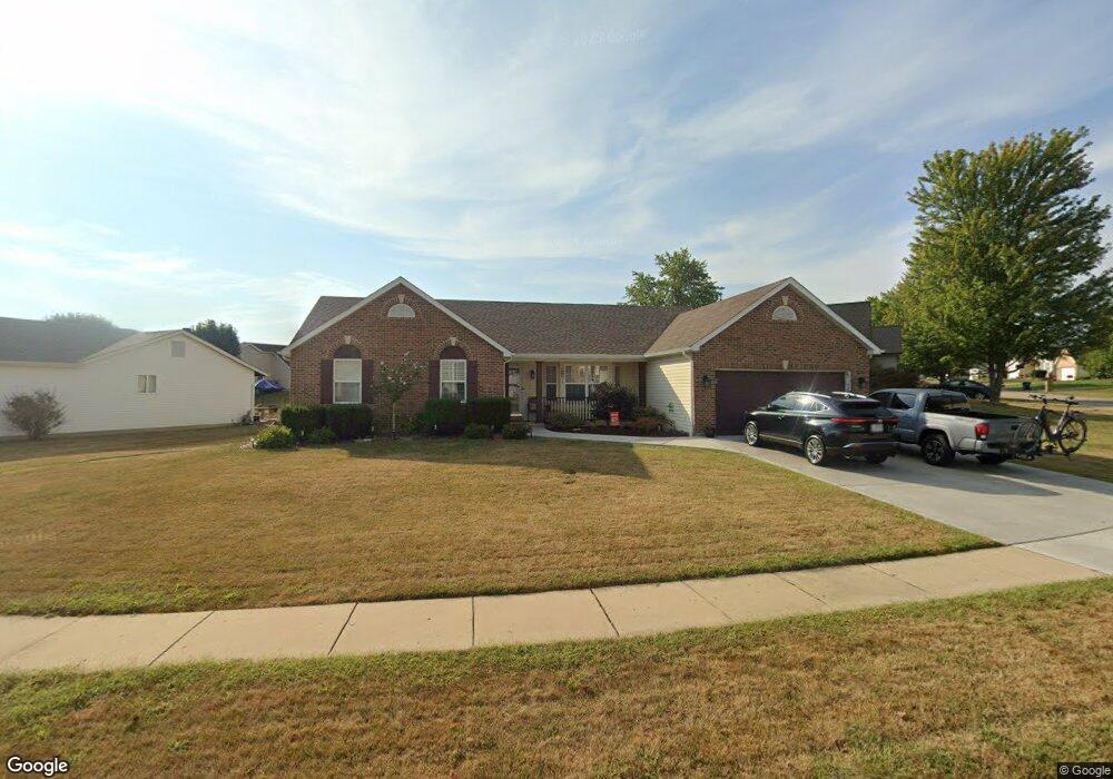
18 Wistar Way O Fallon, MO 63366
Estimated Value: $372,192 - $408,000
About This Home
This home is located at 18 Wistar Way, O Fallon, MO 63366 and is currently estimated at $385,798, approximately $216 per square foot. 18 Wistar Way is a home located in St. Charles County with nearby schools including Rock Creek Elementary School, Fort Zumwalt West Middle School, and Fort Zumwalt West High School.
Ownership History
We collect this data history from publicly available records. To have your information removed, we recommend requesting removal directly through your county’s website.
Purchase Details
Purchase Details
Home Financials for this Owner
Home Financials are based on the most recent Mortgage that was taken out on this home.Home Values in the Area
Average Home Value in this Area
Purchase History
We collect this data history from publicly available records. To have your information removed, we recommend requesting removal directly through your county’s website.
| Date | Buyer | Sale Price | Title Company |
|---|---|---|---|
| -- | None Listed On Document | ||
| $158,000 | Capital Title Co Inc |
Mortgage History
We collect this data history from publicly available records. To have your information removed, we recommend requesting removal directly through your county’s website.
| Date | Status | Borrower | Loan Amount |
|---|---|---|---|
| Previous Owner | $126,400 |
Tax History
We collect this data history from publicly available records. To have your information removed, we recommend requesting removal directly through your county’s website.
| Year | Tax Paid | Tax Assessment Tax Assessment Total Assessment is a certain percentage of the fair market value that is determined by local assessors to be the total taxable value of land and additions on the property. | Land | Improvement |
|---|---|---|---|---|
| 2025 | $3,722 | $63,816 | -- | -- |
| 2023 | $3,724 | $56,240 | $0 | $0 |
| 2022 | $3,363 | $47,227 | $0 | $0 |
| 2021 | $3,366 | $47,227 | $0 | $0 |
| 2020 | $3,220 | $43,768 | $0 | $0 |
| 2019 | $3,227 | $43,768 | $0 | $0 |
| 2018 | $3,011 | $38,973 | $0 | $0 |
| 2017 | $2,972 | $38,973 | $0 | $0 |
| 2016 | $2,778 | $36,284 | $0 | $0 |
| 2015 | $2,582 | $36,284 | $0 | $0 |
| 2014 | $2,426 | $33,509 | $0 | $0 |
Map
- 3 Revolutionary Way Ct
- 7 Windsor Chair Ct
- 1100 Cypress Point Dr
- 1241 Pinehurst Club Ct
- 1156 Ivy Point Dr
- 1473 Shelby Point Dr
- 1307 Norwood Hills Dr
- 1311 Norwood Hills Dr
- 1442 Shelby Point Dr
- 1436 Soaring Eagle Dr
- 1357 Crooked Stick Dr
- 1435 Soaring Eagle Dr
- 406 Winter Wind Dr
- 9 Fort Zumwalt Dr
- 1708 Winter Hill Dr
- 319 Magnolia Valley Dr
- 951 Annabrook Park Dr
- 633 Longhorn Dr
- 64 Hickory Meadows Ct
- 2323 Sundance Dr
Ask me questions while you tour the home.