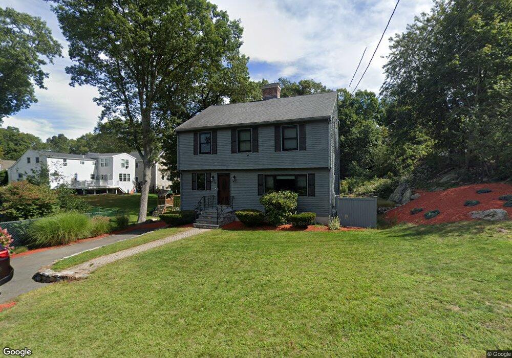
18 Wolcott Rd Quincy, MA 02169
Estimated Value: $688,000 - $834,027
3
Beds
3
Baths
1,815
Sq Ft
$433/Sq Ft
Est. Value
About This Home
This home is located at 18 Wolcott Rd, Quincy, MA 02169 and is currently estimated at $785,007, approximately $432 per square foot. 18 Wolcott Rd is a home located in Norfolk County with nearby schools including South West Middle School, Lincoln-Hancock Community School, and Quincy High School.
Ownership History
Date
Name
Owned For
Owner Type
Purchase Details
Closed on
Aug 14, 2012
Sold by
Pellegrini Barbara K
Bought by
Pellegrini Barbara K and Pellegrini Gerard J
Current Estimated Value
Purchase Details
Closed on
Feb 24, 1998
Sold by
Mouchati Rizkalla A and Mouchati Constance
Bought by
Hill Barbara K
Home Financials for this Owner
Home Financials are based on the most recent Mortgage that was taken out on this home.
Original Mortgage
$156,000
Interest Rate
6.9%
Mortgage Type
Purchase Money Mortgage
Create a Home Valuation Report for This Property
The Home Valuation Report is an in-depth analysis detailing your home's value as well as a comparison with similar homes in the area
Purchase History
| Date | Buyer | Sale Price | Title Company |
|---|---|---|---|
| Pellegrini Barbara K | -- | -- | |
| Hill Barbara K | $195,000 | -- |
Source: Public Records
Mortgage History
| Date | Status | Borrower | Loan Amount |
|---|---|---|---|
| Previous Owner | Hill Barbara K | $156,000 |
Source: Public Records
Tax History
| Year | Tax Paid | Tax Assessment Tax Assessment Total Assessment is a certain percentage of the fair market value that is determined by local assessors to be the total taxable value of land and additions on the property. | Land | Improvement |
|---|---|---|---|---|
| 2025 | $8,770 | $760,600 | $339,600 | $421,000 |
| 2024 | $8,310 | $737,400 | $324,800 | $412,600 |
| 2023 | $7,734 | $694,900 | $310,700 | $384,200 |
| 2022 | $7,367 | $614,900 | $254,000 | $360,900 |
| 2021 | $7,621 | $627,800 | $254,000 | $373,800 |
| 2020 | $7,427 | $597,500 | $254,000 | $343,500 |
| 2019 | $7,216 | $575,000 | $247,500 | $327,500 |
| 2018 | $7,130 | $534,500 | $231,200 | $303,300 |
| 2017 | $7,041 | $496,900 | $221,500 | $275,400 |
| 2016 | $6,620 | $461,000 | $203,900 | $257,100 |
| 2015 | $6,279 | $430,100 | $193,900 | $236,200 |
| 2014 | $5,956 | $400,800 | $193,900 | $206,900 |
Source: Public Records
Map
Nearby Homes
- 36 Village Dr
- 87 Village Dr
- 510 Willard St
- 9 Westford St
- 51 Branch St Unit 2
- 25 McDonald St
- 459 Willard St Unit 303
- 21 Totman St Unit 308
- 21 Totman St Unit 205
- 21 Totman St Unit 404
- 21 Totman St Unit 309
- 21 Totman St Unit 203
- 21 Totman St Unit PH-406
- 21 Totman St Unit 301
- 21 Totman St Unit PH-405
- 21 Totman St Unit 407
- 132 Centre St
- 57 Buckley St
- 211 Copeland St
- 14 Arthur Ave
Your Personal Tour Guide
Ask me questions while you tour the home.