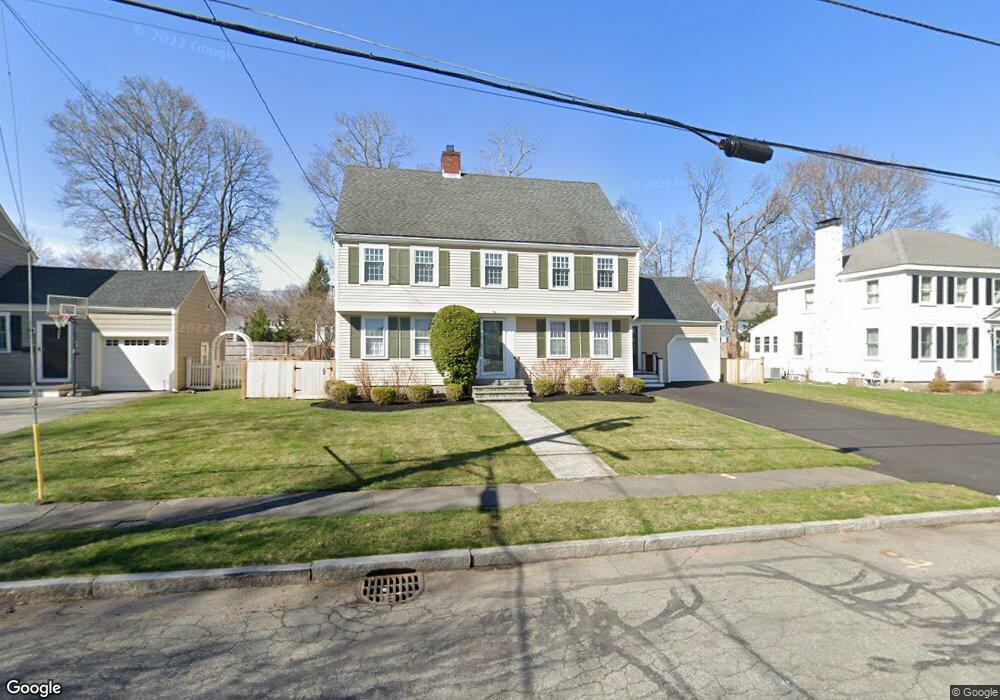
18 Woodcrest Dr Melrose, MA 02176
Melrose East Side NeighborhoodEstimated Value: $1,169,000 - $1,367,481
4
Beds
3
Baths
2,221
Sq Ft
$567/Sq Ft
Est. Value
About This Home
This home is located at 18 Woodcrest Dr, Melrose, MA 02176 and is currently estimated at $1,260,370, approximately $567 per square foot. 18 Woodcrest Dr is a home located in Middlesex County with nearby schools including Winthrop Elementary School, Horace Mann Elementary School, and Hoover Elementary School.
Ownership History
Date
Name
Owned For
Owner Type
Purchase Details
Closed on
Jun 29, 2021
Sold by
Mcclintock Paul C and Breen Alaine M
Bought by
Breen Alaine M
Current Estimated Value
Home Financials for this Owner
Home Financials are based on the most recent Mortgage that was taken out on this home.
Original Mortgage
$548,000
Outstanding Balance
$497,225
Interest Rate
2.9%
Mortgage Type
Stand Alone Refi Refinance Of Original Loan
Estimated Equity
$763,145
Purchase Details
Closed on
Apr 9, 2003
Sold by
Breen Donald F
Bought by
Breen Alaine M and Mcclintock Paul C
Home Financials for this Owner
Home Financials are based on the most recent Mortgage that was taken out on this home.
Original Mortgage
$200,000
Interest Rate
5.86%
Mortgage Type
Purchase Money Mortgage
Create a Home Valuation Report for This Property
The Home Valuation Report is an in-depth analysis detailing your home's value as well as a comparison with similar homes in the area
Home Values in the Area
Average Home Value in this Area
Purchase History
| Date | Buyer | Sale Price | Title Company |
|---|---|---|---|
| Breen Alaine M | -- | None Available | |
| Breen Alaine M | -- | None Available | |
| Breen Alaine M | $512,000 | -- | |
| Breen Alaine M | $512,000 | -- |
Source: Public Records
Mortgage History
| Date | Status | Borrower | Loan Amount |
|---|---|---|---|
| Open | Breen Alaine M | $548,000 | |
| Previous Owner | Breen Alaine M | $410,000 | |
| Previous Owner | Breen Alaine M | $396,700 | |
| Previous Owner | Breen Alaine M | $200,000 |
Source: Public Records
Tax History Compared to Growth
Tax History
| Year | Tax Paid | Tax Assessment Tax Assessment Total Assessment is a certain percentage of the fair market value that is determined by local assessors to be the total taxable value of land and additions on the property. | Land | Improvement |
|---|---|---|---|---|
| 2025 | $112 | $1,134,800 | $514,400 | $620,400 |
| 2024 | $11,122 | $1,120,000 | $514,400 | $605,600 |
| 2023 | $10,505 | $1,008,200 | $458,800 | $549,400 |
| 2022 | $10,175 | $962,600 | $431,000 | $531,600 |
| 2021 | $9,598 | $876,500 | $389,300 | $487,200 |
| 2020 | $9,683 | $876,300 | $389,300 | $487,000 |
| 2019 | $8,683 | $803,200 | $351,700 | $451,500 |
| 2018 | $8,739 | $771,300 | $319,800 | $451,500 |
| 2017 | $8,483 | $718,900 | $305,900 | $413,000 |
| 2016 | $8,074 | $654,800 | $292,000 | $362,800 |
| 2015 | $7,902 | $609,700 | $278,100 | $331,600 |
| 2014 | $7,912 | $595,800 | $264,200 | $331,600 |
Source: Public Records
Map
Nearby Homes
- 118 N Woodcrest Dr
- 83 Altamont Ave
- 515 Upham St
- 36 Slayton Rd
- 110 Ellis Farm Ln
- 46 Country Club Rd
- 218 Upham St
- 33 Mount Hood Terrace
- 55 Burrell St
- 30 Wheeler Ave
- 1 Mill Rd
- 4 Cheever Ave
- 760 Lynn Fells Pkwy
- 5 Hammersmith Dr
- 12B Cheever Ave
- 12C Cheever Ave
- 128 Green St Unit 128
- 1607 Lewis o Gray Dr
- 86 Lynn Fells Pkwy
- 1104 Lewis o Gray Dr
- 12 Woodcrest Dr
- 24 Woodcrest Dr
- 17 Ardsmoor Rd
- 9 Ardsmoor Rd
- 390 Upham St
- 23 Ardsmoor Rd
- 32 Woodcrest Dr
- 6 Woodcrest Dr
- 6 Bancroft Rd
- 3 Bancroft Rd
- 29 Woodcrest Dr
- 3 Ardsmoor Rd
- 29 Ardsmoor Rd
- 36 W Woodcrest Dr
- 36 Woodcrest Dr
- 35 W Woodcrest Dr
- 9 Bancroft Rd
- 33 Ardsmoor Rd
- 410 Upham St
- 16 Ardsmoor Rd