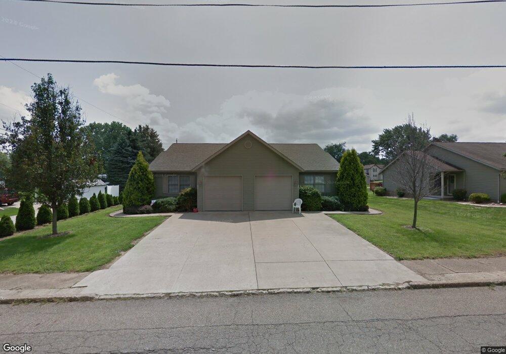
180 9th St SW Strasburg, OH 44680
Estimated Value: $205,430 - $268,000
4
Beds
2
Baths
2,080
Sq Ft
$108/Sq Ft
Est. Value
About This Home
This home is located at 180 9th St SW, Strasburg, OH 44680 and is currently estimated at $224,608, approximately $107 per square foot. 180 9th St SW is a home located in Tuscarawas County with nearby schools including Strasburg-Franklin Elementary School and Strasburg-Franklin High School.
Ownership History
Date
Name
Owned For
Owner Type
Purchase Details
Closed on
Jun 30, 2025
Sold by
Bair Holdings Llc
Bought by
Platinum Realty Llc
Current Estimated Value
Purchase Details
Closed on
Apr 9, 2020
Sold by
Bair Michael D and Bair Larissa
Bought by
Bair Holdings Llc
Purchase Details
Closed on
Aug 12, 2011
Sold by
Bair Michael D and Bair Larissa
Bought by
Bair Michael D and Bair Larissa
Home Financials for this Owner
Home Financials are based on the most recent Mortgage that was taken out on this home.
Original Mortgage
$132,864
Interest Rate
4.64%
Mortgage Type
New Conventional
Purchase Details
Closed on
Nov 2, 2006
Sold by
Diversified Properties & Renovations Llc
Bought by
Bair Michael D
Home Financials for this Owner
Home Financials are based on the most recent Mortgage that was taken out on this home.
Original Mortgage
$134,400
Interest Rate
6.45%
Mortgage Type
Construction
Create a Home Valuation Report for This Property
The Home Valuation Report is an in-depth analysis detailing your home's value as well as a comparison with similar homes in the area
Home Values in the Area
Average Home Value in this Area
Purchase History
| Date | Buyer | Sale Price | Title Company |
|---|---|---|---|
| Platinum Realty Llc | $205,000 | None Listed On Document | |
| Platinum Realty Llc | $205,000 | None Listed On Document | |
| Bair Holdings Llc | -- | None Available | |
| Bair Michael D | -- | Attorney | |
| Bair Michael D | $34,900 | Alban Title |
Source: Public Records
Mortgage History
| Date | Status | Borrower | Loan Amount |
|---|---|---|---|
| Previous Owner | Bair Michael D | $132,864 | |
| Previous Owner | Bair Michael D | $134,400 |
Source: Public Records
Tax History Compared to Growth
Tax History
| Year | Tax Paid | Tax Assessment Tax Assessment Total Assessment is a certain percentage of the fair market value that is determined by local assessors to be the total taxable value of land and additions on the property. | Land | Improvement |
|---|---|---|---|---|
| 2024 | $3,206 | $78,950 | $12,580 | $66,370 |
| 2023 | $3,206 | $225,590 | $35,950 | $189,640 |
| 2022 | $3,091 | $78,957 | $12,583 | $66,374 |
| 2021 | $2,836 | $68,034 | $11,078 | $56,956 |
| 2020 | $2,610 | $68,034 | $11,078 | $56,956 |
| 2019 | $2,621 | $68,034 | $11,078 | $56,956 |
| 2018 | $2,339 | $57,410 | $9,350 | $48,060 |
| 2017 | $2,344 | $57,410 | $9,350 | $48,060 |
| 2016 | $2,338 | $57,410 | $9,350 | $48,060 |
| 2014 | $2,354 | $56,000 | $9,350 | $46,650 |
| 2013 | $2,308 | $56,000 | $9,350 | $46,650 |
Source: Public Records
Map
Nearby Homes
- 433 9th St SW
- 715 S Bodmer Ave
- 602 S Bodmer Ave
- 143 2nd St SE
- 3203 Mount Pleasant Rd
- 0 Dundee Strasburg Rd NW
- 0 7th St NW
- 7500 Central Rd NW
- 713 Dale Ave NW
- 6269 Columbia Rd NW
- 6650 Saint Peters Church Rd NW
- 6238 Saint Peters Church Rd NW
- 0 Cherry Run Rd NW
- 4029 Minard Rd NW
- 5181 State Route 516 NW
- 0 Bair Rd NW Unit 5124469
- 0 Bair Rd NW Unit 5124477
- 0 Bair Rd NW Unit 5124464
- 0 Bair Rd NW Unit 5124485
- 0 Bair Rd NW Unit 5124339
- 190 192 SW 9th
- 174 9th St SW
- 551 Keim Dr NW
- 190 9th St SW
- 166 9th St SW
- 208 9th St SW
- 179 9th St SW
- 175 9th St SW
- 158 9th St SW
- 216 9th St SW
- 199 9th St SW
- 176 9th St SW
- 167 9th St SW
- 186 9th St SW Unit D
- 186 9th St SW Unit A
- 186 9th St SW
- 186 9th St SW Unit C
- 196 9th St SW Unit D
- 196 9th St SW Unit C
- 196 9th St SW