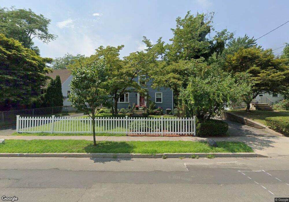
180 Belltown Rd Stamford, CT 06905
Belltown NeighborhoodEstimated Value: $678,000 - $820,043
3
Beds
2
Baths
1,996
Sq Ft
$377/Sq Ft
Est. Value
About This Home
This home is located at 180 Belltown Rd, Stamford, CT 06905 and is currently estimated at $752,261, approximately $376 per square foot. 180 Belltown Rd is a home located in Fairfield County with nearby schools including Julia A. Stark Elementary School, Dolan School, and Stamford High School.
Ownership History
Date
Name
Owned For
Owner Type
Purchase Details
Closed on
Jul 2, 2001
Sold by
Fargniarz Eugenia
Bought by
Antonelli Anna and Socci Luigi
Current Estimated Value
Home Financials for this Owner
Home Financials are based on the most recent Mortgage that was taken out on this home.
Original Mortgage
$250,000
Outstanding Balance
$96,343
Interest Rate
7.14%
Mortgage Type
Purchase Money Mortgage
Estimated Equity
$655,918
Create a Home Valuation Report for This Property
The Home Valuation Report is an in-depth analysis detailing your home's value as well as a comparison with similar homes in the area
Home Values in the Area
Average Home Value in this Area
Purchase History
| Date | Buyer | Sale Price | Title Company |
|---|---|---|---|
| Antonelli Anna | $290,200 | -- | |
| Antonelli Anna | $290,200 | -- |
Source: Public Records
Mortgage History
| Date | Status | Borrower | Loan Amount |
|---|---|---|---|
| Open | Antonelli Anna | $250,000 | |
| Closed | Antonelli Anna | $250,000 |
Source: Public Records
Tax History Compared to Growth
Tax History
| Year | Tax Paid | Tax Assessment Tax Assessment Total Assessment is a certain percentage of the fair market value that is determined by local assessors to be the total taxable value of land and additions on the property. | Land | Improvement |
|---|---|---|---|---|
| 2025 | $10,503 | $443,910 | $240,950 | $202,960 |
| 2024 | $10,272 | $443,910 | $240,950 | $202,960 |
| 2023 | $11,036 | $443,910 | $240,950 | $202,960 |
| 2022 | $9,220 | $344,810 | $181,360 | $163,450 |
| 2021 | $9,120 | $344,810 | $181,360 | $163,450 |
| 2020 | $8,886 | $344,810 | $181,360 | $163,450 |
| 2019 | $8,886 | $344,810 | $181,360 | $163,450 |
| 2018 | $8,558 | $344,810 | $181,360 | $163,450 |
| 2017 | $8,317 | $319,870 | $167,900 | $151,970 |
| 2016 | $7,422 | $293,690 | $167,900 | $125,790 |
| 2015 | $6,315 | $256,600 | $167,900 | $88,700 |
| 2014 | $6,105 | $256,600 | $167,900 | $88,700 |
Source: Public Records
Map
Nearby Homes
- 24 Haig Ave
- 172 Joffre Ave
- 22 Hastings Ln
- 543 Newfield Ave
- 31 Sussex Place
- 143 Overbrook Dr
- 78 Elizabeth Ave
- 100 Hirsch Rd
- 30 Lindsey Ave
- 31 Bellmere Ave
- 27 Crane Rd N
- 31 Gray Farms Rd
- 51 Glendale Rd
- 182 Turner Rd
- 31 Chatfield St
- 39 Camore St
- 59 Holbrook Dr
- 825 Hope St Unit 4
- 88 Pine Hill Ave
- 30 Lake Dr
- 174 Belltown Rd
- 184 Belltown Rd
- 185 Belltown Rd
- 186 Belltown Rd
- 171 Belltown Rd
- 177 Belltown Rd
- 190 Belltown Rd
- 167 Belltown Rd
- 164 Belltown Rd
- 200 Belltown Rd
- 179 Belltown Rd
- 226 Belltown Rd
- 160 Belltown Rd
- 191 Belltown Rd
- 230 Belltown Rd
- 163 Belltown Rd
- 1 Pershing Ave
- 1 Pershing Ave Unit UPPER
- 144 Belltown Rd
- 159 Belltown Rd