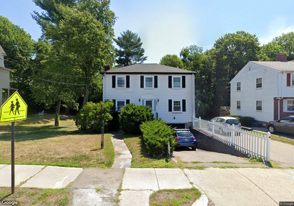
180 Dedham St Newton Highlands, MA 02461
Newton Highlands NeighborhoodEstimated Value: $1,131,000 - $1,308,000
3
Beds
3
Baths
1,536
Sq Ft
$792/Sq Ft
Est. Value
About This Home
This home is located at 180 Dedham St, Newton Highlands, MA 02461 and is currently estimated at $1,216,939, approximately $792 per square foot. 180 Dedham St is a home located in Middlesex County with nearby schools including Countryside Elementary School, Charles E Brown Middle School, and Newton South High School.
Ownership History
Date
Name
Owned For
Owner Type
Purchase Details
Closed on
Jun 30, 2005
Sold by
Peng Mei and Xu Xin
Bought by
Roa Alan L and Roa Lucy Y
Current Estimated Value
Home Financials for this Owner
Home Financials are based on the most recent Mortgage that was taken out on this home.
Original Mortgage
$473,600
Interest Rate
5.73%
Mortgage Type
Purchase Money Mortgage
Purchase Details
Closed on
Jul 10, 2003
Sold by
Matchan Linda H and Israel David A
Bought by
Peng Mei and Xu Xin
Home Financials for this Owner
Home Financials are based on the most recent Mortgage that was taken out on this home.
Original Mortgage
$416,950
Interest Rate
5.45%
Mortgage Type
Purchase Money Mortgage
Purchase Details
Closed on
Dec 7, 1987
Sold by
Berger Melvin S
Bought by
Israel David A
Create a Home Valuation Report for This Property
The Home Valuation Report is an in-depth analysis detailing your home's value as well as a comparison with similar homes in the area
Home Values in the Area
Average Home Value in this Area
Purchase History
| Date | Buyer | Sale Price | Title Company |
|---|---|---|---|
| Roa Alan L | $592,000 | -- | |
| Peng Mei | $530,000 | -- | |
| Israel David A | $223,000 | -- |
Source: Public Records
Mortgage History
| Date | Status | Borrower | Loan Amount |
|---|---|---|---|
| Open | Israel David A | $438,000 | |
| Closed | Roa Alan L | $473,600 | |
| Previous Owner | Peng Mei | $416,950 | |
| Previous Owner | Israel David A | $100,000 | |
| Previous Owner | Israel David A | $163,000 |
Source: Public Records
Tax History Compared to Growth
Tax History
| Year | Tax Paid | Tax Assessment Tax Assessment Total Assessment is a certain percentage of the fair market value that is determined by local assessors to be the total taxable value of land and additions on the property. | Land | Improvement |
|---|---|---|---|---|
| 2025 | $9,216 | $940,400 | $810,900 | $129,500 |
| 2024 | $8,911 | $913,000 | $787,300 | $125,700 |
| 2023 | $8,520 | $836,900 | $606,200 | $230,700 |
| 2022 | $8,152 | $774,900 | $561,300 | $213,600 |
| 2021 | $7,866 | $731,000 | $529,500 | $201,500 |
| 2020 | $7,632 | $731,000 | $529,500 | $201,500 |
| 2019 | $7,416 | $709,700 | $514,100 | $195,600 |
| 2018 | $7,087 | $655,000 | $466,100 | $188,900 |
| 2017 | $6,871 | $617,900 | $439,700 | $178,200 |
| 2016 | $6,572 | $577,500 | $410,900 | $166,600 |
| 2015 | $6,266 | $539,700 | $384,000 | $155,700 |
Source: Public Records
Map
Nearby Homes
- 250 Woodcliff Rd
- 36 Cannon St
- 1308 Walnut St
- 1292 Walnut St
- 125 Oakdale Rd
- 19 Selwyn Rd
- 116 Upland Ave
- 671 Boylston St
- 15 Buff Cir
- 628 Boylston St
- 21 Philbrick Rd
- 45 Brandeis Rd
- 625 Boylston St
- 1629 Centre St
- 1623-1625 Centre St
- 42 Sunhill Ln
- 35 Haynes Rd
- 1597 Centre St Unit 1597
- 1597 Centre St
- 415 Dedham St Unit D
- 188 Dedham St
- 176 Dedham St
- 194 Dedham St
- 249 Woodcliff Rd
- 241 Woodcliff Rd
- 255 Woodcliff Rd
- 235 Woodcliff Rd
- 1412 Walnut St
- 263 Woodcliff Rd
- 229 Woodcliff Rd
- 1408 Walnut St
- 1408 Walnut St Unit SF
- 1408 Walnut St Unit 1408
- 204 Dedham St
- 246 Woodcliff Rd
- 162 Dedham St
- 242 Woodcliff Rd
- 269 Woodcliff Rd
- 256 Woodcliff Rd
- 1404 Walnut St