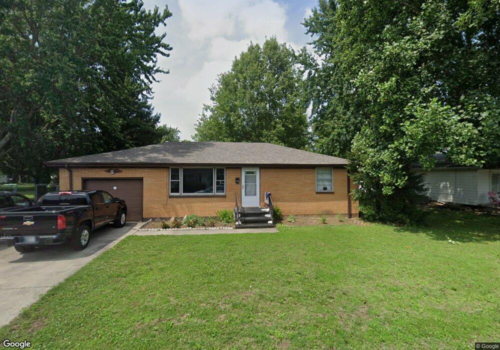
180 Factory Dr Austin, IN 47102
Estimated Value: $86,000 - $133,618
2
Beds
1
Bath
1,092
Sq Ft
$102/Sq Ft
Est. Value
About This Home
This home is located at 180 Factory Dr, Austin, IN 47102 and is currently estimated at $111,155, approximately $101 per square foot. 180 Factory Dr is a home located in Scott County with nearby schools including Austin Elementary School, Austin Middle School, and Austin High School.
Ownership History
Date
Name
Owned For
Owner Type
Purchase Details
Closed on
Jul 27, 2012
Sold by
Barrett Janet
Bought by
Rice Landon
Current Estimated Value
Home Financials for this Owner
Home Financials are based on the most recent Mortgage that was taken out on this home.
Original Mortgage
$33,384
Outstanding Balance
$23,105
Interest Rate
3.65%
Mortgage Type
FHA
Estimated Equity
$88,050
Create a Home Valuation Report for This Property
The Home Valuation Report is an in-depth analysis detailing your home's value as well as a comparison with similar homes in the area
Home Values in the Area
Average Home Value in this Area
Purchase History
| Date | Buyer | Sale Price | Title Company |
|---|---|---|---|
| Rice Landon | -- | None Available |
Source: Public Records
Mortgage History
| Date | Status | Borrower | Loan Amount |
|---|---|---|---|
| Open | Rice Landon | $33,384 |
Source: Public Records
Tax History Compared to Growth
Tax History
| Year | Tax Paid | Tax Assessment Tax Assessment Total Assessment is a certain percentage of the fair market value that is determined by local assessors to be the total taxable value of land and additions on the property. | Land | Improvement |
|---|---|---|---|---|
| 2024 | $402 | $47,100 | $13,500 | $33,600 |
| 2023 | $408 | $49,900 | $13,500 | $36,400 |
| 2022 | $300 | $49,000 | $13,500 | $35,500 |
| 2021 | $275 | $46,100 | $13,500 | $32,600 |
| 2020 | $288 | $46,100 | $13,500 | $32,600 |
| 2019 | $278 | $46,100 | $13,500 | $32,600 |
| 2018 | $287 | $48,100 | $13,500 | $34,600 |
| 2017 | $272 | $48,000 | $13,500 | $34,500 |
| 2016 | $271 | $47,500 | $13,500 | $34,000 |
| 2014 | $343 | $53,100 | $14,000 | $39,100 |
| 2013 | $343 | $55,600 | $14,000 | $41,600 |
Source: Public Records
Map
Nearby Homes