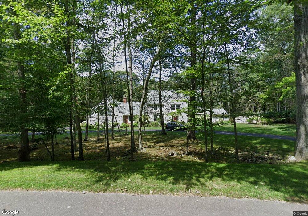
180 Jonathan Rd New Canaan, CT 06840
Estimated Value: $2,170,614 - $2,554,000
4
Beds
4
Baths
4,633
Sq Ft
$515/Sq Ft
Est. Value
About This Home
This home is located at 180 Jonathan Rd, New Canaan, CT 06840 and is currently estimated at $2,385,904, approximately $514 per square foot. 180 Jonathan Rd is a home located in Fairfield County with nearby schools including West Elementary School, Saxe Middle School, and New Canaan High School.
Ownership History
Date
Name
Owned For
Owner Type
Purchase Details
Closed on
Aug 21, 2008
Sold by
Striffler Robert J and Striffler Sheila J
Bought by
Farrell Matthew J and Farrell Joan
Current Estimated Value
Home Financials for this Owner
Home Financials are based on the most recent Mortgage that was taken out on this home.
Original Mortgage
$1,000,000
Interest Rate
5.75%
Purchase Details
Closed on
Jul 16, 1987
Sold by
Riedel Enterprises
Bought by
Striffer Robert
Home Financials for this Owner
Home Financials are based on the most recent Mortgage that was taken out on this home.
Original Mortgage
$500,000
Interest Rate
10.69%
Create a Home Valuation Report for This Property
The Home Valuation Report is an in-depth analysis detailing your home's value as well as a comparison with similar homes in the area
Home Values in the Area
Average Home Value in this Area
Purchase History
| Date | Buyer | Sale Price | Title Company |
|---|---|---|---|
| Farrell Matthew J | $1,550,000 | -- | |
| Striffer Robert | $855,000 | -- |
Source: Public Records
Mortgage History
| Date | Status | Borrower | Loan Amount |
|---|---|---|---|
| Open | Striffer Robert | $1,000,000 | |
| Closed | Striffer Robert | $1,000,000 | |
| Previous Owner | Striffer Robert | $500,000 |
Source: Public Records
Tax History Compared to Growth
Tax History
| Year | Tax Paid | Tax Assessment Tax Assessment Total Assessment is a certain percentage of the fair market value that is determined by local assessors to be the total taxable value of land and additions on the property. | Land | Improvement |
|---|---|---|---|---|
| 2025 | $21,047 | $1,261,050 | $477,260 | $783,790 |
| 2024 | $20,353 | $1,261,050 | $477,260 | $783,790 |
| 2023 | $19,207 | $1,014,090 | $509,810 | $504,280 |
| 2022 | $18,629 | $1,014,090 | $509,810 | $504,280 |
| 2021 | $18,416 | $1,014,090 | $509,810 | $504,280 |
| 2020 | $18,416 | $1,014,090 | $509,810 | $504,280 |
| 2019 | $18,497 | $1,014,090 | $509,810 | $504,280 |
| 2018 | $19,476 | $1,148,350 | $531,440 | $616,910 |
| 2017 | $19,143 | $1,148,350 | $531,440 | $616,910 |
| 2016 | $18,730 | $1,148,350 | $531,440 | $616,910 |
| 2015 | $19,017 | $1,148,350 | $531,440 | $616,910 |
| 2014 | $17,845 | $1,148,350 | $531,440 | $616,910 |
Source: Public Records
Map
Nearby Homes
- 1421 Oenoke Ridge
- 176 Logan Rd
- 39 Louises Ln
- 1247 Oenoke Ridge
- 1038 West Rd
- 171 Proprietors Crossing
- 119 Proprietors Crossing
- 26 Pequot Ln
- 33 Peters Ln
- 62 Summersweet Ln
- 22 Peters Ln
- 22 Father Peters Ln
- 0 Rolling Meadow Ln Unit ONEH6302491
- 1187 Smith Ridge Rd
- 230 & 244 West Rd
- 104 Dans Hwy
- 17 Eastwoods Rd
- 650 Laurel Rd
- 758 Smith Ridge Rd
- 37 East St
- 198 Jonathan Rd
- 142 Jonathan Rd
- 11 Samuel Dann Way
- 214 Jonathan Rd
- 128 Jonathan Rd
- 6 Samuel Dann Way
- 9 Samuel Dann Way
- 145 Jonathan Rd
- 271 Jonathan Rd
- 14 Samuel Dann Way
- 135 Jonathan Rd
- 232 Jonathan Rd
- 7 Samuel Dann Way
- 8 Samuel Dann Way
- 104 Jonathan Rd
- 113 Jonathan Rd
- 238 Jonathan Rd
- 258 Jonathan Rd