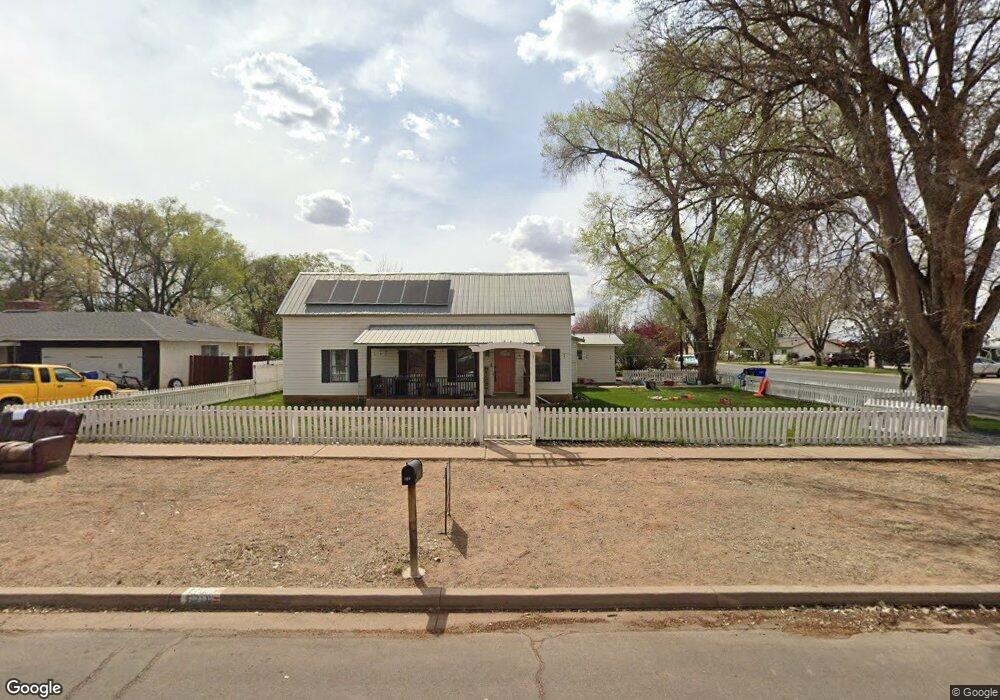
180 N 2nd St W Snowflake, AZ 85937
Estimated Value: $350,000 - $378,000
--
Bed
--
Bath
2,657
Sq Ft
$139/Sq Ft
Est. Value
About This Home
This home is located at 180 N 2nd St W, Snowflake, AZ 85937 and is currently estimated at $368,127, approximately $138 per square foot. 180 N 2nd St W is a home located in Navajo County with nearby schools including Snowflake Intermediate School, Highland Primary School, and Snowflake Junior High School.
Ownership History
Date
Name
Owned For
Owner Type
Purchase Details
Closed on
Apr 27, 2023
Sold by
Flake Jordan and Flake Alexis
Bought by
Mcneil Kaitlyn and Mcneil Devin
Current Estimated Value
Home Financials for this Owner
Home Financials are based on the most recent Mortgage that was taken out on this home.
Original Mortgage
$328,932
Outstanding Balance
$320,130
Interest Rate
6.6%
Mortgage Type
FHA
Estimated Equity
$47,997
Purchase Details
Closed on
Jun 22, 2020
Sold by
Webb Cloris K and Baer Cloris K
Bought by
Flake Jordan and Flake Alexis
Home Financials for this Owner
Home Financials are based on the most recent Mortgage that was taken out on this home.
Original Mortgage
$176,739
Interest Rate
3.2%
Mortgage Type
FHA
Create a Home Valuation Report for This Property
The Home Valuation Report is an in-depth analysis detailing your home's value as well as a comparison with similar homes in the area
Home Values in the Area
Average Home Value in this Area
Purchase History
| Date | Buyer | Sale Price | Title Company |
|---|---|---|---|
| Mcneil Kaitlyn | $335,000 | Lawyers Title | |
| Flake Jordan | $180,000 | Lawyers Title Of Arizona Inc |
Source: Public Records
Mortgage History
| Date | Status | Borrower | Loan Amount |
|---|---|---|---|
| Open | Mcneil Kaitlyn | $328,932 | |
| Previous Owner | Flake Jordan | $176,739 |
Source: Public Records
Tax History Compared to Growth
Tax History
| Year | Tax Paid | Tax Assessment Tax Assessment Total Assessment is a certain percentage of the fair market value that is determined by local assessors to be the total taxable value of land and additions on the property. | Land | Improvement |
|---|---|---|---|---|
| 2026 | $480 | -- | -- | -- |
| 2025 | $466 | $21,898 | $2,658 | $19,240 |
| 2024 | $497 | $21,702 | $2,311 | $19,391 |
| 2023 | $466 | $16,285 | $370 | $15,915 |
| 2022 | $497 | $0 | $0 | $0 |
| 2021 | $540 | $0 | $0 | $0 |
| 2020 | $543 | $0 | $0 | $0 |
| 2019 | $532 | $0 | $0 | $0 |
| 2018 | $219 | $0 | $0 | $0 |
| 2017 | $503 | $0 | $0 | $0 |
| 2016 | $516 | $0 | $0 | $0 |
| 2015 | $453 | $5,570 | $939 | $4,631 |
Source: Public Records
Map
Nearby Homes
- 276 N 2nd St W
- 276 N 2nd St W Unit West
- 177 W 1st St N
- 221 N Main St
- 44 S 3rd St W Unit W
- 44 S 3rd St W
- 177 N 1st East St
- 461 W Center St
- 416 S 2nd St W
- 0 S 1st St W
- 381 W 7th St S
- 420 S Astante Dr
- 662 E 1 2 St
- 662 N 1 2 St
- Parcel C Arizona 77
- Parcel A Arizona 77
- Parcel B Arizona 77
- 864 S 1st St E
- 940 S 2nd St W
- 960 S Highland Dr