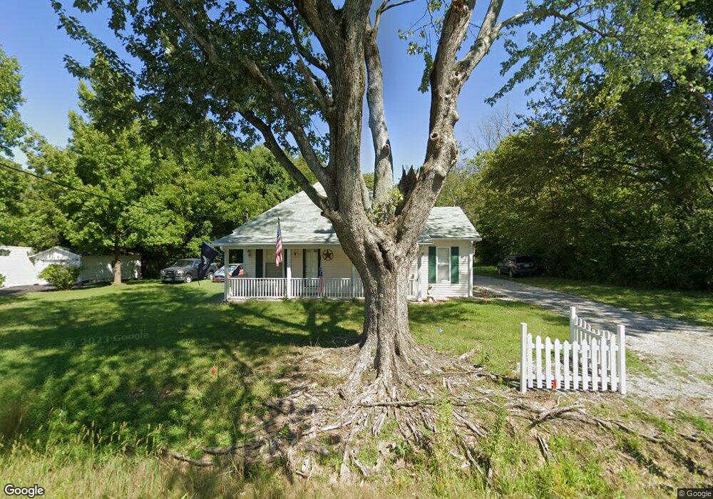
180 Old Cain Rd Harrisburg, IL 62946
Estimated Value: $85,577 - $219,000
--
Bed
--
Bath
--
Sq Ft
3
Acres
About This Home
This home is located at 180 Old Cain Rd, Harrisburg, IL 62946 and is currently estimated at $136,144. 180 Old Cain Rd is a home located in Saline County with nearby schools including East Side Intermediate School, Harrisburg Middle School, and Harrisburg High School.
Ownership History
Date
Name
Owned For
Owner Type
Purchase Details
Closed on
Jan 30, 2025
Sold by
West Ridge Corporation Inc and Westridge Corporation Inc
Bought by
Wbc 1 Llc
Current Estimated Value
Purchase Details
Closed on
Nov 12, 2020
Sold by
Hunt Johnny Ray
Bought by
Jssr Hunt Irrevocable Trust
Purchase Details
Closed on
Mar 4, 2020
Sold by
Hunt Sandra J
Bought by
Hunt Johnny Ray
Create a Home Valuation Report for This Property
The Home Valuation Report is an in-depth analysis detailing your home's value as well as a comparison with similar homes in the area
Home Values in the Area
Average Home Value in this Area
Purchase History
| Date | Buyer | Sale Price | Title Company |
|---|---|---|---|
| Wbc 1 Llc | -- | None Listed On Document | |
| Wbc 1 Llc | -- | None Listed On Document | |
| Jssr Hunt Irrevocable Trust | -- | Accommodation | |
| Hunt Johnny Ray | -- | Attorney |
Source: Public Records
Tax History Compared to Growth
Tax History
| Year | Tax Paid | Tax Assessment Tax Assessment Total Assessment is a certain percentage of the fair market value that is determined by local assessors to be the total taxable value of land and additions on the property. | Land | Improvement |
|---|---|---|---|---|
| 2024 | $151 | $15,464 | $1,227 | $14,237 |
| 2023 | $165 | $13,107 | $1,040 | $12,067 |
| 2022 | $518 | $12,355 | $980 | $11,375 |
| 2021 | $556 | $12,736 | $1,010 | $11,726 |
| 2020 | $532 | $12,355 | $980 | $11,375 |
| 2019 | $536 | $12,355 | $980 | $11,375 |
| 2018 | $543 | $12,355 | $980 | $11,375 |
| 2017 | $533 | $12,355 | $980 | $11,375 |
| 2016 | $5 | $12,355 | $980 | $11,375 |
| 2015 | -- | $12,355 | $980 | $11,375 |
| 2014 | $488 | $12,355 | $980 | $11,375 |
| 2013 | $488 | $12,355 | $980 | $11,375 |
| 2012 | $488 | $12,355 | $980 | $11,375 |
Source: Public Records
Map
Nearby Homes
- 615 Liberty Rd
- 885 Liberty Rd
- 104 Hickory St
- 405 S Shaw St
- 205 S Shaw St
- 1116 S Holland St
- 827 W Raymond St
- 614 W College St
- 1006 S Land St
- 1116 S Land St
- 500 W Sloan St
- 1101 S Mckinley St
- 504 W South St
- 1523 S Mckinley St
- 734 S Mckinley St
- 520 S Mckinley St
- 618 S Mckinley St
- 517 W Barnett St
- 0000 S Commercial St
- 430 W Church St
- 120 Old Cain Rd
- 190 Old Cain Rd
- 140 Old Cain Rd
- 196 Old Cain Rd
- 120 Cain Rd
- 210 Old Cain Rd
- 240 Old Cain Rd
- 20 Old Cain Rd
- 10 Liberty Rd
- 125 Old Cain Rd
- 195 Old Cain Rd
- 85 Old Cain Rd
- 55 Liberty Rd
- 105 Liberty Rd
- 125 Liberty Rd
- 145 Liberty Rd
- 2209 Mchaney Rd
- 205 Liberty Rd
- 225 Liberty Rd
- 508 Riegel Dr