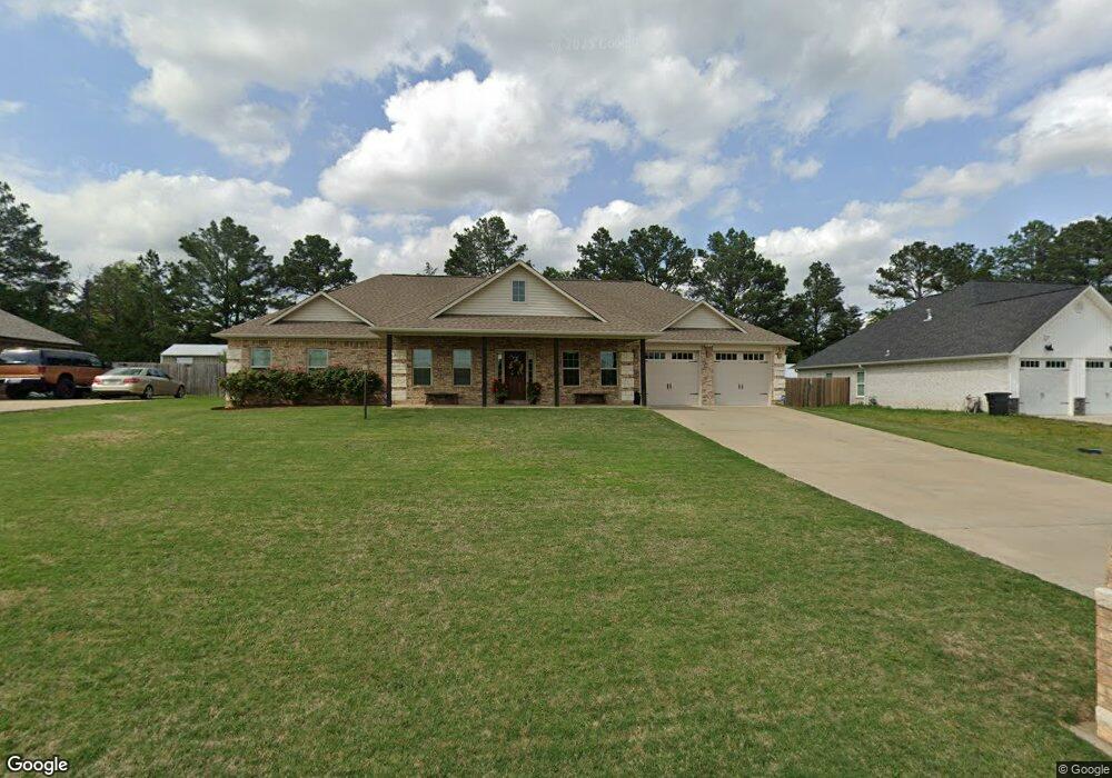
180 Patriot Way Texarkana, TX 75501
Estimated Value: $316,903 - $383,000
--
Bed
--
Bath
2,210
Sq Ft
$157/Sq Ft
Est. Value
About This Home
This home is located at 180 Patriot Way, Texarkana, TX 75501 and is currently estimated at $347,226, approximately $157 per square foot. 180 Patriot Way is a home with nearby schools including Liberty-Eylau Early Childhood Center, Liberty-Eylau Primary School, and Liberty-Eylau C.K. Bender Elementary Campus.
Ownership History
Date
Name
Owned For
Owner Type
Purchase Details
Closed on
Sep 8, 2016
Sold by
Strange Bill and Strange Billie M
Bought by
Griffin Harold G
Current Estimated Value
Home Financials for this Owner
Home Financials are based on the most recent Mortgage that was taken out on this home.
Original Mortgage
$166,382
Outstanding Balance
$132,753
Interest Rate
3.48%
Mortgage Type
New Conventional
Estimated Equity
$214,473
Purchase Details
Closed on
Jan 19, 2010
Sold by
Francis Mitchell W and Francis Sterphanie K
Bought by
Strange Bill
Create a Home Valuation Report for This Property
The Home Valuation Report is an in-depth analysis detailing your home's value as well as a comparison with similar homes in the area
Home Values in the Area
Average Home Value in this Area
Purchase History
| Date | Buyer | Sale Price | Title Company |
|---|---|---|---|
| Griffin Harold G | -- | Twin City Title Company | |
| Strange Bill | -- | None Available |
Source: Public Records
Mortgage History
| Date | Status | Borrower | Loan Amount |
|---|---|---|---|
| Open | Griffin Harold G | $166,382 |
Source: Public Records
Tax History Compared to Growth
Tax History
| Year | Tax Paid | Tax Assessment Tax Assessment Total Assessment is a certain percentage of the fair market value that is determined by local assessors to be the total taxable value of land and additions on the property. | Land | Improvement |
|---|---|---|---|---|
| 2025 | $3,175 | $369,220 | -- | -- |
| 2024 | $3,175 | $334,927 | $20,000 | $365,919 |
| 2023 | $4,549 | $304,479 | $0 | $0 |
| 2022 | $4,769 | $329,739 | $20,000 | $309,739 |
| 2021 | $4,610 | $251,635 | $20,000 | $231,635 |
| 2020 | $4,446 | $240,889 | $20,000 | $220,889 |
| 2019 | $4,480 | $230,640 | $20,000 | $210,640 |
| 2018 | $4,327 | $222,747 | $20,000 | $202,747 |
| 2017 | $4,314 | $222,952 | $20,000 | $202,952 |
| 2016 | $116 | $6,000 | $6,000 | $0 |
| 2015 | $112 | $6,000 | $6,000 | $0 |
| 2014 | $112 | $6,000 | $6,000 | $0 |
Source: Public Records
Map
Nearby Homes
- 194 W Starlite Dr
- 280 Patriot Way
- 101 Redwood Dr
- 6514 Buchanan Loop Rd
- 6 Southridge St
- 403 Brookfield St
- 7689 Us-59
- 6606 Us-59
- 6606 Us Highway 59 S
- 6815 Buchanan Loop Rd
- 7685 State Highway 59
- 144 Joe Tyl Rd
- 2043 Randall Rd
- lot15 B2 Quail Brook
- lot15 B1 Quail Brook
- lot14 B2 Quail Brook
- Lot 1 B2 Quail Brook
- 39 Quail Brook Dr
- 0 Randall Rd
- 206 Fm 3244
- 160 Patriot Way
- 200 Patriot Way
- 140 Patriot Way
- 175 Patriot Way
- 195 Patriot Way
- 155 Patriot Way
- 220 Patriot Way
- 215 Patriot Way
- 135 Patriot Way
- 120 Patriotway
- 240 Patriot Way
- 235 Patriot Way
- 150 W Starlite Dr
- 126 W Starlite Dr
- 172 W Starlite Dr
- 260 Patriot Way
- 118 W Starlite Dr
- 82 Patriot Way
- 255 Patriot Way
- 104 W Starlite Dr