
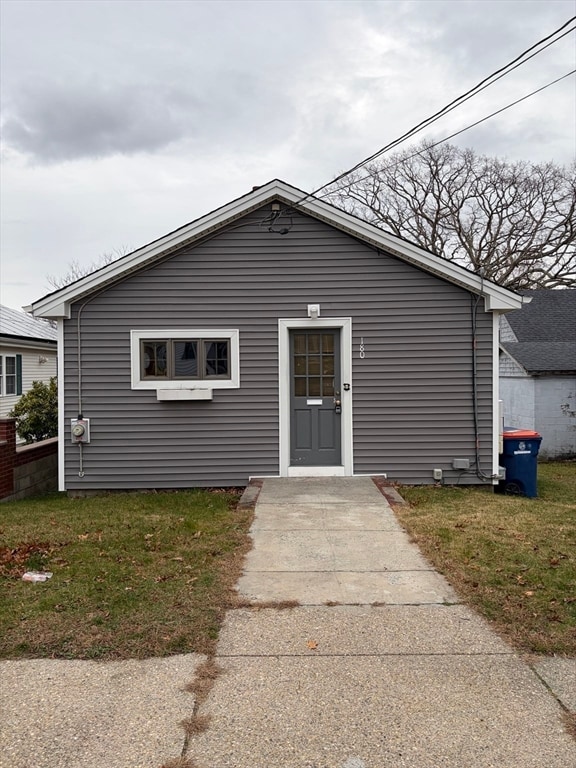
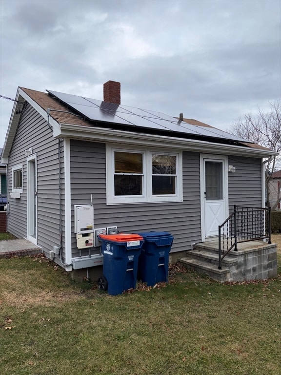

180 Rochambeau St New Bedford, MA 02745
Acushnet Station NeighborhoodEstimated payment $1,415/month
Highlights
- Very Popular Property
- Property is near public transit
- No HOA
- Medical Services
- Ranch Style House
- Porch
About This Home
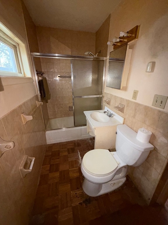
This cozy 1-bedroom, 1-bath home sits in a great North End New Bedford neighborhood, offering an ideal opportunity for a simple and manageable renovation. Many essentials are already taken care of, including a newer heating system, vinyl siding, and solar panels—giving you a strong foundation to work with. This is a fantastic chance to transform a small home with big potential in one of New Bedford’s most desirable areas! To be sold as-is.
Home Details
Home Type
- Single Family
Est. Annual Taxes
- $2,774
Year Built
- Built in 1940
Lot Details
- 3,798 Sq Ft Lot
- Fenced
- Property is zoned RB
Parking
- Open Parking
Home Design
- Ranch Style House
- Block Foundation
- Frame Construction
- Shingle Roof
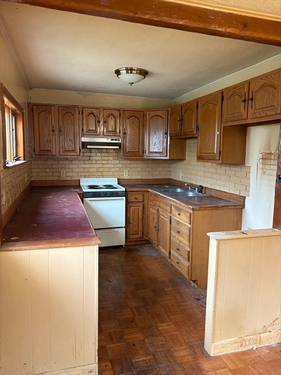
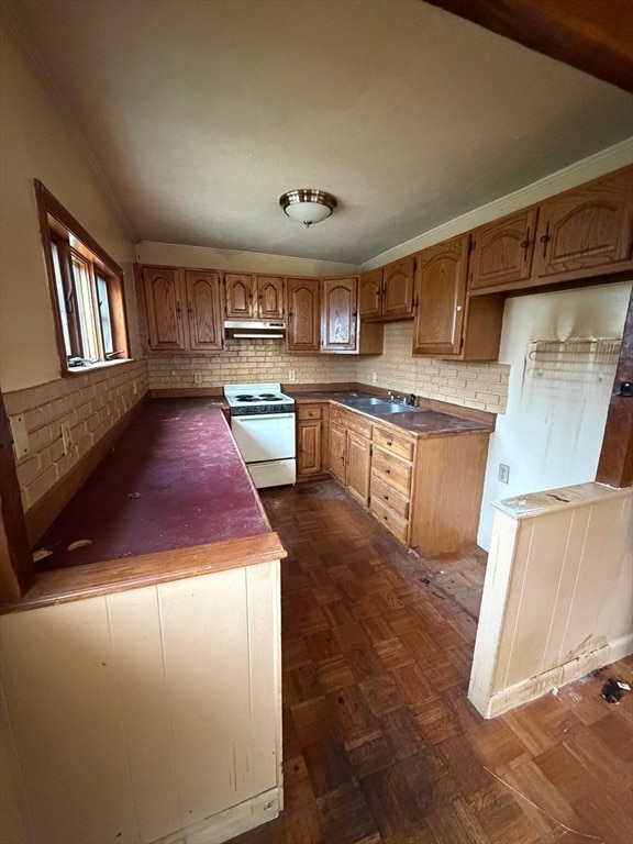
Interior Spaces
- 400 Sq Ft Home
- Parquet Flooring
- Range
Bedrooms and Bathrooms
- 1 Bedroom
- 1 Full Bathroom
Unfinished Basement
- Walk-Out Basement
- Block Basement Construction
Utilities
- No Cooling
- Forced Air Heating System
- 1 Heating Zone
- Heating System Uses Natural Gas
- Gas Water Heater
Additional Features
- Porch
- Property is near public transit
Listing and Financial Details
- Assessor Parcel Number M:0114 L:0125,2901919
Community Details
Overview
- No Home Owners Association
Amenities
- Medical Services
- Shops
Map
Home Values in the Area
Average Home Value in this Area
Tax History
| Year | Tax Paid | Tax Assessment Tax Assessment Total Assessment is a certain percentage of the fair market value that is determined by local assessors to be the total taxable value of land and additions on the property. | Land | Improvement |
|---|---|---|---|---|
| 2025 | $2,774 | $245,300 | $112,400 | $132,900 |
| 2024 | $2,633 | $219,400 | $112,400 | $107,000 |
| 2023 | $2,576 | $180,300 | $90,300 | $90,000 |
| 2022 | $2,345 | $150,900 | $86,000 | $64,900 |
| 2021 | $2,317 | $148,600 | $86,000 | $62,600 |
| 2020 | $2,300 | $142,300 | $86,000 | $56,300 |
| 2019 | $2,260 | $137,200 | $86,000 | $51,200 |
| 2018 | $2,164 | $130,100 | $86,000 | $44,100 |
| 2017 | $2,123 | $127,200 | $82,700 | $44,500 |
| 2016 | $1,959 | $118,800 | $79,400 | $39,400 |
| 2015 | $1,853 | $117,800 | $79,400 | $38,400 |
| 2014 | $1,740 | $114,800 | $76,100 | $38,700 |
Property History
| Date | Event | Price | List to Sale | Price per Sq Ft |
|---|---|---|---|---|
| 12/09/2025 12/09/25 | For Sale | $225,000 | -- | $563 / Sq Ft |
Purchase History
| Date | Type | Sale Price | Title Company |
|---|---|---|---|
| Deed | $63,000 | -- | |
| Deed | $63,000 | -- |
Mortgage History
| Date | Status | Loan Amount | Loan Type |
|---|---|---|---|
| Open | $59,850 | Purchase Money Mortgage | |
| Closed | $59,850 | Purchase Money Mortgage | |
| Previous Owner | $10,000 | No Value Available |
Source: MLS Property Information Network (MLS PIN)
MLS Number: 73460887
APN: NEWB-000114-000000-000125
Disclaimer: Certain information contained herein is derived from information provided by parties other than Homes.com. All information provided is deemed reliable, but is not guaranteed to be accurate and should be independently verified.
![]() The property listing data and information, or the Images, set forth herein were provided to MLS Property Information Network, Inc. from third party sources, including sellers, lessors and public records, and were compiled by MLS Property Information Network, Inc. The property listing data and information, and the Images, are for the personal, non-commercial use of consumers having a good faith interest in purchasing or leasing listed properties of the type displayed to them and may not be used for any purpose other than to identify prospective properties which such consumers may have a good faith interest in purchasing or leasing. MLS Property Information Network, Inc. and its subscribers disclaim any and all representations and warranties as to the accuracy of the property listing data and information, or as to the accuracy of any of the Images, set forth herein.
The property listing data and information, or the Images, set forth herein were provided to MLS Property Information Network, Inc. from third party sources, including sellers, lessors and public records, and were compiled by MLS Property Information Network, Inc. The property listing data and information, and the Images, are for the personal, non-commercial use of consumers having a good faith interest in purchasing or leasing listed properties of the type displayed to them and may not be used for any purpose other than to identify prospective properties which such consumers may have a good faith interest in purchasing or leasing. MLS Property Information Network, Inc. and its subscribers disclaim any and all representations and warranties as to the accuracy of the property listing data and information, or as to the accuracy of any of the Images, set forth herein.
- 325 Park Ave
- 344 Tarkiln Hill Rd Unit 1
- 260 Wood St Unit 2
- 338 Shaw St Unit 1st Floor
- 1942 Acushnet Ave Unit 2
- 149 Wood St Unit 1
- 20 Maryland St Unit B
- 1751-1759-1759 Acushnet Ave Unit 104
- 93 Belleville Rd Unit 2A
- 210 Whitman St Unit 2
- 50 New Plainville Rd
- 229 Brook St Unit 2
- 198-200 Davis St
- 175 Phillips Ave Unit 2
- 143-145 Deane St Unit 2
- 272 Mt Pleasant St Unit 272 Mount Pleasant Street
- 45 Mitchell St Unit 1
- 119 Sycamore St
- 110 Reynolds St Unit 1W
- 940 County St Unit 1
