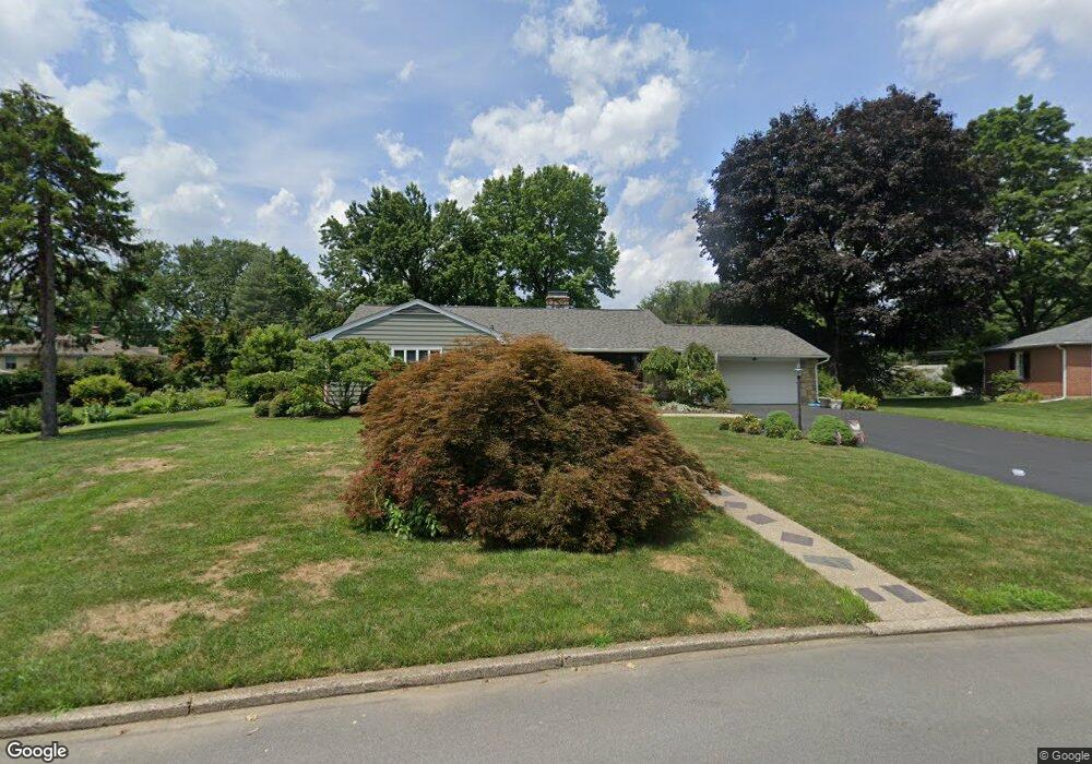
180 Wharton Ln Bethlehem, PA 18017
Northeast Bethlehem NeighborhoodEstimated Value: $482,000 - $587,000
3
Beds
2
Baths
2,163
Sq Ft
$249/Sq Ft
Est. Value
About This Home
This home is located at 180 Wharton Ln, Bethlehem, PA 18017 and is currently estimated at $538,101, approximately $248 per square foot. 180 Wharton Ln is a home located in Northampton County with nearby schools including Spring Garden Elementary School, Northeast Middle School, and Liberty High School.
Ownership History
Date
Name
Owned For
Owner Type
Purchase Details
Closed on
Dec 9, 2003
Sold by
Cisek Lawrence
Bought by
Lund Richard M
Current Estimated Value
Home Financials for this Owner
Home Financials are based on the most recent Mortgage that was taken out on this home.
Original Mortgage
$60,000
Outstanding Balance
$28,094
Interest Rate
6.03%
Mortgage Type
New Conventional
Estimated Equity
$510,007
Purchase Details
Closed on
Oct 1, 1979
Bought by
Cisek Lawrence J and Cisek Barbara J
Create a Home Valuation Report for This Property
The Home Valuation Report is an in-depth analysis detailing your home's value as well as a comparison with similar homes in the area
Home Values in the Area
Average Home Value in this Area
Purchase History
| Date | Buyer | Sale Price | Title Company |
|---|---|---|---|
| Lund Richard M | $319,900 | -- | |
| Cisek Lawrence J | $90,000 | -- |
Source: Public Records
Mortgage History
| Date | Status | Borrower | Loan Amount |
|---|---|---|---|
| Open | Lund Richard M | $60,000 |
Source: Public Records
Tax History Compared to Growth
Tax History
| Year | Tax Paid | Tax Assessment Tax Assessment Total Assessment is a certain percentage of the fair market value that is determined by local assessors to be the total taxable value of land and additions on the property. | Land | Improvement |
|---|---|---|---|---|
| 2025 | $1,125 | $104,200 | $42,700 | $61,500 |
| 2024 | $9,210 | $104,200 | $42,700 | $61,500 |
| 2023 | $9,210 | $104,200 | $42,700 | $61,500 |
| 2022 | $9,138 | $104,200 | $42,700 | $61,500 |
| 2021 | $9,077 | $104,200 | $42,700 | $61,500 |
| 2020 | $8,990 | $104,200 | $42,700 | $61,500 |
| 2019 | $8,960 | $104,200 | $42,700 | $61,500 |
| 2018 | $8,742 | $104,200 | $42,700 | $61,500 |
| 2017 | $8,638 | $104,200 | $42,700 | $61,500 |
| 2016 | -- | $104,200 | $42,700 | $61,500 |
| 2015 | -- | $104,200 | $42,700 | $61,500 |
| 2014 | -- | $104,200 | $42,700 | $61,500 |
Source: Public Records
Map
Nearby Homes
- 2616 Pioneer Rd
- 59 W MacAda Rd
- 1069 Resolution Dr
- 315 Carver Dr
- 1738 Madison Ave
- 1452 Cortland St
- 1451 Iron St
- 1970 Rosewood Dr Unit Lot 6
- 1433 Chelsea Ave
- 1409 Lorain Ave
- 339 E Washington Ave
- 445 Barclay Dr
- 1075 W MacAda Rd
- 922 Wedgewood Rd
- 1247 Birchwood Dr
- 1432 High St
- 2328 Linden St
- 1422 Montrose Ave
- 1215 W MacAda Rd
- 3217 Center St
- 172 Wharton Ln
- 190 Wharton Ln
- 226 Moreland Ave
- 149 W Langhorne Ave
- 164 Wharton Ln
- 167 Wharton Ln
- 135 W Langhorne Ave
- 221 W Langhorne Ave
- 238 Moreland Ave
- 144 Moreland Ave
- 125 W Langhorne Ave
- 156 Wharton Ln
- 215 Moreland Ave
- 229 Moreland Ave
- 250 Moreland Ave
- 225 W Langhorne Ave
- 115 W Langhorne Ave
- 132 Moreland Ave
- 157 Moreland Ave
- 144 W Langhorne Ave