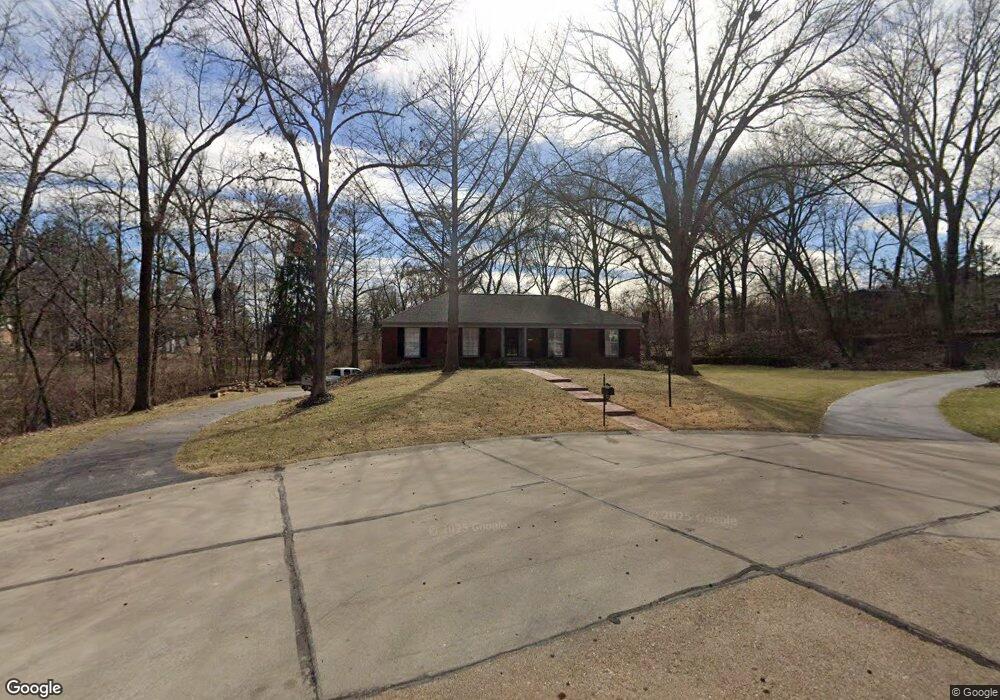
1800 Firethorn Dr Saint Louis, MO 63131
Estimated Value: $656,969 - $791,000
4
Beds
3
Baths
2,202
Sq Ft
$329/Sq Ft
Est. Value
About This Home
This home is located at 1800 Firethorn Dr, Saint Louis, MO 63131 and is currently estimated at $723,742, approximately $328 per square foot. 1800 Firethorn Dr is a home located in St. Louis County with nearby schools including Westchester Elementary School, North Kirkwood Middle School, and Kirkwood Senior High School.
Ownership History
Date
Name
Owned For
Owner Type
Purchase Details
Closed on
Jul 26, 2000
Sold by
Turner Joyce L
Bought by
Carron Michael G and Carron Susan L
Current Estimated Value
Home Financials for this Owner
Home Financials are based on the most recent Mortgage that was taken out on this home.
Original Mortgage
$252,700
Outstanding Balance
$90,425
Interest Rate
8.23%
Estimated Equity
$633,317
Purchase Details
Closed on
Jun 1, 1998
Sold by
Turner Joyce L
Bought by
Turner Joyce L
Create a Home Valuation Report for This Property
The Home Valuation Report is an in-depth analysis detailing your home's value as well as a comparison with similar homes in the area
Home Values in the Area
Average Home Value in this Area
Purchase History
| Date | Buyer | Sale Price | Title Company |
|---|---|---|---|
| Carron Michael G | $346,314 | -- | |
| Turner Joyce L | -- | -- |
Source: Public Records
Mortgage History
| Date | Status | Borrower | Loan Amount |
|---|---|---|---|
| Open | Carron Michael G | $252,700 |
Source: Public Records
Tax History Compared to Growth
Tax History
| Year | Tax Paid | Tax Assessment Tax Assessment Total Assessment is a certain percentage of the fair market value that is determined by local assessors to be the total taxable value of land and additions on the property. | Land | Improvement |
|---|---|---|---|---|
| 2025 | $6,378 | $131,580 | $76,970 | $54,610 |
| 2024 | $6,378 | $110,260 | $62,550 | $47,710 |
| 2023 | $6,378 | $110,260 | $62,550 | $47,710 |
| 2022 | $5,887 | $96,350 | $62,550 | $33,800 |
| 2021 | $5,824 | $96,350 | $62,550 | $33,800 |
| 2020 | $5,877 | $93,480 | $37,920 | $55,560 |
| 2019 | $5,885 | $93,480 | $37,920 | $55,560 |
| 2018 | $5,545 | $79,020 | $27,870 | $51,150 |
| 2017 | $5,560 | $79,020 | $27,870 | $51,150 |
| 2016 | $5,139 | $73,950 | $27,870 | $46,080 |
| 2015 | $5,145 | $73,950 | $27,870 | $46,080 |
| 2014 | $4,963 | $69,700 | $29,170 | $40,530 |
Source: Public Records
Map
Nearby Homes
- 1728 Folkstone Dr
- 8 Briarbrook Trail
- 723 Oak Valley Dr
- 1741 Pine Hill Dr
- 1345 Woodgate Dr
- 1126 Bopp Rd
- 811 Cherry St
- The Hawthorne Plan at Ballas Ridge
- The Roclare II Plan at Ballas Ridge
- The Westchester IV Plan at Ballas Ridge
- The Nottingham II Plan at Ballas Ridge
- The Hawthorne II Plan at Ballas Ridge
- 22 Countryside Ln
- TBB
- TBB Ballas Ridge Roclare II
- TBB Ballas Ridge Hawthorne II
- TBB Ballas Ridge Westchester IV
- TBB
- 1090 Kinstern Dr
- 12439 Springdale Ln Unit TBB
- 1701 Fawnvalley Dr
- 15 Briarbrook Trail
- 1709 Fawnvalley Dr
- 17 Briarbrook Trail
- 1810 Firethorn Dr
- 790 Oak Valley Dr
- 1811 Firethorn Dr
- 1700 Fawnvalley Dr
- 20 Briarbrook Trail
- 13 Briarbrook Trail
- 786 Oak Valley Dr
- 1725 Fawnvalley Dr
- 19 Briarbrook Trail
- 1710 Fawnvalley Dr
- 1816 Firethorn Dr
- 1817 Firethorn Dr
- 775 Oak Valley Dr
- 778 Oak Valley Dr
- 11821 Claychester Dr
- 1731 Fawnvalley Dr