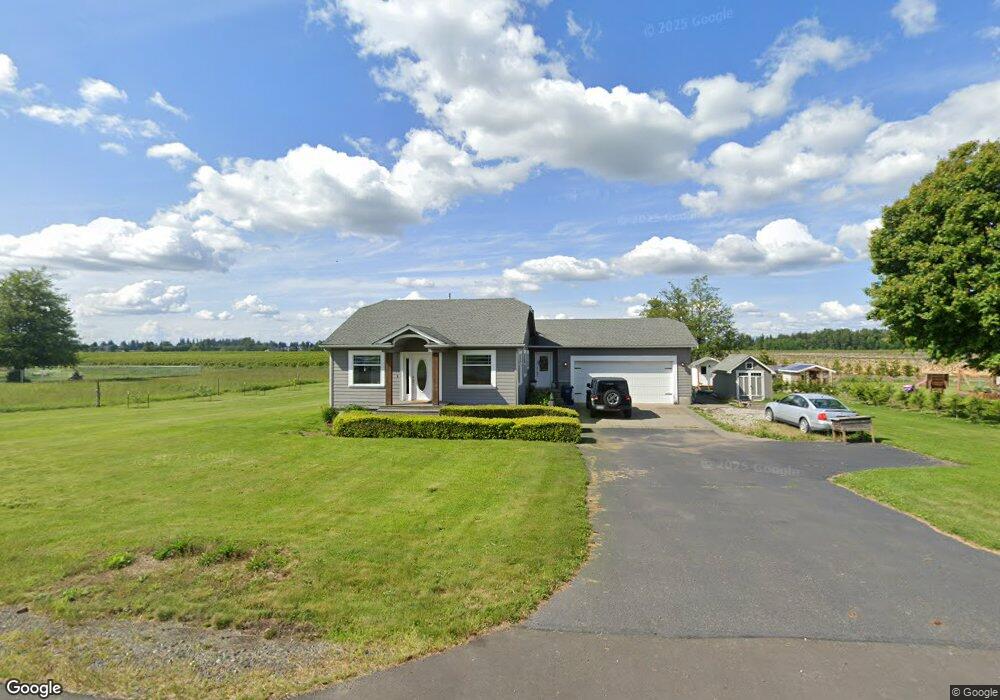
1800 Hampton Rd Everson, WA 98247
Estimated Value: $511,000 - $568,845
2
Beds
1
Bath
1,532
Sq Ft
$348/Sq Ft
Est. Value
About This Home
This home is located at 1800 Hampton Rd, Everson, WA 98247 and is currently estimated at $533,711, approximately $348 per square foot. 1800 Hampton Rd is a home located in Whatcom County with nearby schools including Lynden High School, Lynden Christian School, and Lynden Christian Schools: Administration.
Ownership History
Date
Name
Owned For
Owner Type
Purchase Details
Closed on
Aug 6, 2012
Sold by
Meenderinck Justin G
Bought by
Sorenson David Lyle and Sytsma Alayna Rose
Current Estimated Value
Home Financials for this Owner
Home Financials are based on the most recent Mortgage that was taken out on this home.
Original Mortgage
$175,500
Outstanding Balance
$119,986
Interest Rate
3.62%
Mortgage Type
New Conventional
Estimated Equity
$413,725
Create a Home Valuation Report for This Property
The Home Valuation Report is an in-depth analysis detailing your home's value as well as a comparison with similar homes in the area
Purchase History
| Date | Buyer | Sale Price | Title Company |
|---|---|---|---|
| Sorenson David Lyle | $195,280 | Chicago Title Insurance |
Source: Public Records
Mortgage History
| Date | Status | Borrower | Loan Amount |
|---|---|---|---|
| Open | Sorenson David Lyle | $175,500 |
Source: Public Records
Tax History Compared to Growth
Tax History
| Year | Tax Paid | Tax Assessment Tax Assessment Total Assessment is a certain percentage of the fair market value that is determined by local assessors to be the total taxable value of land and additions on the property. | Land | Improvement |
|---|---|---|---|---|
| 2025 | $4,179 | $491,768 | $212,100 | $279,668 |
| 2024 | $4,053 | $482,847 | $210,000 | $272,847 |
| 2023 | $4,053 | $505,789 | $235,859 | $269,930 |
| 2022 | $3,887 | $455,664 | $212,485 | $243,179 |
| 2021 | $3,346 | $376,575 | $175,604 | $200,971 |
| 2020 | $3,244 | $306,155 | $142,766 | $163,389 |
| 2019 | $2,898 | $306,155 | $142,766 | $163,389 |
| 2018 | $2,374 | $278,779 | $130,000 | $148,779 |
| 2017 | $2,055 | $188,467 | $82,495 | $105,972 |
| 2016 | $1,982 | $172,505 | $75,495 | $97,010 |
| 2015 | $1,671 | $165,204 | $72,450 | $92,754 |
| 2014 | -- | $159,617 | $70,000 | $89,617 |
| 2013 | -- | $159,617 | $70,000 | $89,617 |
Source: Public Records
Map
Nearby Homes
- 1925 Hampton Rd
- 1915 Hampton Rd
- 2080 Bowfin Way
- 2027 Steelhead Way
- 2105 Lagerwey Cir
- 2103 Lagerwey Cir
- 2163 Lagerwey Cir
- 2178 Lagerwey Cir
- 2014 Monteview Ct
- 1967 Feather Dr
- 2021 Brome St
- 2075 Bluestem St
- 1319 Bradley Ct
- 2102 Shortcake Ln
- 1648 Scenic Place
- 1333 Bradley Meadows Ct
- 1660 Eastwood Way
- 1077 Hampton Rd
- 1725 Aaron Dr
- 2202 Berryman Loop
- 1808 Hampton Rd
- 1766 Hampton Rd
- 1776 Hampton Rd
- 8273 Slotemaker Rd
- 1745 Hampton Rd
- 0 Hampton Rd
- 8237 Slotemaker Rd
- 8183 Slotemaker Rd
- 1956 Hampton Rd
- 1902 Timon Rd
- 1996 Hampton Rd
- 1760 Timon Rd
- 1909 Timon Rd
- 2007 Hampton Rd
- 8402 Northwood Rd
- 2056 Hampton Rd
- 1959 Timon Rd
- 2026 Timon Rd
- 8288 Northwood Rd
- 1815 Kamm Rd