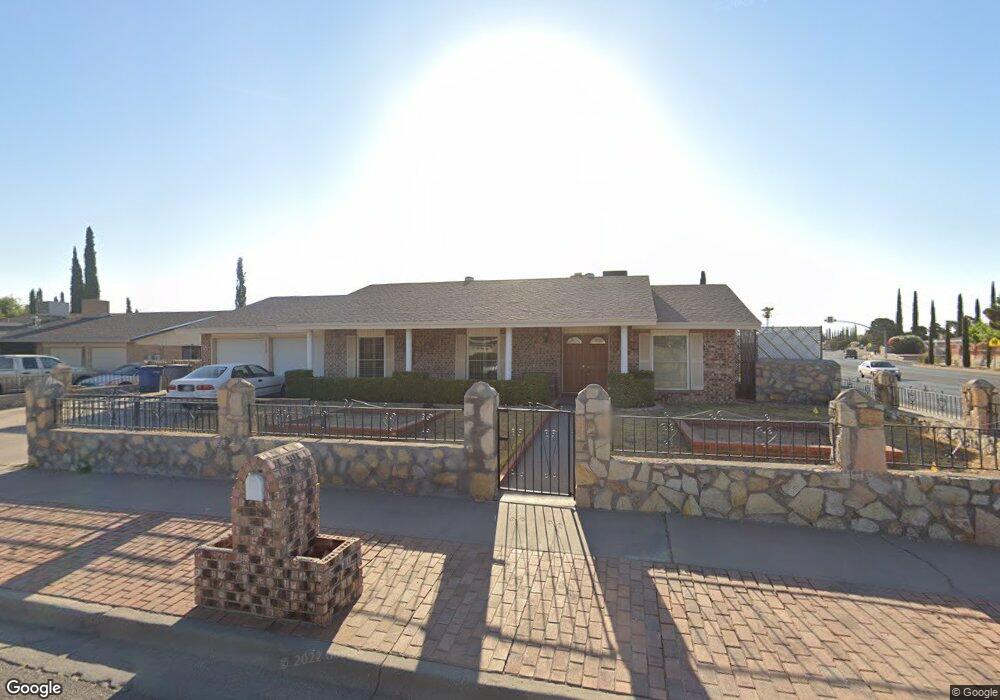
1800 Mike Hill Dr El Paso, TX 79936
Vista Del Sol NeighborhoodEstimated Value: $300,093 - $342,000
--
Bed
2
Baths
2,785
Sq Ft
$117/Sq Ft
Est. Value
About This Home
This home is located at 1800 Mike Hill Dr, El Paso, TX 79936 and is currently estimated at $327,023, approximately $117 per square foot. 1800 Mike Hill Dr is a home located in El Paso County with nearby schools including Tierra Del Sol Elementary School, J M Hanks High School, and EL PASO LEADERSHIP ACADEMY - MIDDLE EAST.
Ownership History
Date
Name
Owned For
Owner Type
Purchase Details
Closed on
Apr 10, 2025
Sold by
Balandran Yolanda Martinez and Balandran Jose
Bought by
Balandran Jose and Balandran Yolanda Martinez
Current Estimated Value
Purchase Details
Closed on
Apr 7, 2003
Sold by
Silva Daniel and Silva Guadalupe C
Bought by
Balandran Jose and Balandran Yolanda
Home Financials for this Owner
Home Financials are based on the most recent Mortgage that was taken out on this home.
Original Mortgage
$42,000
Interest Rate
5.71%
Mortgage Type
Purchase Money Mortgage
Purchase Details
Closed on
Feb 23, 2001
Sold by
Lary Ronald F and Lary Mari R
Bought by
Silva Daniel and Silva Guadalupe C
Create a Home Valuation Report for This Property
The Home Valuation Report is an in-depth analysis detailing your home's value as well as a comparison with similar homes in the area
Home Values in the Area
Average Home Value in this Area
Purchase History
| Date | Buyer | Sale Price | Title Company |
|---|---|---|---|
| Balandran Jose | -- | None Listed On Document | |
| Balandran Jose | -- | -- | |
| Silva Daniel | -- | -- |
Source: Public Records
Mortgage History
| Date | Status | Borrower | Loan Amount |
|---|---|---|---|
| Previous Owner | Balandran Jose | $42,000 | |
| Closed | Silva Daniel | $0 |
Source: Public Records
Tax History Compared to Growth
Tax History
| Year | Tax Paid | Tax Assessment Tax Assessment Total Assessment is a certain percentage of the fair market value that is determined by local assessors to be the total taxable value of land and additions on the property. | Land | Improvement |
|---|---|---|---|---|
| 2025 | $4,948 | $314,019 | -- | -- |
| 2024 | $4,948 | $285,472 | -- | -- |
| 2023 | $4,948 | $259,520 | $0 | $0 |
| 2022 | $7,326 | $235,927 | $0 | $0 |
| 2021 | $6,972 | $214,479 | $32,426 | $182,053 |
| 2020 | $6,427 | $203,472 | $29,433 | $174,039 |
| 2018 | $6,128 | $197,058 | $29,433 | $167,625 |
| 2017 | $5,630 | $184,693 | $29,433 | $155,260 |
| 2016 | $5,118 | $167,442 | $29,433 | $138,009 |
| 2015 | $4,130 | $167,442 | $29,433 | $138,009 |
| 2014 | $4,130 | $169,619 | $29,433 | $140,186 |
Source: Public Records
Map
Nearby Homes
- 1868 Tom Bolt Dr
- 11204 Bob Mitchell Dr
- 1739 Jerry Abbott St
- 1817 Hugh Royer Place
- 1804 Jerry Abbott St
- 1703 Robert Wynn St
- 1913 Seagull Dr
- 1901 Bobby Jones Dr
- 1617 Tommy Aaron Dr
- 1700 Jerry Abbott St
- 1607 Tommy Aaron Dr
- 2001 Bobby Jones Dr Unit A
- 11157 Leo Collins Dr
- 11262 Enid Wilson Ln
- 11268 Enid Wilson Ln
- 2009 Bobby Jones Dr Unit B
- 11016 Bob Stone Dr
- 11012 Bob Stone Dr
- 11013 Bob Stone Dr
- 1664 Dick Ritter St
- 1804 Mike Hill Dr
- 1804 Mike Hill Dr
- 1801 Tom Bolt Dr
- 1805 Tom Bolt Dr
- 1808 Mike Hill Dr
- 1801 Mike Hill Dr
- 1720 Mike Hill Dr
- 1805 Mike Hill Dr
- 1811 Tom Bolt Dr
- 1811 Tom Bolt Dr Unit n/a
- 1729 Tom Bolt Dr
- 1812 Mike Hill Dr
- 1721 Mike Hill Dr
- 1817 Tom Bolt Dr
- 1716 Mike Hill Dr
- 1813 Mike Hill Dr
- 1800 Pete Brown Dr
- 1725 Tom Bolt Dr
- 1804 Tom Bolt Dr
- 1800 Tom Bolt Dr