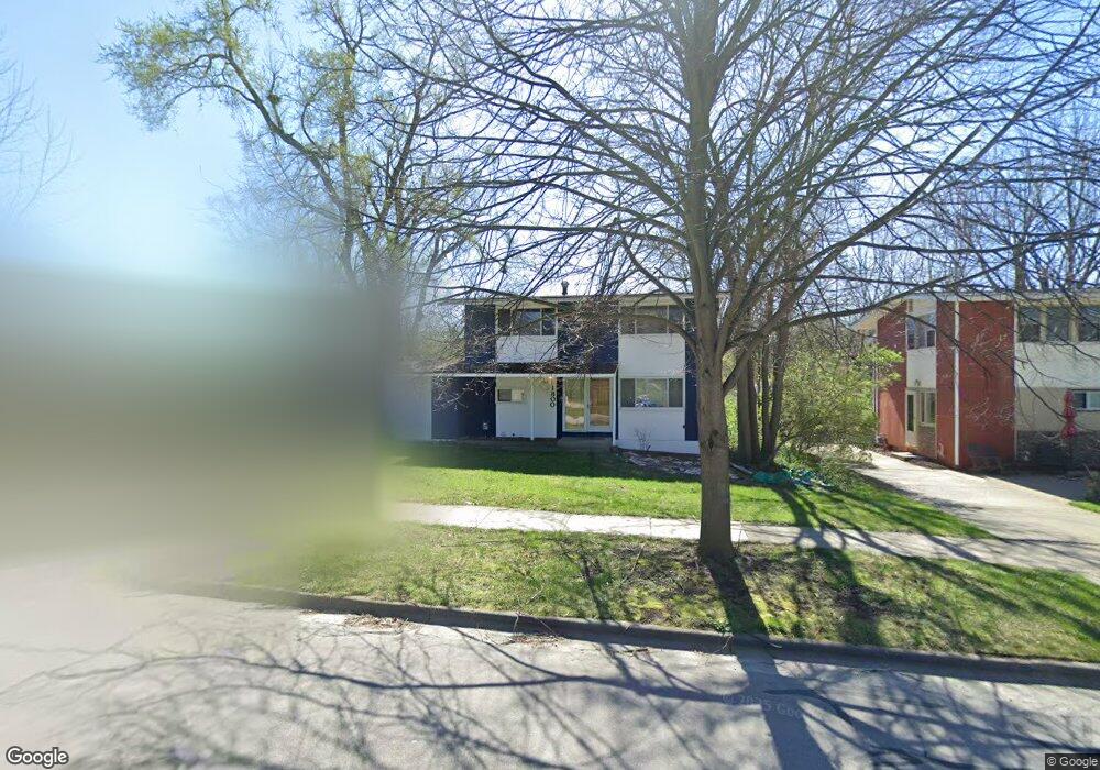
1800 Traver Rd Ann Arbor, MI 48105
Northern Ann Arbor NeighborhoodEstimated Value: $404,000 - $411,530
3
Beds
2
Baths
1,280
Sq Ft
$319/Sq Ft
Est. Value
About This Home
This home is located at 1800 Traver Rd, Ann Arbor, MI 48105 and is currently estimated at $408,383, approximately $319 per square foot. 1800 Traver Rd is a home located in Washtenaw County with nearby schools including Ann Arbor STEAM at Northside, Clague Middle School, and Skyline High School.
Ownership History
Date
Name
Owned For
Owner Type
Purchase Details
Closed on
Feb 25, 2009
Sold by
Hieftje John C and Goodson Kathryn E
Bought by
Hieftje John C and Goodson Kathryn E
Current Estimated Value
Purchase Details
Closed on
Mar 7, 1995
Sold by
Hwa Li Shin
Bought by
John C Hieftje Jr & Kathryn E Goods Al
Home Financials for this Owner
Home Financials are based on the most recent Mortgage that was taken out on this home.
Original Mortgage
$90,400
Interest Rate
7.13%
Mortgage Type
New Conventional
Create a Home Valuation Report for This Property
The Home Valuation Report is an in-depth analysis detailing your home's value as well as a comparison with similar homes in the area
Home Values in the Area
Average Home Value in this Area
Purchase History
| Date | Buyer | Sale Price | Title Company |
|---|---|---|---|
| Hieftje John C | -- | None Available | |
| John C Hieftje Jr & Kathryn E Goods Al | $113,000 | -- |
Source: Public Records
Mortgage History
| Date | Status | Borrower | Loan Amount |
|---|---|---|---|
| Closed | John C Hieftje Jr & Kathryn E Goods Al | $90,400 |
Source: Public Records
Tax History Compared to Growth
Tax History
| Year | Tax Paid | Tax Assessment Tax Assessment Total Assessment is a certain percentage of the fair market value that is determined by local assessors to be the total taxable value of land and additions on the property. | Land | Improvement |
|---|---|---|---|---|
| 2025 | $5,832 | $176,100 | $0 | $0 |
| 2024 | $5,262 | $164,700 | $0 | $0 |
| 2023 | $4,503 | $154,400 | $0 | $0 |
| 2022 | $4,906 | $155,000 | $0 | $0 |
| 2021 | $4,791 | $149,200 | $0 | $0 |
| 2020 | $4,694 | $153,100 | $0 | $0 |
| 2019 | $4,467 | $134,600 | $134,600 | $0 |
| 2018 | $4,404 | $129,600 | $0 | $0 |
| 2017 | $4,285 | $129,300 | $0 | $0 |
| 2016 | $3,650 | $85,677 | $0 | $0 |
| 2015 | $3,936 | $85,421 | $0 | $0 |
| 2014 | $3,936 | $82,752 | $0 | $0 |
| 2013 | -- | $82,752 | $0 | $0 |
Source: Public Records
Map
Nearby Homes
- 822 Starwick Dr
- 1713 Pontiac Trail
- 1540 Jones Dr
- 1261 Island Dr Unit 201
- 2759 Bristol Ridge Dr
- 1201 Island Dr Unit 104
- 519 Longshore Dr Unit A
- 1136 Longshore Dr Unit 1
- 1128 Longshore Dr Unit 1
- 1128 Longshore Dr Unit 2
- 408 Longshore Dr Unit C
- 408 Longshore Dr Unit A
- 1050 Wall St Unit 5A
- 1050 Wall St Unit 3C
- 2757 Polson St
- 2778 Bristol Ridge Dr Unit 38
- 2768 Bristol Ridge Dr Unit 33
- 2776 Bristol Ridge Dr Unit 37
- 2772 Bristol Ridge Dr Unit 35
- 2774 Bristol Ridge Dr Unit 36