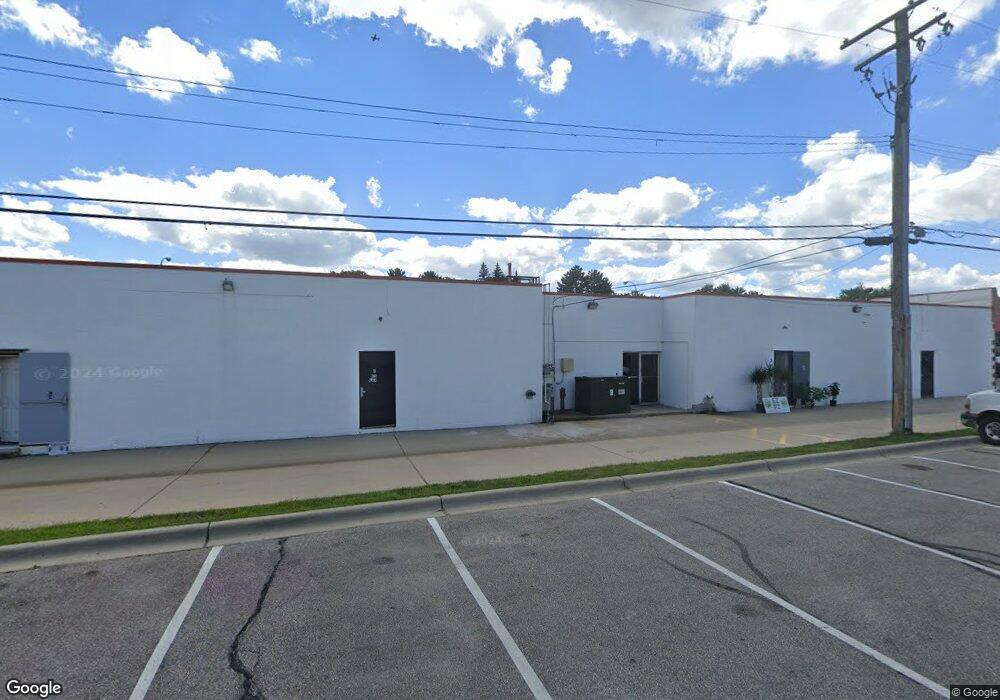
1800 W 14 Mile Rd Unit A Royal Oak, MI 48073
Estimated Value: $901,981
--
Bed
--
Bath
1,440
Sq Ft
$626/Sq Ft
Est. Value
About This Home
This home is located at 1800 W 14 Mile Rd Unit A, Royal Oak, MI 48073 and is currently estimated at $901,981, approximately $626 per square foot. 1800 W 14 Mile Rd Unit A is a home located in Oakland County with nearby schools including Alfred E. Upton Elementary School, Royal Oak Middle School, and Royal Oak High School.
Ownership History
Date
Name
Owned For
Owner Type
Purchase Details
Closed on
Mar 12, 2025
Sold by
Bway Llc
Bought by
1800 W 14 Mile Llc
Current Estimated Value
Purchase Details
Closed on
Aug 17, 2022
Sold by
K & S Investment Group 2 Inc
Bought by
Bway Llc
Purchase Details
Closed on
Aug 29, 2016
Sold by
K&S Investment Group Inc
Bought by
K&S Investment Group 2 Inc
Purchase Details
Closed on
Jun 20, 2016
Sold by
K&S Investment Group Inc
Bought by
K&S Investment Group 2 Inc
Purchase Details
Closed on
Aug 13, 1992
Sold by
Alvaro John
Bought by
K S Investment Grp Inc
Create a Home Valuation Report for This Property
The Home Valuation Report is an in-depth analysis detailing your home's value as well as a comparison with similar homes in the area
Home Values in the Area
Average Home Value in this Area
Purchase History
| Date | Buyer | Sale Price | Title Company |
|---|---|---|---|
| 1800 W 14 Mile Llc | -- | None Listed On Document | |
| Bway Llc | -- | -- | |
| K&S Investment Group 2 Inc | -- | None Available | |
| K&S Investment Group 2 Inc | -- | None Available | |
| K S Investment Grp Inc | $460,000 | -- |
Source: Public Records
Tax History Compared to Growth
Tax History
| Year | Tax Paid | Tax Assessment Tax Assessment Total Assessment is a certain percentage of the fair market value that is determined by local assessors to be the total taxable value of land and additions on the property. | Land | Improvement |
|---|---|---|---|---|
| 2024 | $26,656 | $573,840 | $0 | $0 |
| 2022 | $20,880 | $635,180 | $0 | $0 |
| 2020 | $31,152 | $0 | $0 | $0 |
| 2018 | $20,880 | $358,310 | $0 | $0 |
| 2017 | $18,958 | $358,310 | $0 | $0 |
| 2015 | -- | $331,090 | $0 | $0 |
| 2014 | -- | $342,590 | $0 | $0 |
| 2011 | -- | $365,420 | $0 | $0 |
Source: Public Records
Map
Nearby Homes
- 1807 Samoset Rd
- 4921 Crooks Rd Unit M-10
- 4909 Crooks Rd Unit E8
- 4909 Crooks Rd Unit 4
- 4921 N Crooks Rd Unit N-10
- 4702 Thorncroft Ave
- 4363 Crooks Rd
- 5025 Crooks Rd Unit 42
- 4345 Crooks Rd Unit 36
- 4345 Crooks Rd Unit 24
- 2306 W 14 Mile Rd Unit 14
- 1823 Torquay Ave
- 2356 W 14 Mile Rd Unit 1
- 4830 Briarwood Ave Unit 2
- 4859 Mansfield Ave Unit H5
- 342 S Manitou Ave
- 4227 Crooks Rd
- 2420 Parmenter Blvd Unit 101
- 4625 Leafdale Ave
- 1936 Torquay Ave Unit 205
- 1800 W 14 Mile Rd
- 1800 W 14 Mile Rd Unit H
- 1800 W 14 Mile Rd Unit C
- 1805-1819 W 14 Mile Rd
- 1805-1819 W 14 Mile Rd
- 1811 W 14 Mile Rd Unit 205
- 4710 Hillcrest Ave
- 4709 Hillcrest Ave
- 4710 Sedgemoor Ave
- 1905 W 14 Mile Rd
- 1905 W Fourteen Mile
- 4706 Hillcrest Ave
- 4708 Sedgemoor Ave
- 4707 Hillcrest Ave
- 4717 Crooks Rd
- 4821 Sedgemoor Ave Unit 206
- 4821 Sedgemoor Ave
- 4702 Hillcrest Ave
- 1825 Parmenter Blvd Unit 106
- 1825 Parmenter Blvd Unit 320