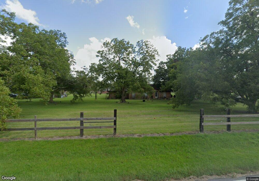
18007 County Road 132 Pearland, TX 77581
West Friendswood NeighborhoodEstimated Value: $418,000 - $596,000
3
Beds
2
Baths
1,628
Sq Ft
$294/Sq Ft
Est. Value
About This Home
This home is located at 18007 County Road 132, Pearland, TX 77581 and is currently estimated at $478,673, approximately $294 per square foot. 18007 County Road 132 is a home located in Brazoria County with nearby schools including Rustic Oak Elementary School, Alexander Middle School, and Pearland Junior High School East.
Ownership History
Date
Name
Owned For
Owner Type
Purchase Details
Closed on
Jun 18, 2010
Sold by
Orford Robert Lee and Orford Raymond Edwin
Bought by
Rodriguez Gustavo and Rodriguez Susan Hill
Current Estimated Value
Home Financials for this Owner
Home Financials are based on the most recent Mortgage that was taken out on this home.
Original Mortgage
$145,600
Outstanding Balance
$97,101
Interest Rate
4.87%
Mortgage Type
New Conventional
Estimated Equity
$381,572
Create a Home Valuation Report for This Property
The Home Valuation Report is an in-depth analysis detailing your home's value as well as a comparison with similar homes in the area
Home Values in the Area
Average Home Value in this Area
Purchase History
| Date | Buyer | Sale Price | Title Company |
|---|---|---|---|
| Rodriguez Gustavo | -- | Texas American Title Company |
Source: Public Records
Mortgage History
| Date | Status | Borrower | Loan Amount |
|---|---|---|---|
| Open | Rodriguez Gustavo | $145,600 |
Source: Public Records
Tax History Compared to Growth
Tax History
| Year | Tax Paid | Tax Assessment Tax Assessment Total Assessment is a certain percentage of the fair market value that is determined by local assessors to be the total taxable value of land and additions on the property. | Land | Improvement |
|---|---|---|---|---|
| 2025 | $1,265 | $259,556 | $163,930 | $255,220 |
| 2023 | $1,265 | $214,509 | $146,930 | $259,200 |
| 2022 | $3,670 | $195,008 | $100,000 | $127,510 |
| 2021 | $3,898 | $208,020 | $127,340 | $80,680 |
| 2020 | $3,544 | $181,100 | $117,540 | $63,560 |
| 2019 | $3,746 | $188,280 | $127,340 | $60,940 |
| 2018 | $3,702 | $194,750 | $127,340 | $67,410 |
| 2017 | $3,536 | $210,860 | $137,130 | $73,730 |
| 2016 | $3,227 | $199,240 | $103,610 | $95,630 |
| 2014 | $2,348 | $202,470 | $82,720 | $119,750 |
Source: Public Records
Map
Nearby Homes
- 2243 County Road 130
- 0 County Road 130
- 18120 County Road 127
- 1914 Quinn Rd
- 153 Mooney Rd
- 158 Mooney Rd
- 18118 County Road 125
- 17810 County Road 125
- 17903 County Road 125
- 0 Cr 124 Unit 13541782
- 205 Del Monte Dr
- 101 Westfield Ln
- 1208 Cowards Creek Dr
- 1204 Cowards Creek Dr
- 310 Rustic Ln
- 1004 Tall Pines Dr
- 1040 Glenview Dr
- 1003 Glenview Dr
- 805 W Edgewood Dr
- 1013 Chesterwood Dr
- 1810 County Road 130
- 18109 County Road 132
- 18025 County Road 132
- TBD County Road 130
- 2024 County Road 130
- 1313 County Road 130
- 1829 Brown Rd Cr 130
- 1914 County Road 130
- 18125 County Road 132
- 2210 County Road 130
- 1815 County Road 130
- 1815 County Road 130 Unit 6
- 18203 County Road 132
- 18230 County Road 132
- 1921 County Road 130
- 18036 County Road 127
- 1925 Quinn Rd
- 18042 County Road 127
- 1915 Quinn Rd
- 18206 County Road 127
